More From Contributor

£5.59
Map No. 191, Okehampton & North Dartmoor, in the Ordnance Survey Landranger series at 1:50, 000, including Crediton, Bovey Tracy, Tavistock, Petrockstowe, Hollocombe, Wembworthy, Puddington, Sheepwash, Winkleigh, Lapford, Poughill, Hatherleigh, Bondleigh, Morchard Bishop, Highampton, Jacobstowe, Copplestone, Sandford, Colebrooke, North Tawton, Northlew, Folly Gate, Spreyton, Tedburn St. Mary, South Zeal, Hittisleigh, Belstone, Meldon, Bridestowe, Drewsteignton, Longdown, Dunsford, Bridford, Moretonhampstead, Christow, Lustleigh, Manaton, Widecombe in the Moor, Ilsington, Heathfield, Bickington, Ponsworthy, Two Bridges, Princetown, Peter Tavy, Mary Tavy, Postbridge, North Brentor, Lydford, Chagford, & Gidleigh, together with the northern part of the Dartmoor National Park & the peaks of Yes Tor, Hangingstone Hill & Cut Hill. Edition D1; Revised for selected changes 2003/2004; Revised for selected changes 2009; Copyright date 2009 This title is also available on our website in a waterproof & tear-resistant version. Maps in this series are only published folded. Stanfords can also print flat versions of Ordnance Survey maps through the OS Select system, centring the map on a location of your choice & with a picture provided by you on the cover. For more information please click on the link at the bottom of this description. About Ordnance Survey ...
Archived Product
£9.99
Map No. 191, Okehampton & North Dartmoor 1809, in the Cassini Historical Series of old Ordnance Survey mapping of England & Wales at 1:50, 000 in a format designed to offer a convenient comparison with the present day coverage from the OS, & most locations in three different editions. Old historical maps have been combined so that the sheet lines correspond to the current Landranger series & reproduced with the scale changed from one inch to one mile to 1:50, 000. Most locations are covered by three separate maps, showing how the area has changed over the decades, with selected major cities also presented in a fourth edition. * Old Series: the first detailed survey mapping dating for most areas from the first half of the 19th century, in black & white & with relief shown by hachuring.* Revised New Series from 1880s/1900s, with some colouring & a mixture of hachuring & contour lines.* Popular Edition from the inter-war years, with contour lines & colouring to indicate woodlands, parks, etc.* New Popular Edition from the late 1940s, reproduced in the Cassini series for the major cities. Each map

Includes::
notes on the development of Ordnance Survey & the various series produced by them. For those interested in maps & cartography in general, the Cassini series also provides a fascinating insight into how Ordnance Survey cartographic style has developed over a period of over 100 years. Coverage in this title

Includes::
present day Crediton, Bovey Tracy, Tavistock, Petrockstowe, Hollocombe, Wembworthy, Puddington, Sheepwash, Winkleigh, Lapford, Poughill, Hatherleigh, Bondleigh, Morchard Bishop, Highampton, Jacobstowe, Copplestone, Sandford, Colebrooke, North Tawton, Northlew, Folly Gate, Spreyton, Tedburn St. Mary, South Zeal, Hittisleigh, Belstone, Meldon, Bridestowe, Drewsteignton, Longdown, Dunsford, Bridford, Moretonhampstead, Christow, Lustleigh, Manaton, Widecombe in the Moor, Ilsington, Heathfield, Bickington, Ponsworthy, Two Bridges, Princetown, Peter Tavy, Mary Tavy, Postbridge, North Brentor, Lydford, Chagford, & Gidleigh, together with the northern part of the Dartmoor National Park & the peaks of Yes Tor, Hangingstone Hill & Cut Hill.* PLEASE NOTE: Stanfords can also print on request mapping from all four series *centring the map on a location of your choice.* For more information please click on the link below.


...
Archived Product
£14.99
Map No. 191, Okehampton & North Dartmoor 1809-1919 (3-map set), in the Cassini Historical Series of old Ordnance Survey mapping of England & Wales at 1:50, 000 in a format designed to offer a convenient comparison with the present day coverage from the OS, & most locations in three different editions. Old historical maps have been combined so that the sheet lines correspond to the current Landranger series & reproduced with the scale changed from one inch to one mile to 1:50, 000. Most locations are covered by three separate maps, showing how the area has changed over the decades, with selected major cities also presented in a fourth edition. Old Series: the first detailed survey mapping dating for most areas from the first half of the 19th century, in black & white & with relief shown by hachuring. Revised New Series from 1880s/1900s, with some colouring & a mixture of hachuring & contour lines. Popular Edition from the inter-war years, with contour lines & colouring to indicate woodlands, parks, etc. New Popular Edition from the late 1940s, reproduced in the Cassini series for the major cities. Each map

Includes::
notes on the development of Ordnance Survey & the various series produced by them. For those interested in maps & cartography in general, the Cassini series also provides a fascinating insight into how Ordnance Survey cartographic style has developed over a period of over 100 years. Coverage in this title

Includes::
present day Crediton, Bovey Tracy, Tavistock, Petrockstowe, Hollocombe, Wembworthy, Puddington, Sheepwash, Winkleigh, Lapford, Poughill, Hatherleigh, Bondleigh, Morchard Bishop, Highampton, Jacobstowe, Copplestone, Sandford, Colebrooke, North Tawton, Northlew, Folly Gate, Spreyton, Tedburn St. Mary, South Zeal, Hittisleigh, Belstone, Meldon, Bridestowe, Drewsteignton, Longdown, Dunsford, Bridford, Moretonhampstead, Christow, Lustleigh, Manaton, Widecombe in the Moor, Ilsington, Heathfield, Bickington, Ponsworthy, Two Bridges, Princetown, Peter Tavy, Mary Tavy, Postbridge, North Brentor, Lydford, Chagford, & Gidleigh, together with the northern part of the Dartmoor National Park & the peaks of Yes Tor, Hangingstone Hill & Cut Hill. PLEASE NOTE: Stanfords can also print on request mapping from all four series centring the map on a location of your choice. For more information please click on the link below.


...
Archived Product
£9.99
Map No. 191, Okehampton & North Dartmoor 1899-1900, in the Cassini Historical Series of old Ordnance Survey mapping of England & Wales at 1:50, 000 in a format designed to offer a convenient comparison with the present day coverage from the OS, & most locations in three different editions. Old historical maps have been combined so that the sheet lines correspond to the current Landranger series & reproduced with the scale changed from one inch to one mile to 1:50, 000. Most locations are covered by three separate maps, showing how the area has changed over the decades, with selected major cities also presented in a fourth edition. * Old Series: the first detailed survey mapping dating for most areas from the first half of the 19th century, in black & white & with relief shown by hachuring.* Revised New Series from 1880s/1900s, with some colouring & a mixture of hachuring & contour lines.* Popular Edition from the inter-war years, with contour lines & colouring to indicate woodlands, parks, etc.* New Popular Edition from the late 1940s, reproduced in the Cassini series for the major cities. Each map

Includes::
notes on the development of Ordnance Survey & the various series produced by them. For those interested in maps & cartography in general, the Cassini series also provides a fascinating insight into how Ordnance Survey cartographic style has developed over a period of over 100 years. Coverage in this title

Includes::
present day Crediton, Bovey Tracy, Tavistock, Petrockstowe, Hollocombe, Wembworthy, Puddington, Sheepwash, Winkleigh, Lapford, Poughill, Hatherleigh, Bondleigh, Morchard Bishop, Highampton, Jacobstowe, Copplestone, Sandford, Colebrooke, North Tawton, Northlew, Folly Gate, Spreyton, Tedburn St. Mary, South Zeal, Hittisleigh, Belstone, Meldon, Bridestowe, Drewsteignton, Longdown, Dunsford, Bridford, Moretonhampstead, Christow, Lustleigh, Manaton, Widecombe in the Moor, Ilsington, Heathfield, Bickington, Ponsworthy, Two Bridges, Princetown, Peter Tavy, Mary Tavy, Postbridge, North Brentor, Lydford, Chagford, & Gidleigh, together with the northern part of the Dartmoor National Park & the peaks of Yes Tor, Hangingstone Hill & Cut Hill.* PLEASE NOTE: Stanfords can also print on request mapping from all four series *centring the map on a location of your choice.* For more information please click on the link below.


...
Archived Product
£9.99
Map No. 191, Okehampton & North Dartmoor 1919, in the Cassini Historical Series of old Ordnance Survey mapping of England & Wales at 1:50, 000 in a format designed to offer a convenient comparison with the present day coverage from the OS, & most locations in three different editions. Old historical maps have been combined so that the sheet lines correspond to the current Landranger series & reproduced with the scale changed from one inch to one mile to 1:50, 000. Most locations are covered by three separate maps, showing how the area has changed over the decades, with selected major cities also presented in a fourth edition. * Old Series: the first detailed survey mapping dating for most areas from the first half of the 19th century, in black & white & with relief shown by hachuring.* Revised New Series from 1880s/1900s, with some colouring & a mixture of hachuring & contour lines.* Popular Edition from the inter-war years, with contour lines & colouring to indicate woodlands, parks, etc.* New Popular Edition from the late 1940s, reproduced in the Cassini series for the major cities. Each map

Includes::
notes on the development of Ordnance Survey & the various series produced by them. For those interested in maps & cartography in general, the Cassini series also provides a fascinating insight into how Ordnance Survey cartographic style has developed over a period of over 100 years. Coverage in this title

Includes::
present day Crediton, Bovey Tracy, Tavistock, Petrockstowe, Hollocombe, Wembworthy, Puddington, Sheepwash, Winkleigh, Lapford, Poughill, Hatherleigh, Bondleigh, Morchard Bishop, Highampton, Jacobstowe, Copplestone, Sandford, Colebrooke, North Tawton, Northlew, Folly Gate, Spreyton, Tedburn St. Mary, South Zeal, Hittisleigh, Belstone, Meldon, Bridestowe, Drewsteignton, Longdown, Dunsford, Bridford, Moretonhampstead, Christow, Lustleigh, Manaton, Widecombe in the Moor, Ilsington, Heathfield, Bickington, Ponsworthy, Two Bridges, Princetown, Peter Tavy, Mary Tavy, Postbridge, North Brentor, Lydford, Chagford, & Gidleigh, together with the northern part of the Dartmoor National Park & the peaks of Yes Tor, Hangingstone Hill & Cut Hill.* PLEASE NOTE: Stanfords can also print on request mapping from all four series *centring the map on a location of your choice.* For more information please click on the link below.


...
Archived Product
£10.39
Map No. 191, Okehampton & North Dartmoor, in a waterproof & tear-resistant version of the Ordnance Survey Landranger series at 1:50, 000, including Crediton, Bovey Tracy, Tavistock, Petrockstowe, Hollocombe, Wembworthy, Puddington, Sheepwash, Winkleigh, Lapford, Poughill, Hatherleigh, Bondleigh, Morchard Bishop, Highampton, Jacobstowe, Copplestone, Sandford, Colebrooke, North Tawton, Northlew, Folly Gate, Spreyton, Tedburn St. Mary, South Zeal, Hittisleigh, Belstone, Meldon, Bridestowe, Drewsteignton, Longdown, Dunsford, Bridford, Moretonhampstead, Christow, Lustleigh, Manaton, Widecombe in the Moor, Ilsington, Heathfield, Bickington, Ponsworthy, Two Bridges, Princetown, Peter Tavy, Mary Tavy, Postbridge, North Brentor, Lydford, Chagford, & Gidleigh, together with the northern part of the Dartmoor National Park & the peaks of Yes Tor, Hangingstone Hill & Cut Hill. Edition D1; Revised 2003/2004; Revised for selected changes 2009; Copyright date 2009 This title is also available on our website in a paper version. Maps in this series are only published folded. Stanfords can also print flat versions of Ordnance Survey maps through the OS Select system, centring the map on a location of your choice & with a picture provided by you on the cover. For more information please click on the link at the bottom of this description. About Ordnance Survey ...
Archived Product
£11.19
Laminated waterproof edition of a detailed topographic map from the Ordnance Survey Explorer series, covering Hatherleigh, North Tawton & Lapford. Edition B1 with minor changes; Publication date March 2009 About this series: These highly detailed maps show all the administrative boundaries, settlements as small as isolated farms, the road network down to unfenced roads & country tracks, & field boundaries (hedges & drystone walls) which make navigation across the countryside much easier. Steep gradients on roads are indicated. Various landmarks, e.g. powerlines, archaeological sites, windmills, churches & lighthouses are shown & additional graphics indicate natural terrain features such as cliffs, scree, mud & vegetation variations. The contour interval is 5 metres in the lower parts of the country & 10 metres in the uplands, & spot heights are marked. Each map covers an area of 30 x 20km (i.e. approx. 19 x 12 miles), with some double-sided maps covering more, as indicated in the individual descriptions. The maps are fully GPS compatible, with the National Grid shown at 1km intervals & latitude & longitude indicated by margin ticks at 1'. The Explorer series has replaced the earlier, green-cover Pathfinder maps. The Explorer series is now complete & covers all of Engl&, Wales & Scotl&. Some sheets for popular areas like the National Parks are still branded as Outdoor Leisure (OL) maps, but are now included in this series as the cartography is the same as that in the Explorer Maps. The Explorer maps offer a substantial improvement on the Pathfinder series, with greater use of colour, larger area per map, & stronger emphasis on information for ramblers & tourists. This series is ideal for walking & other outdoor pursuits & each map shows a large amount of information for ramblers & tourists. Public rights of way are shown (except in Scotland), together with other routes with public access: National Trails & Recreational Paths, permitted paths & bridleways, & selected cycle routes. Open access land created under the Countryside & Rights of Way Act 2000 is marked. Tourist information

Includes::
caravan & camp sites, Park & Ride locations, recreation/leisure/sport centres, museums, historic buildings, English Heritage & National Trust sites, rural pubs, etc. The map legend is in English only, except for the tourist information content which is also in French & German.

...
Archived Product
£14.99
Okehampton & the northern part of the Dartmoor National Park on a waterproof & tear-resistant OS Active version of map No. 191 from the Ordnance Survey’s Landranger series at 1:50, 000, with contoured & GPS compatible topographic mapping plus tourist information.MOBILE DOWNLOADS: As well as the physical edition of the map, each Landranger title now

Includes::
a code for downloading after purchase its digital version onto your smartphone or tablet for viewing on the OS smartphone app.OS LANDRANGER SERIES: to see the list of all the titles in the OS Landranger series, both paper & waterproof versions, please click on the series link. Maps in the Landranger series provide plenty of recreational & tourist information, indicating the traditional public right of way paths (except in Scotland where different laws apply), including bridleways & byways restricted or open to motorized traffic. National Trails & selected other long-distance paths are marked, as well as on-road & traffic-free cycle routes with their National/ Regional Cycle Network numbers. National Trust/ National Trust for Scotland & Forestry Commission land is clearly marked, indicating open or restricted access. A range of symbols highlights camping & caravanning sites, youth hostels, tourist information offices & visitors’ centres, parking & picnicking places, World Heritage sites, sport & recreational facilities, etc. The maps provide detailed presentation of topography with contours at 10m intervals, numerous spot heights & additional colouring and/or graphics for different types of woodlands, orchards or parkl&, rock features including scree & cliffs, water features inland & along the sea shore with marshl&, dunes, s&, mud, shingle & the high water mark. All the standard information expected of survey mapping at this scale is included: finely graded road network, railway lines with stations, cuttings, embankments, etc; individual isolated buildings; archaeological & historical sites, etc. For GPS users the British National Grid is shown at 1km intervals, with latitude & longitude given by margin ticks at 1` & cross hairs on the map at 5`. Each map covers an area of 40 x 40km, (approx. 25 x 25 miles).

...
Archived Product
£8.99
Okehampton & the northern part of the Dartmoor National Park on a paper version of map No. 191 from the Ordnance Survey’s Landranger series at 1:50, 000, with contoured & GPS compatible topographic mapping plus tourist information.MOBILE DOWNLOADS: As well as the physical edition of the map, each Landranger title now

Includes::
a code for downloading after purchase its digital version onto your smartphone or tablet for viewing on the OS smartphone app.OS LANDRANGER SERIES: to see the list of all the titles in the OS Landranger series, both paper & waterproof versions, please click on the series link. Maps in the Landranger series provide plenty of recreational & tourist information, indicating the traditional public right of way paths (except in Scotland where different laws apply), including bridleways & byways restricted or open to motorized traffic. National Trails & selected other long-distance paths are marked, as well as on-road & traffic-free cycle routes with their National/ Regional Cycle Network numbers. National Trust/ National Trust for Scotland & Forestry Commission land is clearly marked, indicating open or restricted access. A range of symbols highlights camping & caravanning sites, youth hostels, tourist information offices & visitors’ centres, parking & picnicking places, World Heritage sites, sport & recreational facilities, etc. The maps provide detailed presentation of topography with contours at 10m intervals, numerous spot heights & additional colouring and/or graphics for different types of woodlands, orchards or parkl&, rock features including scree & cliffs, water features inland & along the sea shore with marshl&, dunes, s&, mud, shingle & the high water mark. All the standard information expected of survey mapping at this scale is included: finely graded road network, railway lines with stations, cuttings, embankments, etc; individual isolated buildings; archaeological & historical sites, etc. For GPS users the British National Grid is shown at 1km intervals, with latitude & longitude given by margin ticks at 1` & cross hairs on the map at 5`. Each map covers an area of 40 x 40km, (approx. 25 x 25 miles).

...
Archived Product
£6.99
Okinawa & the Ryukyu Islands of southern Japan presented by Periplus on panels across both sides of the sheet showing road maps & street plans at various scales to provide good coverage of the archipelago’s most visited areas. Topography of the islands is vividly shown by altitude colouring & shading. Both the road maps & the street plans highlight numerous places of interest, with enlargements & street plans also indicating locations of hotels. The panels show:- An overview of the whole region at 1:1, 750, 000, from Kagoshima on the southern tip of Kyushu to the Yaeyama Islands in the south, & further east the Daiyo Islands, indicating which islands or groups are presented on other panels in greater detail.- OKINAWA: the whole island at 1:200, 000; enlargements of its southern part & of the Motubu Peninsula at 1:60, 000; plus a street plan of central Naha.
- OTHER ISLANDS: Yakushima (1:200, 000); Amami Oshima & nearby islands (1:400, 000) with a street plan of Amami Town/ Nazé; Miyako Islands (1:275, 000) with a street plan of Miyako City/ Hirara; Yaeyama Islands (1:350, 000) with a street plan of Ishigaki City.- KAGOSHIMA & THE FERRY CONNECTIONS: a street plan of central Kagoshima on Kyushu, including the city’s port area showing terminals for ferry connections to various groups; plus a diagram showing ferry connections from Kagoshima to Naha & the Daito Islands.
...
Archived Product

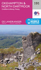
Okehampton And North Dartmoor OS ACTIVE Map

Map No. 191, Okehampton and North Dartmoor, in the waterproof and tear-resistant OS Active version of the Ordnance Survey Landranger series at 1:50, 000, including Crediton, Bovey Tracy, Tavistock, Petrockstowe, Hollocombe, Wembworthy, Puddington, Sheepwash, Winkleigh, Lapford, Poughill, Hatherleigh, Bondleigh, Morchard Bishop, Highampton, Jacobstowe, Copplestone, Sandford, Colebrooke, North Tawton, Northlew, Folly Gate, Spreyton, Tedburn St. Mary, South Zeal, Hittisleigh, Belstone, Meldon, Bridestowe, Drewsteignton, Longdown, Dunsford, Bridford, Moretonhampstead, Christow, Lustleigh, Manaton, Widecombe in the Moor, Ilsington, Heathfield, Bickington, Ponsworthy, Two Bridges, Princetown, Peter Tavy, Mary Tavy, Postbridge, North Brentor,
Lydford, Chagford, and Gidleigh, together with the northern part of the Dartmoor National Park and the peaks of Yes Tor, Hangingstone Hill and Cut Hill.Edition D1; Publication date April 2012About Ordnance Survey
RIP - This product is no longer available on our network. It was last seen on 25.09.2019

This page now acts as a permanent archive for this product. Add more information using the comments box below to ensure it can still be found by future generations.

Use our search facility to see if it is available from an alternative contributor.
  • Availability: Out Of Stock
  • Supplier: Stanfords
  • SKU: 9780319482216
Availability: In Stock
£9.09

Product Description

Map No. 191, Okehampton & North Dartmoor, in the waterproof & tear-resistant OS Active version of the Ordnance Survey Landranger series at 1:50, 000, including Crediton, Bovey Tracy, Tavistock, Petrockstowe, Hollocombe, Wembworthy, Puddington, Sheepwash, Winkleigh, Lapford, Poughill, Hatherleigh, Bondleigh, Morchard Bishop, Highampton, Jacobstowe, Copplestone, Sandford, Colebrooke, North Tawton, Northlew, Folly Gate, Spreyton, Tedburn St. Mary, South Zeal, Hittisleigh, Belstone, Meldon, Bridestowe, Drewsteignton, Longdown, Dunsford, Bridford, Moretonhampstead, Christow, Lustleigh, Manaton, Widecombe in the Moor, Ilsington, Heathfield, Bickington, Ponsworthy, Two Bridges, Princetown, Peter Tavy, Mary Tavy, Postbridge, North Brentor, Lydford, Chagford, & Gidleigh, together with the northern part of the Dartmoor National Park & the peaks of Yes Tor, Hangingstone Hill & Cut Hill. Edition D1; Publication date April 2012 About Ordnance Survey

Reviews/Comments

Add New

Intelligent Comparison

Oooops!
We couldn't find anything!
Perhaps this product's unique.... Or perhaps we are still looking for comparisons!
Click to bump this page and we'll hurry up.

Price History

Vouchers

No voucher codes found.
Do you know a voucher code for this product or supplier? Add it to Insights for others to use.

Facebook

Jargon Buster

Date - A day on a calendar
Date - A social activity whith a current or potential partner
Waterproof - Resistant to water, usualy specified by depth in metres
Resistant - Something that can repel against something.

Supplier Information

Stanfords
Stanfords was established in 1853 and opened their iconic Covent Garden flagship store in 1901. They have become the top retailer of maps, travel books and accessories in the UK and arguably offer the largest selection of maps and travel books worldwide. Famous names such as Captain Robert Falcon Scott, Ranulph Fiennes and Michael Palin have purchased from Stanfords. They now have a shop in Bristol and both stores together with other venues operate a calendar of events including talks, book signings and exhibitions. As a specialist map retailer, the map selection is comprehensive and includes road maps, street maps and walking maps from worldwide destinations, as well as a selection of world atlases and wall maps. Books include travel guides and travel literature. Stanfords also stock globes, from miniatures made of blue marble to magnificent floor-standing globes. The website features a selection of interesting articles on travel topics.
Page Updated: 2023-11-12 20:15:36

Community Generated Product Tags

Oh No! The productWIKI community hasn't generated any tags for this product yet!
Menu