More From Contributor

£12.99

Offa's Dyke Path is the 177-mile (283-km) National Trail along the man-made dyke that gives the Path its name. This volume features

...
Archived Product
£8.25
Map No. 48, Offaly North
- Westmeath South in the Discovery series from the OSI, the Ordnance Survey of Irel&, which presents
...
Archived Product
£8.25
Map No. 48, Offaly North
- Westmeath South in the Discovery series from the OSI, the Ordnance Survey of Irel&, which presents
...
Archived Product
£16.95
This guidebook describes Offa`s Dyke Path National Trail, following the longest linear earthwork in Britain, running 177 miles along the English-Welsh border between Sedbury (near Chepstow) & Prestatyn on the north Wales Coast, linking the Severn Estuary & the Irish Sea, contouring above the Wye & Dee, visiting hillforts & Norman castles & exploring the hidden heritage of the Marches. The book splits one of Britain`s classic trails into 12 stages, with suggestions for alternative 8 & 16 day schedules. This is a long but not too difficult walk for walkers of all abilities. Step-by-step route descriptions are accompanied by 1:100, 000 OS mapping. A trek planner gives at a glance information about facilities, public transport & accommodation available along the route. A separate convenient booklet of 1:25, 000 OS maps provides all the mapping needed to complete the trail. The walk is astonishingly varied, taking in the lower Wye gorge, the Severn & the Dee rift valley, the pastures & woodlands of the border country, the remote moorland of the Black Mountains & the Clwydian range, & the dramatic limestone escarpments of Eglwyseg mountain. What makes it even more special is over 60 miles walking alongside the Saxon earthwork of Offa`s Dyke. ...
Archived Product
£11.99
Offa`s Dyke Path in Trailblazer’s British Walking Guides series; highly practical, informative & portable guides designed with the adventurous walker in mind, & produced by one of the leading outdoor guide-book publishers. Each title in the series explores a range of popular walking routes & long-distance footpaths in Engl&, Scotland & Wales. Designed with practicality in mind, each guide describes a long-distance walking route in clearly defined stages, allowing walkers to easily identify which parts of the route they want to attempt. Strong on both practical content & cultural & historical background, Trailblazer Guides include extensive commentary on sites along the way, including areas of historical interest & outstanding beauty, in addition to cultural & social background, as walkers pass through the landscape. in addition, there are detailed descriptions of places to stay & eat & drink on each walk, as well as boxed insets exploring a local tradition or custom. Detailed, large-scale walking maps are included in each title – a unique feature of Trailblazer guides – which include important information on walking times, directions, tricky junctions, places to stay & eat & general points of interest. The guide is arranged in 4 sections – Planning Your Walk, the Environment & Nature, Minimum Impact Walking & Outdoor Safety & Route Guides & Maps. There is detailed advice & guidance on the route itself, practical information for the walker, budgeting, when to go, itineraries, what to take & getting to & from the route. in addition, informative sections on the environment, flora & fauna & walking safety seek to improve walkers’ experiences of the routes & get the most from their trip. A Minimum Impact Walking & Outdoor Safety section also informs readers of the economic & environmental impact of walking. An appendix gives a list of GPS waypoints along each of the walks. ...
Archived Product
£9.95
Offa’s Dyke Path National Trail on mapping at 1:25, 000 from the Ordnance Survey’s Explorer series in a pocket-size booklet from Cicerone Press. The 285km / 177-mile trail between Chepstow & Prestatyn is presented with a route profile, plus summaries for each section showing GPS coordinates for the start & finish, distance & approximate walking time in either direction. Mapping in the pocket booklets from Cicerone Press is identical to the OS Explorer Series, but with the route more prominently highlighted: contours at 5m or 10m intervals, extensive range of symbols for tourist information including campsites, pubs, castles & forts, museums, etc, & for GPS users the lines of the British National Grid at 1km intervals. To see other titles in this series please click on the series link. ...
Archived Product
£14.99
Offa`s Dyke Path National Trail, the whole 285km/177 miles route from Chepstow to Prestatyn, in a series of walking guides to the National Trails in England & Wales with colour extracts from the Ordnance Survey`s Explorer series at 1:25, 000 showing points along the route cross-referenced to the text. The maps also indicate nearby places of interest & various facilities including campsites & caravan parks, youth hostels, water points, pubs, information or visitor centres, etc. Also shown are alternative sections of the route & stretches designated as bridleways or suitable for cycling. The guides are illustrated throughout with colour photos & include an introductory section on the path & the surrounding landscape, plus a chapter of useful information including access to various locations along the route by public transport, a list of tourist information offices & principal overnight stopping places, a bibliography, etc. Current edition of this title was published in June 2014. To see other titles in the Aurum Press series of guides to the national trails & other long-distance footpaths, please click on the series link. ...
Archived Product
£13.95
The northern part of the Offa’s Dyke National Trail between Knighton & Prestatyn presented at 1:40, 000 on a light, waterproof & tear-resistant map from Harvey Map Services. The map shows this section of the route on seven overlapping panels, with a separate panel highlighting various historic sites along the whole route. Maps in the Harvey’s series covering Great Britain’s national trails & other long-distance footpaths are printed on light, waterproof & tear-resistant synthetic paper & cover the routes at 1:40, 000 or 1:60, 000. Topography is shown by contours at 15m intervals, with additional spot heights plus colouring and/or graphics to provide a very detailed picture of the terrain (boulder fields, scree, crags, etc) & vegetation / land use (pastures, moorl&, woodlands, etc). In Scotland peaks & hills classified as Munros, Corbetts & Donalds are marked. The overprint for the long-distance trail shows sections on local or main roads (highlighting danger points), on tracks, & on footpaths, indicating intermittent or not visible paths. The maps also show other right of way paths, including permissive paths & bridleways. Symbols indicate various facilities & accommodation options (including campsites & youth hostels), pubs & refreshments, food shops, banks, information points, etc, both along the route itself & in the nearby locations. All maps are GPS compatible, with the British National Grid overprinted on each panel. The maps also include useful contact details & general advice. To see other titles in this series please click on the series link. ...
Archived Product
£13.95
The southern part of the Offa’s Dyke National Trail between Chepstow & Knighton presented at 1:40, 000 on a light, waterproof & tear-resistant map from Harvey Map Services. The map shows this section of the route on seven overlapping panels, with a separate panel highlighting various historic sites along the whole route. Maps in the Harvey’s series covering Great Britain’s national trails & other long-distance footpaths are printed on light, waterproof & tear-resistant synthetic paper & cover the routes at 1:40, 000 or 1:60, 000. Topography is shown by contours at 15m intervals, with additional spot heights plus colouring and/or graphics to provide a very detailed picture of the terrain (boulder fields, scree, crags, etc) & vegetation / land use (pastures, moorl&, woodlands, etc). In Scotland peaks & hills classified as Munros, Corbetts & Donalds are marked. The overprint for the long-distance trail shows sections on local or main roads (highlighting danger points), on tracks, & on footpaths, indicating intermittent or not visible paths. The maps also show other right of way paths, including permissive paths & bridleways. Symbols indicate various facilities & accommodation options (including campsites & youth hostels), pubs & refreshments, food shops, banks, information points, etc, both along the route itself & in the nearby locations. All maps are GPS compatible, with the British National Grid overprinted on each panel. The maps also include useful contact details & general advice. To see other titles in this series please click on the series link. ...
Archived Product
£14.99
Offa`s Dyke Path (Gogledd Llwybr Clawdd Offa) is the 177-mile National Trail following the ancient earthwork that criss-crosses the border country of modern England & Wales, from the Severn Estuary to the seaside resort of Prestatyn on the Irish Sea. This is the complete, official guide for the long-distance walker or the weekend stroller. All you need is this one book. It contains: the route split into convenient sections Ordnance Survery mapping for the entire routecomprehensive, up-to-date information on public transport, accommodation & places of interestbackground information on everything from archaeology to wildlifelavishly illustrated with colour photography throughout ...
Archived Product

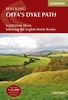
Offa`s Dyke Path Adventure Atlas

The A-Z Adventure Series of maps combines the best of OS and A-Z, creating the perfect companion for walkers, off-road cyclists, horse riders and anyone wishing to explore the great outdoors.Offa`s Dyke Path is a National Trail skirting the English/Welsh border. The 177 mile (285km) path is named after, and often follows, the spectacular 8th century Offa`s Dyke. The trail links Sedbury Cliffs near Chepstow with the coastal town of Prestatyn, crossing the border over 20 times along the way. The route on the map is clearly highlighted in yellow with mileage markers to gauge distances when planning sections of the walk to enjoy.This official National Trail Map of Offa`s Dyke Path features 52 pages of continuous Ordnance Survey Explorer mapping, providing complete coverage of the Offa`s
Dyke Path. The atlas includes a route planner showing distances between places and the amenities available, featuring: Information Centres, Hotels/B&Bs, Youth Hostels, Campsites (seasonal opening), Public Houses, Shops, Restaurants, Cafes (seasonal opening) and Petrol Stations.Also featured is advice on safety and security when walking and a selection of QR codes linked to useful websites, including temporary route updates from the National Trails, regional information, map reading advice and weather reports. Unlike the original OS sheets, this A-Z Adventure Atlas includes a comprehensive index to towns, villages, hamlets and locations, natural features, nature reserves, car parks and youth hostels, making it easy to find the required location quickly. Each index entry
has a page reference and a six figure National Grid Reference. With a book size of 240mm x 134mm it is the same size as a standard OS Explorer map when closed.
RIP - This product is no longer available on our network. It was last seen on 25.09.2019

This page now acts as a permanent archive for this product. Add more information using the comments box below to ensure it can still be found by future generations.

Use our search facility to see if it is available from an alternative contributor.
  • Availability: Out Of Stock
  • Supplier: Stanfords
  • SKU: 9781782571667
Availability: In Stock
£8.95

Product Description

The A-Z Adventure Series of maps combines the best of OS & A-Z, creating the perfect companion for walkers, off-road cyclists, horse riders & anyone wishing to explore the great outdoors. Offa`s Dyke Path is a National Trail skirting the English/ Welsh border. The 177 mile (285km) path is named after, & often follows, the spectacular 8th century Offa`s Dyke. The trail links Sedbury Cliffs near Chepstow with the coastal town of Prestatyn, crossing the border over 20 times along the way. The route on the map is clearly highlighted in yellow with mileage markers to gauge distances when planning sections of the walk to enjoy. This official National Trail Map of Offa`s Dyke Path features 52 pages of continuous Ordnance Survey Explorer mapping, providing complete coverage of the Offa`s Dyke Path. The atlas

Includes::
a route planner showing distances between places & the amenities available, featuring: Information Centres, Hotels/B& Bs, Youth Hostels, Campsites (seasonal opening), Public Houses, Shops, Restaurants, Cafes (seasonal opening) & Petrol Stations. Also featured is advice on safety & security when walking & a selection of QR codes linked to useful websites, including temporary route updates from the National Trails, regional information, map reading advice & weather reports. Unlike the original OS sheets, this A-Z Adventure Atlas

Includes::
a comprehensive index to towns, villages, hamlets & locations, natural features, nature reserves, car parks & youth hostels, making it easy to find the required location quickly. Each index entry has a page reference & a six figure National Grid Reference. With a book size of 240mm x 134mm it is the same size as a standard OS Explorer map when closed.

Reviews/Comments

Add New

Intelligent Comparison

Oooops!
We couldn't find anything!
Perhaps this product's unique.... Or perhaps we are still looking for comparisons!
Click to bump this page and we'll hurry up.

Price History

Vouchers

No voucher codes found.
Do you know a voucher code for this product or supplier? Add it to Insights for others to use.

Facebook

Jargon Buster

Yellow - A primary colour. The sun is often described as yellow
Car - A machine used for transport which runs on roads
Size - is the measurement of how big an object is in space.
Weather - is the change of an atmospheres conditions.
Safety - prevents damage being caused.
Natural - not manmade
Adventure - an undertaking of an exciting challenge or experience.
Road - a manmade lane or a path that is used to speed up travel.
Horse - A large animal with four legs that tends to be ridden.
Spectacular - Something that catches that eye due to its eye catchingness.
Regional - An adjective to describe a set geographic area.
Reference - To prove evidence with a back up source.

Supplier Information

Stanfords
Stanfords was established in 1853 and opened their iconic Covent Garden flagship store in 1901. They have become the top retailer of maps, travel books and accessories in the UK and arguably offer the largest selection of maps and travel books worldwide. Famous names such as Captain Robert Falcon Scott, Ranulph Fiennes and Michael Palin have purchased from Stanfords. They now have a shop in Bristol and both stores together with other venues operate a calendar of events including talks, book signings and exhibitions. As a specialist map retailer, the map selection is comprehensive and includes road maps, street maps and walking maps from worldwide destinations, as well as a selection of world atlases and wall maps. Books include travel guides and travel literature. Stanfords also stock globes, from miniatures made of blue marble to magnificent floor-standing globes. The website features a selection of interesting articles on travel topics.
Page Updated: 2023-11-12 20:15:36

Community Generated Product Tags

Oh No! The productWIKI community hasn't generated any tags for this product yet!
Menu