More From Contributor

£7.99
` For the first time, perhaps, since that land emerged from the waters of geologic ages, a human face was set toward it with love & yearning. It seemed beautiful to her, rich & strong & glorious.` Willa Cather`s second novel, O Pioneers! (1913) tells the story of Alexandra Bergson & her determination to save her immigrant family`s Nebraska farm. Clear-headed & fiercely independent, Alexandra`s passionate faith in the prairie makes her a wealthy landowner. By placing a strong, self-reliant woman at the centre of her tale, Cather gives the quintessentially American novel of the soil a radical cast. Yet, although influenced by the democratic utopianism of Walt Whitman & the serene regionalism of Sarah Orne Jewett, O Pioneers! is more than merely an elegy for the lost glories of America`s pioneer past. In its rage for order & efficiency, the novel testifies to the cultural politics of the Progressive Era, the period of massive social & economic transformations that helped to modernize the United States in the years between the Civil War & World War.ABOUT THE SERIES: For over 100 years Oxford World`s Classics has made available the widest range of literature from around the globe. Each affordable volume reflects Oxford`s commitment to scholarship, providing the most accurate text plus a wealth of other valuable features, including expert introductions by leading authorities, helpful notes to clarify the text, up-to-date bibliographies for further study, & much more. ...
Archived Product
£5.99
` She had felt as if her heart were hiding down there, somewhere, with the quail & the plover & all the little wild things that crooned or buzzed in the sun...` A rapturous work of savage beauty, Willa Cather`s 1913 tale of a pioneer woman who tames the wild, hostile lands of the Nebraskan prairie is also the story of what it means to be American. It is a new series of twenty distinctive, unforgettable Penguin Classics in a beautiful new design & pocket-sized format, with coloured jackets echoing Penguin`s original covers. ...
Archived Product
£13.99
Oahu is the most popular Hawaiian island for travelers, with excellent resorts, beautiful scenery, & extensive opportunities for activities both on the water & on l&. This guide covers all the popular areas of the isl&, including Honolulu, Waikiki, & the North Shore. ...
Archived Product
£9.99
Oahu at 1:80, 000 with a street plan of Honolulu from the Pearl Harbour to the Waikiki Beach & the Diamond Head Crater, plus the Big island at 1:200, 00 with plans of Hilo & Kailua-Kona on a waterproof & tear-resistant, double-side map from ITMB. Topography of the two islands is vividly presented by altitude colouring with numerous spot heights (both in feet); on the Big Island numerous crates are highlighted. The network of roads & local tracks indicates routes practical only for 4WD vehicles & shows locations of petrol stations. Symbols highlight various places of interest & tourist facilities, including botanical gardens & nature reserves, hot springs & waterfalls, historic sites, etc. Latitude & longitude are shown by lines at 0.4ºon Oahu & 0.2ºon the Big Isl&. Each island has a separate index & brief descriptions of various sights. The map of Oahu clearly indicates which area is covered by the plan of Honolulu at 1:35, 000 which extends along the coast to both sides of the downtown area: to the Honolulu International Airport & beyond it to the historic monuments in Pearl Harbour, & south-west to the Waikiki district & the Diamond Head Crater. Plans of Hilo & Kailua-Kona are at 1:30, 000 &, like the Honolulu plan, highlight hotels & other tourist accommodation, shopping centres, etc. To see other regional titles from ITMB covering USA please click on the series link. ...
Archived Product
£16.99
The magic & mystery of the woods are embedded in British culture, from ancient folklore to modern literature. They offer us refuge: a place to play, a place to think. They are the generous providers of fuel, timber, energy & life. They let us dream of other ways of living. Yet we now face a future where taking a walk in the woods is consigned to the tales we tell our children. Threatened by development, neglect & climate chaos, they are emptier
- of flora & fauna, but also of people
- than they have ever been. Immersing himself in the beauty of Britain`s woodlands & the art & writing they have inspired, Peter Fiennes explores our long relationship with the woods & the sad & violent story of how so many have been lost. Just as we need them, our woods need us too. But who, if anyone, is looking out for them? Fiennes journeys to Croft Castle & Parkland (Herefordshire), Clapham Common, Northfield Wood, The Weald, Knockwood & Secret Wood (Tenterden), Windsor Great Park, Runnymede (Surrey), Sherwood Forest, Cranborne Chase (Dorset), Kingley Vale (W. Sussex), Kipling`s house (South Downs), Wistman`s Wood (Dartmoor), Wayland Wood (Norfolk), Queen`s Wood (Highgate), Hardcastle Crags (W. Yorkshire), Glover`s Wood (Sussex), Smithy Wood (Sheffield).

...
Archived Product
£3.50
Oakengates South in 1901 in a fascinating series of reproductions of old Ordnance Survey plans in the Alan Godfrey Editions, ideal for anyone interested in the history of their neighbourhood or family. The map covers the southern part of the town & stretches south to include Pudley Hill Colliery & Forge Row just south of Hollinswood. From west to east coverage

Includes::
Mossey Green & Snowhill. Features include Snedhill Barracks, St Peter`s Church, Steel Works, Pudleyhill Colliery, Holy Trinity Church, Oakengates Station & GWR Railway Line. On the reverse is an extract from a commercial directory. About the Alan Godfrey Editions of the 25” OS Series: Selected towns in Great Britain & Ireland are covered by maps showing the extent of urban development in the last decades of the 19th & early 20th century. The plans have been taken from the Ordnance Survey mapping & reprinted at about 15 inches to one mile (1:4, 340). On the reverse most maps have historical notes & many also include extracts from contemporary directories. Most maps cover about one mile (1.6kms) north/south, one & a half miles (2.4kms) across; adjoining sheets can be combined to provide wider coverage.FOR MORE INFORMATION & A COMPLETE LIST OF ALL AVAILABLE TITLES PLEASE CLICK ON THE SERIES LINK.

...
Archived Product
£3.50
Oakenshaw, Low Moor & Wyke in 1905 in a fascinating series of reproductions of old Ordnance Survey plans in the Alan Godfrey Editions, ideal for anyone interested in the history of their neighbourhood or family. The map the southern part of Low Moor & northern part of Wyke, & extends eastward to Oakenshaw. Features include railways with Low Moor station, several mineral lines, Oakenshaw village, St Andrew`s church, Lower Woodlands, Salt Horn, Oakenshaw Mills, The Towers Dyeworks, Low Moor Chemical Works, Fearnley Farm, Pearson Fold, Ben Ing Pit, Raw Nook, Storr Hill, New Works Furnaces, part of Low Moor Iron Works, St Mark`s church, New Road Side, Upper Wyke, City Shed, etc About the Alan Godfrey Editions of the 25” OS Series: Selected towns in Great Britain & Ireland are covered by maps showing the extent of urban development in the last decades of the 19th & early 20th century. The plans have been taken from the Ordnance Survey mapping & reprinted at about 15 inches to one mile (1:4, 340). On the reverse most maps have historical notes & many also include extracts from contemporary directories. Most maps cover about one mile (1.6kms) north/south, one & a half miles (2.4kms) across; adjoining sheets can be combined to provide wider coverage.FOR MORE INFORMATION & A COMPLETE LIST OF ALL AVAILABLE TITLES PLEASE CLICK ON THE SERIES LINK. ...
Archived Product
£3.50
Oakham in 1903 in a fascinating series of reproductions of old Ordnance Survey plans in the Alan Godfrey Editions, ideal for anyone interested in the history of their neighbourhood or family. Though the most important town in Rutl&, Oakham was always relatively small & did not achieve borough status. However, the town did have the attributes of a county town, with the Assizes held in the Castle & a good range of shops & offices. The map captures most of the town &

Includes::
an introduction, along with a good contemporary directory. About the Alan Godfrey Editions of the 25” OS Series: Selected towns in Great Britain & Ireland are covered by maps showing the extent of urban development in the last decades of the 19th & early 20th century. The plans have been taken from the Ordnance Survey mapping & reprinted at about 15 inches to one mile (1:4, 340). On the reverse most maps have historical notes & many also include extracts from contemporary directories. Most maps cover about one mile (1.6kms) north/south, one & a half miles (2.4kms) across; adjoining sheets can be combined to provide wider coverage.FOR MORE INFORMATION & A COMPLETE LIST OF ALL AVAILABLE TITLES PLEASE CLICK ON THE SERIES LINK.

...
Archived Product
£6.50
Oakl&, Berkeley & Richmond in California on an indexed street plan from Rand Mc Nally in their extensive range of maps covering cities in the United States. Insets provide more detailed street plans of downtown Oakland & Berkeley (including the western part of the University campus), a detailed plan of the Oakland International Airport (OAK), plus a road map of Oakland & vicinity. Other communities covered by this map include Alameda, Bay Farm Isl&, Crockett, El Cerrito, Emeryville, Moraga, Orinda, Piedmont, Pinole, Rodeo, San Leandro & San Pablo. Rand Mc Nally street plans provide coverage of cities with their outer suburbs, clearly indicating main traffic arteries: highways (distinguishing between free & toll access), plus primary & secondary routes. Road numbers and/or names are clearly displayed & exit numbers are indicated. Locations of service & rest areas are marked & one way streets are shown. Longer streets are annotated with block numbers for easier identification of addresses. The maps show railway, bus &, where appropriate, metro stations. A range of symbols indicate various places of interest including cultural & academic institutions, various municipal facilities, golf courses, etc. The plans have extensive street indexes, supplemented by lists of points of interest, parks & recreational areas, shopping malls, stations, schools, etc. ...
Archived Product
£13.99
The Oakridge, Oregon trail map from Adventure Maps, Inc. is a waterproof, topographic map that

Includes::


...
Archived Product

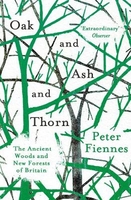
Oak And Ash And Thorn: The Ancient Woods And New Forests Of Britain

A Guardian Best Nature Book of the YearThe magic and mystery of the woods are embedded in culture, from ancient folklore to modern literature. They offer us refuge: a place to play, a place to think. They are the generous providers of timber and energy. They let us dream of other ways of living. Yet we now face a future where taking a walk in the woods is consigned to the tales we tell our children. Immersing himself in the beauty of woodland Britain, Peter Fiennes explores our long relationship with the woods and the sad and violent story of how so many have been lost. Just as we need them, our woods need us too. But who, if anyone, is looking out for them?
RIP - This product is no longer available on our network. It was last seen on 25.09.2019

This page now acts as a permanent archive for this product. Add more information using the comments box below to ensure it can still be found by future generations.

Use our search facility to see if it is available from an alternative contributor.
  • Availability: Out Of Stock
  • Supplier: Stanfords
  • SKU: 9781786073211
Availability: In Stock
£9.99

Product Description

A Guardian Best Nature Book of the Year The magic & mystery of the woods are embedded in culture, from ancient folklore to modern literature. They offer us refuge: a place to play, a place to think. They are the generous providers of timber & energy. They let us dream of other ways of living. Yet we now face a future where taking a walk in the woods is consigned to the tales we tell our children. Immersing himself in the beauty of woodland Britain, Peter Fiennes explores our long relationship with the woods & the sad & violent story of how so many have been lost. Just as we need them, our woods need us too. But who, if anyone, is looking out for them?

Reviews/Comments

Add New

Intelligent Comparison

Oooops!
We couldn't find anything!
Perhaps this product's unique.... Or perhaps we are still looking for comparisons!
Click to bump this page and we'll hurry up.

Price History

Vouchers

No voucher codes found.
Do you know a voucher code for this product or supplier? Add it to Insights for others to use.

Facebook

Jargon Buster

Oak - A member of the beech tree family that has acorns growing on it.
Children - A young life form within the early stages of physical development,

Supplier Information

Stanfords
Stanfords was established in 1853 and opened their iconic Covent Garden flagship store in 1901. They have become the top retailer of maps, travel books and accessories in the UK and arguably offer the largest selection of maps and travel books worldwide. Famous names such as Captain Robert Falcon Scott, Ranulph Fiennes and Michael Palin have purchased from Stanfords. They now have a shop in Bristol and both stores together with other venues operate a calendar of events including talks, book signings and exhibitions. As a specialist map retailer, the map selection is comprehensive and includes road maps, street maps and walking maps from worldwide destinations, as well as a selection of world atlases and wall maps. Books include travel guides and travel literature. Stanfords also stock globes, from miniatures made of blue marble to magnificent floor-standing globes. The website features a selection of interesting articles on travel topics.
Page Updated: 2023-11-12 20:15:36

Community Generated Product Tags

Oh No! The productWIKI community hasn't generated any tags for this product yet!
Menu