More From Contributor

£3.99
Be ready to write in a New York minute with this handy reporter style notebook. The New York Times lenticular journal features a full-colour cover image that changes to show the Empire State Building & Manhattan skyline from day to night. With 120 lined pages, this fun journal is more than just a novelty
- it`s the perfect way to show off your New York pride.
...
Archived Product
£90.00
This book by the famous Caribbean chef Rosemary Parkinson is filled with beautiful colour photography of the island & its culinary produce. Parkinson takes us on her culinary adventure with her prose & stories gathered from local people It takes us on a culinary ride from parish to parish gathering the best recipes from the area as well as residents’ specialities. This is not only a cookbook. It is a cultural guide to Jamaica. ...
Archived Product
£12.95
Nyboe Land area in a series covering the northern coast of Greenland at 1:500, 000, originally produced by the Danish survey organization Kort & Martikelstyrelsen in April 2000 & now printed by Saga Maps. The maps have contours at 100m intervals with spot heights & indicate areas covered by icecap. Local settlements, research stations, airstrips & boundaries of protected areas are marked. The maps have a latitude grid at intervals of 15’ & longitude at 1º. Map legend is in Danish only. ...
Archived Product
£16.99
Topographic survey of Sweden at 1:50, 000, the Terrängkartan, from the Lantmäteriet, covering most of the country in 244 double-sided maps. Please note: the mountainous regions of central & northern Sweden are not covered by this series but presented in a separate “ Fjällkartan
- Mountain Map” series also listed on our website. Each 1:50, 000 topographic survey map covers an area of 37.5 x 40km. The maps have contours at 5 metre intervals, plus relief shading & graphics for rocky outcrops & boulders. Further graphics and/or colouring show different types of land use or vegetation (forests, arable l&, orchards, marshes, peat bogs, etc). An unusual feature of this survey is the colouring indicating buildings below or above two storeys high & “leisure/holiday homes”. The maps indicate privately maintained roads & include all other information expected of topographic survey at this scale. The maps have a 1-km UTM grid, plus latitude & longitude lines 5’ intervals. Map legend

Includes::
English. For coverage of the country’s most visited hiking areas in central & northern Sweden please see Lantmäteriet’s Mountain Map series, listed separately on our website.


...
Archived Product
£16.99
Sverigeserien is an outdoor map series consisting of 116 sheets with coverage of southern & central Sweden & the northern coastline. The map is suitable for outdoor activities such as hiking, excursions, trail running, hunting, fishing, riding, cycling, mountain biking, paddling, skating & much more. Every sheet covers an area of 45x 68km. These topographical maps in scale 1:50 000 contain all the information needed for outdoor activities: Terrain information, hiking trails, illuminated tracks, camping, shelters, golf courses, leisure baths, historical remains, roads in different categories, railway lines & much more. Easy to read topography with contour lines, vertical interval 5 m. Sverigeserien is a high-quality map series & is durable for frequent use! Updated content with map data from Lantmäteriet (National Land Survey of Sweden) & printed on Polyart which is water & tear resistant. This means that the map can be folded repeatedly without breaking & can withstand the challenging weather in Sweden during both winter & summer. Legend is in Swedish, English & German. ...
Archived Product
£21.95
New York City is known for its yellow cabs, retail stores, & phenomenal skyline. It’s a city full of coffee culture, alternative fashion & rock climbing. This lesser known fact may come as a surprise to most who have yet to explore the hidden landscapes beneath the city’s veil of steel & concrete. These unique boulders are steeped in history & offer a climbing experience like nowhere else in the world. With colour photos throughout. Coverage

Includes::
Central Park, Morningside Park, St Nicholas Park, High Bridge Park, Loony Bin Boulder, Fort Tryon & Inwood Park.

...
Archived Product
£14.95
NYC Guide for Instagrammers is a one-of-a-kind guide to the Big Apple: hip & trendy, up-to-date, informative & playful. The book provides the reader with no less than a hundred scenic & impressive ` Instagrammable` spots in New York. Of course, some classics have been included
- Brooklyn Bridge, Grand Central, Liberty Isl&, Central Park
- but most of all, the reader will be introduced to hidden gems, known only to locals, & to `new classics`, relatively new landmarks on the verge of becoming some of the biggest attractions New York has to offer.

...
Archived Product
£16.99
Topographic survey of Sweden at 1:50, 000, the Terrängkartan, from the Lantmäteriet, covering most of the country in 244 double-sided maps. Please note: the mountainous regions of central & northern Sweden are not covered by this series but presented in a separate “ Fjällkartan
- Mountain Map” series also listed on our website. Each 1:50, 000 topographic survey map covers an area of 37.5 x 40km. The maps have contours at 5 metre intervals, plus relief shading & graphics for rocky outcrops & boulders. Further graphics and/or colouring show different types of land use or vegetation (forests, arable l&, orchards, marshes, peat bogs, etc). An unusual feature of this survey is the colouring indicating buildings below or above two storeys high & “leisure/holiday homes”. The maps indicate privately maintained roads & include all other information expected of topographic survey at this scale. The maps have a 1-km UTM grid, plus latitude & longitude lines 5’ intervals. Map legend

Includes::
English. For coverage of the country’s most visited hiking areas in central & northern Sweden please see Lantmäteriet’s Mountain Map series, listed separately on our website.


...
Archived Product
£29.99
Topographic survey of Denmark at 1:100, 000 from Kort & Matrikelstyrelsen, the country’s national survey organization. The maps have contours at 5 metre intervals, with colouring and/or graphics showing various types of terrain & land use: woodlands, orchards, heath, sand & dunes, tidal flats, meadows & marshl&, etc. The maps provide detailed presentation of the road & rail networks & other information expected of topographic mapping at this scale. No specifically tourist information such as waymarked cycling or hiking routes is shown. Standard size sheets cover an area of 56 x 45km / 35x 28 miles approx. Map legend

Includes::
English. To see other titles in this series please click on the series link.IMPORTANT – PLEASE NOTE BEFORE ORDERING:AVAILABILITY: all the maps are now printed on dem&. Delivery from Denmark can take over 4 weeks. Once an order has been placed we cannot accept any returns for credit.COORDINATES: although the maps are meant to have UTM coordinates for EUREF 89 (WGS 84) datum, sheets are sometimes delivered printed without any grid or margin ticks for UTM or latitude & longitude.

...
Archived Product
£16.99
Sverigeserien is an outdoor map series consisting of 116 sheets with coverage of southern & central Sweden & the northern coastline. The map is suitable for outdoor activities such as hiking, excursions, trail running, hunting, fishing, riding, cycling, mountain biking, paddling, skating & much more. Every sheet covers an area of 45x 68km. These topographical maps in scale 1:50 000 contain all the information needed for outdoor activities: Terrain information, hiking trails, illuminated tracks, camping, shelters, golf courses, leisure baths, historical remains, roads in different categories, railway lines & much more. Easy to read topography with contour lines, vertical interval 5 m. Sverigeserien is a high-quality map series & is durable for frequent use! Updated content with map data from Lantmäteriet (National Land Survey of Sweden) & printed on Polyart which is water & tear resistant. This means that the map can be folded repeatedly without breaking & can withstand the challenging weather in Sweden during both winter & summer. Legend is in Swedish, English & German. ...
Archived Product

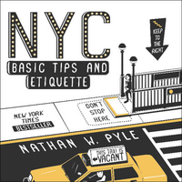
NYC Basic Tips And Etiquette

Living in New York City for five years as a transplant from Ohio, illustrator and T-shirt designer Nathan Pyle was fascinated by the unique habits and unspoken customs New Yorkers follow to make life bearable in a city with 8 million people (and seemingly twice the number of tourists). In NYC Basic Tips and Etiquette, Pyle reveals the secrets and unwritten rules for living in and visiting New York including the answers to such burning questions as, how do I hail a cab? What is a bodega? Which way is Uptown? Why are there so many doors in the sidewalk? How do I walk on an escalator? Do we need be touching right now? Where should I inhale or exhale while passing sidewalk garbage? How long should I honk my horn? If New York were a game show, how would I win? What happens when I stand in
the bike lane? Who should get the empty subway seats? How do I stay safe during a trash tornado? Each tip is a little story illustrated in simple black and white drawings.
RIP - This product is no longer available on our network. It was last seen on 25.09.2019

This page now acts as a permanent archive for this product. Add more information using the comments box below to ensure it can still be found by future generations.

Use our search facility to see if it is available from an alternative contributor.
  • External links may include paid for promotion
  • Availability: Out Of Stock
  • Supplier: Stanfords
  • SKU: 9780062303110
Availability: In Stock
£8.99

Product Description

Living in New York City for five years as a transplant from Ohio, illustrator & T-shirt designer Nathan Pyle was fascinated by the unique habits & unspoken customs New Yorkers follow to make life bearable in a city with 8 million people (and seemingly twice the number of tourists). In NYC Basic Tips & Etiquette, Pyle reveals the secrets & unwritten rules for living in & visiting New York including the answers to such burning questions as, how do I hail a cab? What is a bodega? Which way is Uptown? Why are there so many doors in the sidewalk? How do I walk on an escalator? Do we need be touching right now? Where should I inhale or exhale while passing sidewalk garbage? How long should I honk my horn? If New York were a game show, how would I win? What happens when I stand in the bike lane? Who should get the empty subway seats? How do I stay safe during a trash tornado? Each tip is a little story illustrated in simple black & white drawings.

Reviews/Comments

Add New

Intelligent Comparison

Oooops!
We couldn't find anything!
Perhaps this product's unique.... Or perhaps we are still looking for comparisons!
Click to bump this page and we'll hurry up.

Price History

Vouchers

No voucher codes found.
Do you know a voucher code for this product or supplier? Add it to Insights for others to use.

Facebook

Jargon Buster

Bodega - Spanish term for winery
Black - A colour which does not emit any colour of the spectrum. Black absorbs all frequencies of the spectrum.
White - A colour combining all colours
New York - A United States State. Commonly known as the Big Apple
t-shirt - A buttonless shirt pulled over a persons head to cover most of the torso.
Shirt - an item of clothing. Shirts are worn over the shoulders and are buttoned together at the front. Shirts also have a collar.
Simple - Basic, easy no difficulty in understanding.

Supplier Information

Stanfords
Stanfords was established in 1853 and opened their iconic Covent Garden flagship store in 1901. They have become the top retailer of maps, travel books and accessories in the UK and arguably offer the largest selection of maps and travel books worldwide. Famous names such as Captain Robert Falcon Scott, Ranulph Fiennes and Michael Palin have purchased from Stanfords. They now have a shop in Bristol and both stores together with other venues operate a calendar of events including talks, book signings and exhibitions. As a specialist map retailer, the map selection is comprehensive and includes road maps, street maps and walking maps from worldwide destinations, as well as a selection of world atlases and wall maps. Books include travel guides and travel literature. Stanfords also stock globes, from miniatures made of blue marble to magnificent floor-standing globes. The website features a selection of interesting articles on travel topics.
Page Updated: 2023-11-12 20:15:36

Community Generated Product Tags

Oh No! The productWIKI community hasn't generated any tags for this product yet!
Menu