More From Contributor
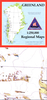
£12.99
Twenty-four miniature board books are nestled into 24 windows, numbered 1 through 24 &, like the peek-a-boo windows of an Advent calendar, are meant to be opened one-per-day from December 1 through Christmas Eve. Read in sequence, night after night, the full-colour four-page books & capture the magic of Marie`s Christmas Eve adventures, from the entrance of the mysterious Herr Drosselmeyer (Book 6) to the Nutcracker`s battle with the Mouse King (Book 15), to a thrilling celebration at the palace of the Sugar Plum Fairy (Book 19). In addition, children can use the vividly illustrated books-with gold thread loops & four different trim sizes---to hang on the family Christmas tree. ...
Archived Product
£15.99
In this fully updated second edition, expert dieticians Sue Baic & Nigel Denby provide no-nonsense advice, equipping you with all the information you need to make informed decisions about your diet. The book acts as a sound reference point if you want to know the facts about food, & debunks the myths behind fad diets. Nutrition For Dummies, 2nd Edition provides a detailed understanding of the nutritional breakdown of different food groups & examines the relationship food has with one`s physical & mental wellbeing. The book also advises you on how to establish healthy eating patterns & how to maximise the health benefits of what you eat. This new edition

Includes::
approx 20% new & updated material, including new chapters on nutrition in institutions & how to eat healthily on the go. New content also

Includes::
up-to-date health guidelines & government policies, information on probiotics & over the counter weight loss drugs, plus advice on how to eat well on a budget. Nutrition For Dummies, 2 nd Edition
Includes:: Part I: The Basic Facts about Nutrition Chapter 1: What`s Nutrition, Anyway? Chapter 2: Digestion: The 24-Hour Food Factory Chapter 3: Why You Eat What You Eat & Like What You Like Part II: What You Get from Food Chapter 4: Powerful Protein Chapter 5: The Lowdown on Fat & Cholesterol Chapter 6: Calories: The Energisers Chapter 7: Carbohydrates: A Complex Story Chapter 8: The Alcohol Truth: The Whole Truth Chapter 9: Vigorous Vitamins Chapter 10: Mighty Minerals Chapter 11: Phabulous Phytochemicals Chapter 12: Water Works Part III: Healthy Eating Chapter 13: What Is a Healthy Diet? Chapter 14: Making Wise Food Choices Chapter 15: Ensuring Good Nutrition Whoever You Are NEW! Chapter 16: Eating in Institutions NEW! Chapter 17: Being Nutritionally Savvy on the Go Part IV: Processed Food Chapter 18: What Is Processed Food? Chapter 19: Cooking & Keeping Food Chapter 20: Weird Science: Examining Food Additives Part V: Food & Health Chapter 21: Food & Allergies Chapter 22: Food & Mood Chapter 23: Food & Medicine Chapter 24: Food & Dietary Supplements Part VI: The Part of Tens Chapter 25: Ten Nutrition Web Sites You Can Trust Chapter 26: Ten Superfoods Chapter 27: Ten Fad Diets: The Truth Behind the Headlines


...
Archived Product
£6.99
An elite crew of furry animals are celebrating. They have found the Lost Nuts of Legend & according to the myth, the bearer of this mythical snack will be immortal, invincible & never will it be past their bedtime
- now all they have to do is go home. But
- oh dear
- if only it were that simple. Everyone is starving, the Star Nav is broken, the neighbours are distinctly unfriendly & it was a really, REALLY bad idea to stop at the Death Banana & ask for directions. Will they EVER find their way home? &, most importantly will they get home before something happens to the Nuts?`


...
Archived Product
£8.99
Trudy has betrayed her husb&, John. She`s still in the marital home – a dilapidated, priceless London townhouse – but not with John. Instead, she`s with his brother, the profoundly banal Claude, & the two of them have a plan. But there is a witness to their plot: the inquisitive, nine-month-old resident of Trudy`s womb. ...
Archived Product
£16.99
Trudy has betrayed her husb&, John. She`s still in the marital home
- a dilapidated, priceless London townhouse
- but not

...
Archived Product
£16.95
Nuuk, map no. 11, in a series of topographic maps of popular coastal areas of southern & central Greenl&. Countours are shown at 25-metre intervals, with additional altitude colouring. The maps show settlements, farms, shepherds` huts, water supply areas, roads & tracks, fords, rivers & streams, etc. Tourist information

Includes::
marked or partly marked hiking routes, recommended kayak routes, information centres, hotels, campsites, youth hostels, general stores, places of interest, etc. A grid gives UTM co-ordinates plus latitude in steps of 5` & longitude in 10`. Map legend

Includes::
English. On the reverse of selected titles there are notes, in English, with advice on hiking in Greenl&, as well as descriptions of the area, including plans of main settlements highlighting important buildings & institutions.


...
Archived Product
£13.95
Topographic survey of Greenland at 1:250, 000 from Sagamaps in a series which along the western coast extends past Thule to the latitude of 78°, plus covers selected areas of the east coast including the Stauning Alps. Relief is shown by contours at 50m intervals, augmented by frequent spot heights. Main peaks are named, along with many other physical features, e.g. bays & islands. Glaciers, moraine & low-lying coastal plains are also indicated & contours continue for a limited extent into the icecap region. The maps show settlements, roads, airstrips & heliports, anchorages & selected other landmarks. Lines of longitude & latitude are drawn at 1° & 15` intervals respectively. Map legend which

Includes::
English is provided in a separate sheet. Saga’s topographic mapping of Greenland at 1:250, 000 is available either as 22 smaller sheets, sold separately or in sets of four maps, plus as three larger maps covering the western coast up to approx 65°. Selected titles are also published with a historical guide on the reverse illustrated with old photos, drawings & maps; all the text is in English. To see the full list of titles in this series please click on the series link.

...
Archived Product
£15.95
Topographic survey of Greenland at 1:250, 000 from Sagamaps in a series which along the western coast extends past Thule to the latitude of 78°, plus covers selected areas of the east coast including the Stauning Alps. Relief is shown by contours at 50m intervals, augmented by frequent spot heights. Main peaks are named, along with many other physical features, e.g. bays & islands. Glaciers, moraine & low-lying coastal plains are also indicated & contours continue for a limited extent into the icecap region. The maps show settlements, roads, airstrips & heliports, anchorages & selected other landmarks. Lines of longitude & latitude are drawn at 1° & 15` intervals respectively. Map legend which

Includes::
English is provided in a separate sheet. Saga’s topographic mapping of Greenland at 1:250, 000 is available either as 22 smaller sheets, sold separately or in sets of four maps, plus as three larger maps covering the western coast up to approx 65°. Selected titles are also published with a historical guide on the reverse illustrated with old photos, drawings & maps; all the text is in English. To see the full list of titles in this series please click on the series link.

...
Archived Product
£16.50
One of the titles in a series of contoured physical maps covering the coastal areas of Greenl&. The maps have the same cartography as the 1:250, 000 series by this publisher, reproduced here at half the original scale. The reduction means that some place names, symbols & fine detail are harder to read than on the original 1:250, 000 series. Main peaks, bays, channels etc. are named, & settlements, airstrips, & anchorages are shown. Glaciers, moraine & low-lying coastal plains are also distinguished. Lines of longitude & latitude are drawn at 1° & 15` intervals respectively. There is no map legend. ...
Archived Product
£17.50
Nuuksio Luukki area of Finland at 1:20, 000 in a series of beautiful & informative maps of popular outdoor leisure areas with cartography of the country’s topographic survey. Excellent use of colours, shading & symbols provides a very detailed picture of the terrain & vegetation. Extensive overprint highlights routes for hiking, and/or other outdoor pursuits, a wide variety of accommodation, from hotels & holiday villages to Lapland tepees, food & fuel supplies, etc. The maps have a UTM grid & margin ticks for latitude & longitude. Map legends include English. ...
Archived Product

Nuuk

Nuuk, map no. 11, in a series of waterproof and tear-resistant topographic maps of popular coastal areas of southern and central Greenland. Countours are shown at 25-metre intervals, with additional altitude colouring. The maps show settlements, farms, shepherds' huts, water supply areas, roads and tracks, fords, rivers and streams, etc. Tourist information includes marked or partly marked hiking routes, recommended kayak routes, information centres, hotels, campsites, youth hostels, general stores, places of interest, etc. A grid gives UTM co-ordinates plus latitude in steps of 5' and longitude in 10'. Map legend includes English.On the reverse of selected titles there are notes, in English, with advice on hiking in Greenland, as well as descriptions of the area,
including plans of main settlements highlighting important buildings and institutions.
RIP - This product is no longer available on our network. It was last seen on 25.09.2019

This page now acts as a permanent archive for this product. Add more information using the comments box below to ensure it can still be found by future generations.

Use our search facility to see if it is available from an alternative contributor.
  • Availability: Out Of Stock
  • Supplier: Stanfords
  • SKU: XL00000079892
Availability: In Stock
£12.95

Product Description

Nuuk, map no. 11, in a series of waterproof & tear-resistant topographic maps of popular coastal areas of southern & central Greenl&. Countours are shown at 25-metre intervals, with additional altitude colouring. The maps show settlements, farms, shepherds' huts, water supply areas, roads & tracks, fords, rivers & streams, etc. Tourist information

Includes::
marked or partly marked hiking routes, recommended kayak routes, information centres, hotels, campsites, youth hostels, general stores, places of interest, etc. A grid gives UTM co-ordinates plus latitude in steps of 5' & longitude in 10'. Map legend

Includes::
English. On the reverse of selected titles there are notes, in English, with advice on hiking in Greenl&, as well as descriptions of the area, including plans of main settlements highlighting important buildings & institutions.

Reviews/Comments

Add New

Intelligent Comparison

Oooops!
We couldn't find anything!
Perhaps this product's unique.... Or perhaps we are still looking for comparisons!
Click to bump this page and we'll hurry up.

Price History

Vouchers

No voucher codes found.
Do you know a voucher code for this product or supplier? Add it to Insights for others to use.

Facebook

Jargon Buster

Hiking - An outdoor activity envolving walking in nature
water - A chemical substance. Chemical formula H2O.
Waterproof - Resistant to water, usualy specified by depth in metres
Resistant - Something that can repel against something.
Metre - 100cm. A unit of length.
Altitude - Something that can be quite high in relation to sea or ground level.
Popular - Something that is admired and liked by many people.

Supplier Information

Stanfords
Stanfords was established in 1853 and opened their iconic Covent Garden flagship store in 1901. They have become the top retailer of maps, travel books and accessories in the UK and arguably offer the largest selection of maps and travel books worldwide. Famous names such as Captain Robert Falcon Scott, Ranulph Fiennes and Michael Palin have purchased from Stanfords. They now have a shop in Bristol and both stores together with other venues operate a calendar of events including talks, book signings and exhibitions. As a specialist map retailer, the map selection is comprehensive and includes road maps, street maps and walking maps from worldwide destinations, as well as a selection of world atlases and wall maps. Books include travel guides and travel literature. Stanfords also stock globes, from miniatures made of blue marble to magnificent floor-standing globes. The website features a selection of interesting articles on travel topics.
Page Updated: 2023-11-12 20:15:36

Community Generated Product Tags

Oh No! The productWIKI community hasn't generated any tags for this product yet!
Menu