More From Contributor
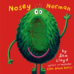
£3.50
Norwich, Hingham & District in 1908 in a series of reproductions of Ordnance Survey’s famous ” Inch to the Mile” maps published in the Alan Godfrey Editions to provide a historical record of England & Wales in the second half of 19th & early 20th century. In this title coverage stretches from East Dereham eastward to Thorpe-next-Norwich, & from Ringland southward to Attleborough. Other locations on the map include Arminghall, Ashwellthorpe, Barford, Barnham Broom, Bawburgh, Besthorpe, Bixley, Bracon Ash, Brandon Parva, Caistor St Edmunds, Carleton Forehoe, Catton, Colton, Costessey, Coston, Cringleford, Crownthorpe, Deopham, Drayton, Dunston, East Carleton, East Tuddenham, Easton, Flordon, Framingham Pigot, Fundenhall, Garveston, Great Ellingham, Great Melton, Hackford, Hapton, Hardingham, Hellesdon, Hethel, Hethersett, Hingham, Hockering, Honingham, Howe, Intwood, Keswick, Ketteringham, Kimberley, Little Ellingham, Little Melton, Mattishall, Mattishall Burghs, Morley St Botolph, Morley St Peter, Mulbarton, Newton Flotman, North Tuddenham, Reymerston, Rockland St Peter, Saxlingham Nethergate, Saxlingham Thorpe, Scoulton, Shotesham All Saints, Shotesham St Mary, Southburgh, Sproweston, Stoke Holy Cross, Swainsthorpe, Swardeston, Tacolneston, Tasburgh, Taverham, Thuxton, Welborne, Westfield, Whinbergh, Wicklewood, Woodrising, Wramplingham, Wreningham, Wymondham & Yaxham. On the reverse is an extract from Norfolk Sheet 73.10, which shows the centre of Hingham in detail & a directory for the town. About the Alan Godfrey Editions of the OS Inch to the Mile Maps: the maps provide an invaluable overview of a wider area, typically 18 x 12 miles (29 x 19 kms approx.), & offer historical mapping for small towns & villages not covered by the more detailed series for which the Godfrey Editions are better known. On the reverse all the maps have historical notes & most titles also include a more detailed, large scale map of a small town or a village in the area. To see other titles in this series please click on the series link. ...
Archived Product
£14.99
Waterproof & tear-resistant OS Active version of map No. 134 from the Ordnance Survey’s Landranger series at 1:50, 000, with contoured & GPS compatible topographic mapping plus tourist information.MOBILE DOWNLOADS: As well as the physical edition of the map, each Landranger title now

Includes::
a code for downloading after purchase its digital version onto your smartphone or tablet for viewing on the OS smartphone app.OS LANDRANGER SERIES: to see the list of all the titles in the OS Landranger series, both paper & waterproof versions, please click on the series link. Maps in the Landranger series provide plenty of recreational & tourist information, indicating the traditional public right of way paths (except in Scotland where different laws apply), including bridleways & byways restricted or open to motorized traffic. National Trails & selected other long-distance paths are marked, as well as on-road & traffic-free cycle routes with their National/ Regional Cycle Network numbers. National Trust/ National Trust for Scotland & Forestry Commission land is clearly marked, indicating open or restricted access. A range of symbols highlights camping & caravanning sites, youth hostels, tourist information offices & visitors’ centres, parking & picnicking places, World Heritage sites, sport & recreational facilities, etc. The maps provide detailed presentation of topography with contours at 10m intervals, numerous spot heights & additional colouring and/or graphics for different types of woodlands, orchards or parkl&, rock features including scree & cliffs, water features inland & along the sea shore with marshl&, dunes, s&, mud, shingle & the high water mark. All the standard information expected of survey mapping at this scale is included: finely graded road network, railway lines with stations, cuttings, embankments, etc; individual isolated buildings; archaeological & historical sites, etc. For GPS users the British National Grid is shown at 1km intervals, with latitude & longitude given by margin ticks at 1` & cross hairs on the map at 5`. Each map covers an area of 40 x 40km, (approx. 25 x 25 miles).

...
Archived Product
£8.99
Paper version of map No. 134 from the Ordnance Survey’s Landranger series at 1:50, 000, with contoured & GPS compatible topographic mapping plus tourist information.MOBILE DOWNLOADS: As well as the physical edition of the map, each Landranger title now

Includes::
a code for downloading after purchase its digital version onto your smartphone or tablet for viewing on the OS smartphone app.OS LANDRANGER SERIES: to see the list of all the titles in the OS Landranger series, both paper & waterproof versions, please click on the series link. Maps in the Landranger series provide plenty of recreational & tourist information, indicating the traditional public right of way paths (except in Scotland where different laws apply), including bridleways & byways restricted or open to motorized traffic. National Trails & selected other long-distance paths are marked, as well as on-road & traffic-free cycle routes with their National/ Regional Cycle Network numbers. National Trust/ National Trust for Scotland & Forestry Commission land is clearly marked, indicating open or restricted access. A range of symbols highlights camping & caravanning sites, youth hostels, tourist information offices & visitors’ centres, parking & picnicking places, World Heritage sites, sport & recreational facilities, etc. The maps provide detailed presentation of topography with contours at 10m intervals, numerous spot heights & additional colouring and/or graphics for different types of woodlands, orchards or parkl&, rock features including scree & cliffs, water features inland & along the sea shore with marshl&, dunes, s&, mud, shingle & the high water mark. All the standard information expected of survey mapping at this scale is included: finely graded road network, railway lines with stations, cuttings, embankments, etc; individual isolated buildings; archaeological & historical sites, etc. For GPS users the British National Grid is shown at 1km intervals, with latitude & longitude given by margin ticks at 1` & cross hairs on the map at 5`. Each map covers an area of 40 x 40km, (approx. 25 x 25 miles).

...
Archived Product
£14.95
Originally, Norwood was a venue for days out at tea gardens & it was the site of Beulah Spa. By 1854, the re-erected Crystal Palace of Joseph Paxton towered over the Norwood area, making it fashionable, & large houses adorned the attractive upper slopes, whose residents were in their turn served by those who lived in the smaller houses further down. Yet by the 1930s Norwood was a place of unlet houses, its heyday gone. Norwood now provides a welcome respite for commuting Londoners. ...
Archived Product
£12.99
The contrasting suburbs of West, Upper, & South Norwood grew up during the nineteenth century, on the range of hills once covered by the Great North Wood. West Norwood was intended to be smart & exclusive, but that ambition was achieved instead by Upper Norwood, which enjoyed the highest ground, the freshest air & the best views. South Norwood, which developed after the arrival of the railway in 1839, was more industrial & commercial than its older sisters. All three were at their peak of prosperity late in the nineteenth century. The 200 photographs presented here for the first time, each with a detailed caption, show the district in the early twentieth century, . A selection of contemporary maps helps to set the scene, & the book features a detailed index. ...
Archived Product
£29.99
Map No. 2520, Nossob, in South Africa’s official topographic survey at 1:250, 000 from the country’s national survey organization, the Chief Directorate of Surveys & Mapping. The maps have altitude colouring & contours at 50m or 100m intervals, depending on the map edition, plus spot heights. Deserts, marshes, dry pans, perennial & seasonal water features, etc, as well as protected areas are shown. The maps present the country’s road & rail networks & include the usual information expected on topographic mapping at this scale, although in more rapidly developing areas road information may not necessarily be up to date. Also indicated are magisterial district & provincial boundaries. Latitude & longitude values are shown in the margins at 5` intervals together with South African grid co-ordinates. Typically, each sheet covers an area of one degree of latitude & two degrees of longitude. The projection used is Gauss Conformal. The legend is in English & Afrikaans. ...
Archived Product
£12.99
The small Tuscan town of Castelluccio is preparing for its annual festival, a spectacular pageant in which a leading role will be taken by the self-exiled English painter Gideon Westfall. A man proudly out of step with modernity, Westfall is regarded by some as a maestro, but in Castelluccio
- as in the wider art world
- he has his enemies, & his niece
- just arrived from England
- is no great admirer either. & a local girl is missing, a disappearance that seems to implicate the artist. But the life & art of Gideon Westfall form just one strand of Nostalgia, a novel that teems with incidents & characters, from religious visionaries to folk heroes. Constantly shifting between the panoramic & the intimate, between the past & the present, Nostalgia is a fiction into which are woven the kaleidoscopic narratives of art, architecture, history, legend & much more.


...
Archived Product
£9.99
Nostromo, published in 1904, is one of Conrad`s finest works. Nostromo
- though one hundred years old
- says as much about

...
Archived Product
£6.99
From the award-winning author of RUDIE NUDIE comes a beautiful, lyrical story about friendship & the power of imagination
- now
...
Archived Product
£9.99
More than two decades have passed since Peter Esterhazy ended his book ” Helping Verbs of the Heart” with the sentence, `I will write about all that in more detail later`. In this luminous novel, he finally makes the meaning of this literary mystery clear. ” Not Art” is the story of a mother whose defining communication with the world is in the language of football, a vocabulary that eclipses not only her son, but everything else. Football, in the author`s next to the last book a stage & a medium for private historiography, now acts as a filter through which the world is seen, & is the root of his relationship to his mother & his mother tongue: a mother`s language complex. Readers will discover `family stories`, subtly written & rounded, filled with irony, beauty, history, the Magnificent Magyars, father, grandmother, aunt, uncle, mother, life & death. There is emotion-platonic love, marital love, & a son`s love for his parents. & there is the Esterhazyesque auto-reflexive textual world (Where does the author begin & end?). Old world glamour meets fractured post-war reality in a tale that touches on many aspects of life & philosophy relevant to us today
- while centering on a son`s relationship to his mother & the game of football that they love. The author received the following international awards: Vilenica Prize, Slovenia (1988, 1998) Ordre des Arts et des Lettres, France (1992, 1994, 2003) Prize of the Literary Festival in Rome, Italy (1993) Bjornson Prize, Norway (1995) Austrian State Prize, Austria (1999) Herder Prize, Austria (2002) Peace Prize of the German Book Trade at Frankfurt Book Fair (2004). He has also received nearly 20 awards in his native country.
...
Archived Product

Nosey Norman

Meet the Mini Monster Mates, from the creator of the award-winning Calm Down, Boris! Nosey Norman is sniffing out numbers from one to five. Also available is Ernie the Eye Monster who is looking at all the colours in the park. These appealing, interactive finger puppet books are a perfect introduction to simple concepts, and come with a texture patch on the final spread.
RIP - This product is no longer available on our network. It was last seen on 25.09.2019

This page now acts as a permanent archive for this product. Add more information using the comments box below to ensure it can still be found by future generations.

Use our search facility to see if it is available from an alternative contributor.
  • External links may include paid for promotion
  • Availability: Out Of Stock
  • Supplier: Stanfords
  • SKU: 9781848773141
Availability: In Stock
£2.99

Product Description

Meet the Mini Monster Mates, from the creator of the award-winning Calm Down, Boris! Nosey Norman is sniffing out numbers from one to five. Also available is Ernie the Eye Monster who is looking at all the colours in the park. These appealing, interactive finger puppet books are a perfect introduction to simple concepts, & come with a texture patch on the final spread.

Reviews/Comments

Add New

Intelligent Comparison

Oooops!
We couldn't find anything!
Perhaps this product's unique.... Or perhaps we are still looking for comparisons!
Click to bump this page and we'll hurry up.

Price History

Vouchers

No voucher codes found.
Do you know a voucher code for this product or supplier? Add it to Insights for others to use.

Facebook

Jargon Buster

Eye - An organ which detects light
Interactive - Interaction can take place between a person and a device
Simple - Basic, easy no difficulty in understanding.

Supplier Information

Stanfords
Stanfords was established in 1853 and opened their iconic Covent Garden flagship store in 1901. They have become the top retailer of maps, travel books and accessories in the UK and arguably offer the largest selection of maps and travel books worldwide. Famous names such as Captain Robert Falcon Scott, Ranulph Fiennes and Michael Palin have purchased from Stanfords. They now have a shop in Bristol and both stores together with other venues operate a calendar of events including talks, book signings and exhibitions. As a specialist map retailer, the map selection is comprehensive and includes road maps, street maps and walking maps from worldwide destinations, as well as a selection of world atlases and wall maps. Books include travel guides and travel literature. Stanfords also stock globes, from miniatures made of blue marble to magnificent floor-standing globes. The website features a selection of interesting articles on travel topics.
Page Updated: 2023-11-12 20:15:36

Community Generated Product Tags

Oh No! The productWIKI community hasn't generated any tags for this product yet!
Menu