-
Home
-
Contributors
-
International
-
Account
-
Information
More From Contributor
Includes:: French & German translations for the tourist information symbols. ...
Includes:: French & German translations for the tourist information symbols. ...
Includes:: Blofield Heath, Brundall, Costessey, Cringleford, Hethersett, Horsford, Poringl&, Spixworth, Sprowston, Taverham, Wroxham & Wymondham. Current edition of this title was published in 2013. To see other titles in this series of A-Z street atlases of towns & cities please click on the series link. A-Z also publish a series of County Street Atlases
- for a list of titles in that series please search for SI00000917.A-Z street atlases present motorways plus A & B roads highlighted by colouring & shown with route numbers. One way or restricted access streets & car parks are marked, as are in more recently published titles locations of speed cameras. Also shown are selected cycleway routes. Where appropriate, A & B roads are annotated with selected house numbers for easier identification of addresses. Railway lines are shown with stations & level crossings. Colouring indicates different types of buildings: educational, hospitals & healthcare, industrial, leisure & recreational, shopping centres & markets, public buildings, & places of interest. Symbols mark locations of facilities usually indicated on street mapping: post offices, emergency services, public toilets, etc. Also marked are postcode & local authority boundaries. Each page has the lines & coordinates of the British National Grid. The indexes list streets, places & areas, hospitals, industrial estates, blocks of flats on housing estates, railway stations, & selected places o interest; the latter are printed in contrasting colouring to make them easier to find. ...
Includes:: notes on the development of Ordnance Survey & the various series produced by them. For those interested in maps & cartography in general, the Cassini series also provides a fascinating insight into how Ordnance Survey cartographic style has developed over a period of over 100 years. Coverage in this title
Includes:: present day Great Yarmouth, Lowestoft, Beccles, Aylsham, Honing, Smallburgh, Buxton, Stalham, Eccles on Sea, Sea Palling, Horsey, Hickling, Winterton-on-Sea, Martham, How Hill, Caltishall, Horsford, Horning, Wroxham, Hemsby, Ormesby St Margaret, Filby, Spixworth, Sprowston, Blofield, Acle, Caister-on-Sea, Cringleford, Brundall, Halvergate, Swardeston, Poringl&, Cantley, Burgh Castle, Belton, Reedham, Newton Flotman, Brooke, Loddon, Hopton on Sea, Corton, Haddiscoe, Hales, Hempnall, Woodton, Long Stratton & Ditchingham.* PLEASE NOTE: Stanfords can also print on request mapping from all four series *centring the map on a location of your choice.* For more information please click on the link below. ...
Includes:: notes on the development of Ordnance Survey & the various series produced by them. For those interested in maps & cartography in general, the Cassini series also provides a fascinating insight into how Ordnance Survey cartographic style has developed over a period of over 100 years. Coverage in this title
Includes:: present day Great Yarmouth, Lowestoft, Beccles, Aylsham, Honing, Smallburgh, Buxton, Stalham, Eccles on Sea, Sea Palling, Horsey, Hickling, Winterton-on-Sea, Martham, How Hill, Caltishall, Horsford, Horning, Wroxham, Hemsby, Ormesby St Margaret, Filby, Spixworth, Sprowston, Blofield, Acle, Caister-on-Sea, Cringleford, Brundall, Halvergate, Swardeston, Poringl&, Cantley, Burgh Castle, Belton, Reedham, Newton Flotman, Brooke, Loddon, Hopton on Sea, Corton, Haddiscoe, Hales, Hempnall, Woodton, Long Stratton & Ditchingham. PLEASE NOTE: Stanfords can also print on request mapping from all four series centring the map on a location of your choice. For more information please click on the link below. ...

Norwich And The Broads 1837-1922 (3-map Set)
relief shown by hachuring. Revised New Series from 1880s/1900s, with some colouring and a mixture of hachuring and contour lines. Popular Edition from the inter-war years, with contour lines and colouring to indicate woodlands, parks, etc. New Popular Edition from the late 1940s, reproduced in the Cassini series for the major cities.Each map includes notes on the development of Ordnance Survey and the various series produced by them. For those interested in maps and cartography in general, the Cassini series also provides a fascinating insight into how Ordnance Survey cartographic style has developed over a period of over 100 years.Coverage in this title includes present day Great Yarmouth, Lowestoft, Beccles, Aylsham, Honing, Smallburgh, Buxton, Stalham, Eccles on Sea, Sea
Palling, Horsey, Hickling, Winterton-on-Sea, Martham, How Hill, Caltishall, Horsford, Horning, Wroxham, Hemsby, Ormesby St Margaret, Filby, Spixworth, Sprowston, Blofield, Acle, Caister-on-Sea, Cringleford, Brundall, Halvergate, Swardeston, Poringland, Cantley, Burgh Castle, Belton, Reedham, Newton Flotman, Brooke, Loddon, Hopton on Sea, Corton, Haddiscoe, Hales, Hempnall, Woodton, Long Stratton and Ditchingham. PLEASE NOTE: Stanfords can also print on request mapping from all four series centring the map on a location of your choice. For more information please click on the link below.
This page now acts as a permanent archive for this product. Add more information using the comments box below to ensure it can still be found by future generations.
Use our search facility to see if it is available from an alternative contributor.
- External links may include paid for promotion
- Availability: Out Of Stock
- Supplier: Stanfords
- SKU: 9781847368737
Product Description
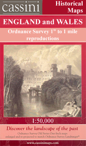
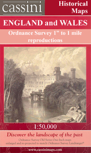
Map No. 134, Norwich & The Broads 1837-1922 (3-map set), in the Cassini Historical Series of old Ordnance Survey mapping of England & Wales at 1:50, 000 in a format designed to offer a convenient comparison with the present day coverage from the OS, & most locations in three different editions. Old historical maps have been combined so that the sheet lines correspond to the current Landranger series & reproduced with the scale changed from one inch to one mile to 1:50, 000. Most locations are covered by three separate maps, showing how the area has changed over the decades, with selected major cities also presented in a fourth edition. Old Series: the first detailed survey mapping dating for most areas from the first half of the 19th century, in black & white & with relief shown by hachuring. Revised New Series from 1880s/1900s, with some colouring & a mixture of hachuring & contour lines. Popular Edition from the inter-war years, with contour lines & colouring to indicate woodlands, parks, etc. New Popular Edition from the late 1940s, reproduced in the Cassini series for the major cities. Each map
Includes:: notes on the development of Ordnance Survey & the various series produced by them. For those interested in maps & cartography in general, the Cassini series also provides a fascinating insight into how Ordnance Survey cartographic style has developed over a period of over 100 years. Coverage in this title
Includes:: present day Great Yarmouth, Lowestoft, Beccles, Aylsham, Honing, Smallburgh, Buxton, Stalham, Eccles on Sea, Sea Palling, Horsey, Hickling, Winterton-on-Sea, Martham, How Hill, Caltishall, Horsford, Horning, Wroxham, Hemsby, Ormesby St Margaret, Filby, Spixworth, Sprowston, Blofield, Acle, Caister-on-Sea, Cringleford, Brundall, Halvergate, Swardeston, Poringl&, Cantley, Burgh Castle, Belton, Reedham, Newton Flotman, Brooke, Loddon, Hopton on Sea, Corton, Haddiscoe, Hales, Hempnall, Woodton, Long Stratton & Ditchingham. PLEASE NOTE: Stanfords can also print on request mapping from all four series centring the map on a location of your choice. For more information please click on the link below.
Reviews/Comments
Add New
Intelligent Comparison
Price History
Vouchers
Do you know a voucher code for this product or supplier? Add it to Insights for others to use.


 United Kingdom
 France
 Germany
 Netherlands
 Sweden
 USA
USA
 Italy
Italy
 Spain
Spain


 Denmark