
 United Kingdom
 France
 Germany
 Netherlands
 Sweden
 USA
USA
 Italy
Italy
 Spain
Spain
More From Contributor


Northumberland Walking
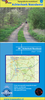
Alan Hall’s Cicerone guide to Walking in Northumberland is an extensive survey of some of the best walking opportunities in one of England’s most northerly counties. A collection of 36 walks guides those exploring the area through a diverse landscape ranging from wild walks, craggy ascents and forest treks to gentle riverside strolls. Endless miles of sandy bays, rippling dunes and rocky points resonate with the region’s rich history as the walks lead you through one of the cradles of northern Christianity and past silhouetted coastal castles. The guide is organized into four sections - the Cheviot Hills, Crags and Dales, Northumbrian Shores and Long Distance walks - each providing a revealing insight into some of the county’s most beautiful landscapes, both inland and on the
coast of the North Sea. An extensive introduction provides information on the county, climate and weather patterns, flora and fauna and a history timer chart giving a snapshot of Northumberland through the ages. Detailed route descriptions are accompanied by Ordnance Survey extracts mapping the route ahead as well as colour photographs illustrating some of the highlights of the region.
coast of the North Sea. An extensive introduction provides information on the county, climate and weather patterns, flora and fauna and a history timer chart giving a snapshot of Northumberland through the ages. Detailed route descriptions are accompanied by Ordnance Survey extracts mapping the route ahead as well as colour photographs illustrating some of the highlights of the region.
Product Description
Reviews/Comments
Add New
Vouchers
No voucher codes found.
Do you know a voucher code for this product or supplier? Add it to Insights for others to use.
Do you know a voucher code for this product or supplier? Add it to Insights for others to use.
 Denmark