More From Contributor
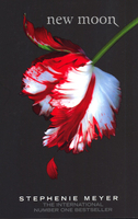
£30.00
Detailed physical wall map of New Mexico State at a scale of 1:550, 000. The cartography shows relief through a stunning, ...
Archived Product
£3.50
New Mills North in 1896 in a fascinating series of reproductions of old Ordnance Survey plans in the Alan Godfrey Editions, ideal for anyone interested in the history of their neighbourhood or family. The map covers the north-western part of New Mills, stretching from Meal Street northward to Leaver Castle & westward to Woodend Bridge. Features include Shaw Marsh, Hague Bar, Brook Bottom, Woodend Mill, Eaves Knoll, Shaw Farm, Whitle, Tanpits Farm, High Lee, Mount Pleasant Chapel, St James church, Salem Mill, Beardhough, Hidebank etc. About the Alan Godfrey Editions of the 25” OS Series: Selected towns in Great Britain & Ireland are covered by maps showing the extent of urban development in the last decades of the 19th & early 20th century. The plans have been taken from the Ordnance Survey mapping & reprinted at about 15 inches to one mile (1:4, 340). On the reverse most maps have historical notes & many also include extracts from contemporary directories. Most maps cover about one mile (1.6kms) north/south, one & a half miles (2.4kms) across; adjoining sheets can be combined to provide wider coverage.FOR MORE INFORMATION & A COMPLETE LIST OF ALL AVAILABLE TITLES PLEASE CLICK ON THE SERIES LINK. ...
Archived Product
£3.50
New Mills: Low Leighton in 1896 in a fascinating series of reproductions of old Ordnance Survey plans in the Alan Godfrey Editions, ideal for anyone interested in the history of their neighbourhood or family. The map covers the area south-east of New Mills, stretching from Low Leighton eastward to Piece Farm & southward to Shedyard Piece. Features on this rural map include a stretch of Midland Railway but no station, Low Leighton, Ballbeard, Beard Hall, Ollersetthall Farm, Pingot Colliery, Brownbrow Quarry, St George`s church, Hollinhurst Head, Moor Lodge, etc. Directories of Beard & Ollersett are on the reverse. About the Alan Godfrey Editions of the 25” OS Series: Selected towns in Great Britain & Ireland are covered by maps showing the extent of urban development in the last decades of the 19th & early 20th century. The plans have been taken from the Ordnance Survey mapping & reprinted at about 15 inches to one mile (1:4, 340). On the reverse most maps have historical notes & many also include extracts from contemporary directories. Most maps cover about one mile (1.6kms) north/south, one & a half miles (2.4kms) across; adjoining sheets can be combined to provide wider coverage.FOR MORE INFORMATION & A COMPLETE LIST OF ALL AVAILABLE TITLES PLEASE CLICK ON THE SERIES LINK. ...
Archived Product
£2.95
New Mills: Newtown in 1899 in a fascinating series of reproductions of old Ordnance Survey plans in the Alan Godfrey Editions, ideal for anyone interested in the history of their neighbourhood or family. Selected towns in Great Britain & Ireland are covered by maps showing the extent of urban development in the last decades of the 19th & early 20th century. In this title: coverage stretches from Market Street southward to Bankend, & westward to Shady Oak. Features include LNWR railway with New Mills station, Sheffield & Midland Jt Railway with station, Torn Top, Peak Forest Canal, Grove Paper Mill, Bankend, Albert Works, Warkmoor Mill, Victoria Mills, Torvale, Higher Waterside, Waterside Mill, Disley Hall (in the south-west corner), Knathole Wood, Torvale Mill, Rock Mills, Highlee Hall, St Mary's RC Chapel, etc. On the reverse is a commercial directory. About the Alan Godfrey Editions of the 25 ...
Archived Product
£3.50
New Mills: Newtown in 1899 in a fascinating series of reproductions of old Ordnance Survey plans in the Alan Godfrey Editions, ideal for anyone interested in the history of their neighbourhood or family. Coverage stretches from Market Street southward to Bankend, & westward to Shady Oak. Features include LNWR railway with New Mills station, Sheffield & Midland Jt Railway with station, Torn Top, Peak Forest Canal, Grove Paper Mill, Bankend, Albert Works, Warkmoor Mill, Victoria Mills, Torvale, Higher Waterside, Waterside Mill, Disley Hall (in the south-west corner), Knathole Wood, Torvale Mill, Rock Mills, Highlee Hall, St Mary`s RC Chapel, etc. On the reverse is a commercial directory. About the Alan Godfrey Editions of the 25” OS Series: Selected towns in Great Britain & Ireland are covered by maps showing the extent of urban development in the last decades of the 19th & early 20th century. The plans have been taken from the Ordnance Survey mapping & reprinted at about 15 inches to one mile (1:4, 340). On the reverse most maps have historical notes & many also include extracts from contemporary directories. Most maps cover about one mile (1.6kms) north/south, one & a half miles (2.4kms) across; adjoining sheets can be combined to provide wider coverage.FOR MORE INFORMATION & A COMPLETE LIST OF ALL AVAILABLE TITLES PLEASE CLICK ON THE SERIES LINK. ...
Archived Product
£45.00
This is a definitive natural history of the Gower Peninsula, from its heritage coast & its appeal to the naturalist, to the geology, geomorphology, conservation & ecological history. It coincides with the 50th anniversary of the area as an AONB. Located to the south west of Swansea & often described as Wales in miniature, the Gower Peninsula was designated as an Area of Outstanding Natural Beauty (AONB) in May, 1946. The area is unique in terms of the variety of the habitats & species that occur within its 188 square kilometres. As a result, it has a greater diversity of conservation designations than almost anywhere else in the UK. The natural history of Gower is like most parts of the British Isles
- inextricably linked to the activities of man across many thousand years. New Naturalist Gower Peninsula uses the evolving landscape & the effect that the associated changes have had on species & habitats as its core. It provides a detailed examination of: the integration of the archaeological & historic landscape with the natural landscape & its associated species; the geological creation of the peninsula; man's influence on the natural environment over the centuries; the coast & channel, including the limestone cliffs, beaches, caves & saltwater marsh; the environmental impact of the Sea Empress oil disaster in 1996, which discharged 72, 000 tonnes of oil into the sea off Gower; & the ongoing conservation of the area & the contribution that naturalists can make. Mullard also looks at notable plants species & the over-wintering bird populations on the estuary, which are of international importance. Professional ecologist & writer Jonathan Mullard specialises in the management of protected areas & has spent a considerable part of his career on the peninsula. The culmination of years of research & rich with the latest information & full colour illustrations, New Naturalist Gower Peninsula is a valuable source of information on this diverse & fascinating area & its natural history.N.99 in the Collins New Naturalist series.
...
Archived Product
£29.95
At the beginning of the 21st century, New York has been enjoying a decade-long renaissance, made only more apparent following the tragedy of the September 11th 2001 attacks. The city draws more tourists than ever before & is looking the best it has looked in years. The will to construct & rebuild will not be stifled. In a celebration of New York, this volume

Includes::
50 major new buildings & interiors built in New York between 1993 & 2003.

...
Archived Product
£11.19
New Orleans in the Countries, Regions & Cities series from Rough Guides; comprehensively detailed guidebooks specifically designed for independent travellers & serving a range of worldwide destinations. Widely recognised for their free editorial style, Rough Guide authors are allowed to express their personal opinions on a range of subjects. Although sometimes controversial, this editorial stance allows readers to experience more detailed & personal takes on each destination, a feature often more limited in other guidebooks. Cultural & historical nuances are explored in significant depth throughout the text & descriptions on the ambience of individual settings alongside personal recommendations, particularly in cities, are notably prevalent. Each Rough Guide in the Countries, Regions & Cities series has a similar layout. A ...
Archived Product
£6.99
New Orleans on a light, waterproof & tear-resistant tourist map from the National Geographic combining a street plan of the city’s central districts with road maps of the environs & the Louisiana plantations, plan of the airport, tourist information, etc. On one side is a street plan of the city’s central districts, including the French Quarter, Central Business District with the Louisiana Superdome, the Warehouse / Arts district & the Garden district. Important public buildings & numerous hotels are highlighted & named. Tramway lines are shown with stops & also indicated is the route of Vieux Carré shuttle & the ferry across the Mississippi. The index on the reverse lists districts, streets, parks & cemeteries, piers & wharfs, hotels, & public buildings. The reverse side also

Includes::
two road maps: the environs of the city, plus a wider region extending beyond Baton Rouge & highlighting Louisiana’s Old South plantations. Accompanying notes provide more information about the plantations as well as about the sights within the city. Also provided is a plan showing road access to & the layout of the Louis Armstrong International Airport with notes on transport to the city centre.

...
Archived Product
£12.00
New Orleans in the Cities of the Imagination guide series; providing an in-depth cultural & historical exploration of some of the great city landscapes of the world. Presented as a cultural & literary guide, each title in the series explores the history of the city, providing an overview of the city’s development from its earliest roots to the modern day. Particular emphasis is placed on the literary, poetic, architectural, cultural & historical elements that make up the city & each title is written & researched by an academic expert. An Epilogue offers thoughts on the future of the city, suggested further reading & indices of literary & historical names & famous places & attractions. ...
Archived Product

New Moon

New Moon - Book 2 in the Twilight Saga by Stephenie Meyer. Being in love with a vampire is proving to be more difficult than teenager Bella Swan could have imagined. As Bella and Edward’s daring relationship continues, threatening all that is near and dear to them, they realize their troubles may be just beginning. ‘“Shoot”, I muttered when the paper sliced my finger; I pulled it out to examine the damage. A single drop of blood oozed from the tiny cut. It all happened very quickly then. “No!” Edward roared…Dazed and disoriented, I looked up from the bright red blood pulsing out of my arm - into the fevered eyes of the six suddenly ravenous vampires.’
RIP - This product is no longer available on our network. It was last seen on 25.09.2019

This page now acts as a permanent archive for this product. Add more information using the comments box below to ensure it can still be found by future generations.

Use our search facility to see if it is available from an alternative contributor.
  • External links may include paid for promotion
  • Availability: Out Of Stock
  • Supplier: Stanfords
  • SKU: 9781904233886
Availability: In Stock
£7.99

Product Description

New Moon
- Book 2 in the Twilight Saga by Stephenie Meyer. Being in love with a vampire is proving to be more difficult than teenager Bella Swan could have imagined. As Bella & Edward’s daring relationship continues, threatening all that is near & dear to them, they realize their troubles may be just beginning. ‘“ Shoot”, I muttered when the paper sliced my finger; I pulled it out to examine the damage. A single drop of blood oozed from the tiny cut. It all happened very quickly then. “ No!” Edward roared… Dazed & disoriented, I looked up from the bright red blood pulsing out of my arm
- into the fevered eyes of the six suddenly ravenous vampires.’

Reviews/Comments

Add New

Intelligent Comparison

Oooops!
We couldn't find anything!
Perhaps this product's unique.... Or perhaps we are still looking for comparisons!
Click to bump this page and we'll hurry up.

Price History

Vouchers

No voucher codes found.
Do you know a voucher code for this product or supplier? Add it to Insights for others to use.

Facebook

Jargon Buster

Paper - A thin sheet mainly used for writing. Available in a variety of colours. Made mainly from wood pulp.
Red - One of the three primary colours
Love - Someone who shows deep affection for someone else.
Blood - A red liquid that circulates around the body for all the bodies needs.

Supplier Information

Stanfords
Stanfords was established in 1853 and opened their iconic Covent Garden flagship store in 1901. They have become the top retailer of maps, travel books and accessories in the UK and arguably offer the largest selection of maps and travel books worldwide. Famous names such as Captain Robert Falcon Scott, Ranulph Fiennes and Michael Palin have purchased from Stanfords. They now have a shop in Bristol and both stores together with other venues operate a calendar of events including talks, book signings and exhibitions. As a specialist map retailer, the map selection is comprehensive and includes road maps, street maps and walking maps from worldwide destinations, as well as a selection of world atlases and wall maps. Books include travel guides and travel literature. Stanfords also stock globes, from miniatures made of blue marble to magnificent floor-standing globes. The website features a selection of interesting articles on travel topics.
Page Updated: 2023-11-12 20:15:36

Community Generated Product Tags

Oh No! The productWIKI community hasn't generated any tags for this product yet!
Menu