
 United Kingdom
 France
 Germany
 Netherlands
 Sweden
 USA
USA
 Italy
Italy
 Spain
Spain
More From Contributor


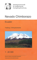
Nevado Chimborazo
Chimborazo at 1:20, 000 on a detailed contoured map showing climbing routes and mountain refuges, produced under the auspices of Consortium for the Comparative High-Mountain Research by the Heinrich Heine University in Düsseldorf and the Technical University of Dresden.The map uses as its base a digital orthophoto of the area overprinted with contours at 25 metres intervals and enhanced by colouring and shading to indicate glaciers, etc. Local roads and tracks are clearly shown, with an overprint highlighting and naming various climbing routes to the summit and showing locations of refuges. The map has both UTM margin ticks and crosshairs, and latitude and longitude margin ticks at 1’ intervals. Map legend and explanatory text include English.

Product Description
Reviews/Comments
Add New
Vouchers
No voucher codes found.
Do you know a voucher code for this product or supplier? Add it to Insights for others to use.
Do you know a voucher code for this product or supplier? Add it to Insights for others to use.
 Denmark