More From Contributor

£14.99
Clive James` power as a poet has increased year by year, & there has been no stronger evidence for this than Nefertiti in the Flak Tower. Here, his polymathic learning & technical virtuosity are worn more lightly than ever; the effect is merely to produce a deep sense of trust into which the reader gratefully sinks, knowing they are in the presence of a master. The most obvious token of that mastery is the book`s breathtaking range of theme: there are moving elegies, a meditation on the later Yeats, a Hollywood Iliad, odes to rare orchids, wartime typewriters & sharks -- as well as a poem on the fate of Queen Nefertiti in Nazi Germany. But despite the dizzying variety, James` poetic intention becomes increasingly clear: what marks this new collection out is his intensified concentration on the individual poem as self-contained universe. Poetry is a practice he compares (in ` Numismatics`) to striking new coin; & Nefertiti in the Flak Tower is a treasure-chest of one-off marvels, with each poem a twin-sided, perfect human balance of the unashamedly joyous & the deadly serious, `whose play of light pays tribute to the dark`. Praise for Angels Over Elsinore: ` The new poems again apply faultless technique to subject matter that ranges in weight from helium to promethium.. . These poems are dazzling` Prospect ` There is a casually rich mix of cultural allusions, but the most important quality is complete clarity` Independent ...
Archived Product
£20.00
We are able to source a wide range flags in many sizes, sewn or printed on 100% Ministry Of Defence Standard Woven & Knitted Polyester. Flags are supplied with rope & toggle. If you would like more information, have a custom size request or cannot find a desired product, please email us at maritime@stanfords.co.uk. We will be glad to help! ...
Archived Product
£6.50
Topographic coverage of mainland Spain at 1:25, 000 published by the Centro Nacional de Información Geograficá, the country’s civilian survey organization. The maps have contours at 10m intervals & colouring and/or graphics to show different types of vegetation or land use. Boundaries of national parks & other protected areas are marked. In addition to all the usual information shown on topographic maps at this scale, detailed presentation of the road & rail networks, rural tracks & paths, etc, the maps also show campsites. The maps have a 1-km UTM grid, with margin ticks for latitude & longitude at 1` intervals. Map legend is in Spanish only.PLEASE NOTE: our grid for the whole of Spain is in preparation
- in the meantime, for areas other than those shown on the attached grid please use CNIG’s topographic survey at 1:50, 000 by searching for ‘SI00000832’. Each 25K map covers one quarter of the corresponding 50K map, with the numbering system: I = NW quarter, II = NE quarter, III = SW quarter & IV = SE quarter. CNIG maps in the Provincial Road Maps series at 1:200, 000 are overprinted with the grid for the 1:50, 000 survey & can be used to see the area covered by each 50K or 25K title in more detail. To see the list of titles in this series please click on the series grid
- for map numbers not yet listed on our website please contact us by email.

...
Archived Product
£17.99
One of the titles in the topographic survey of the Svalbard group published in a colour version, available for the western coast, central & southern part of Spitzbergen, plus two small islands of Svenskøya & Kongsøya. The map has contours at 25-metre intervals, bold relief shading & spot heights, & shows settlements, roads & tracks, working & disused mines, airfields, lighthouses & radio beacons, etc. A grid gives UTM co-ordinates plus latitude in steps of 10` & longitude in 20’. The rest of Spitzbergen, Nordaustlandet, Edgeøya & other small islands are covered by black & white maps with contours only. Most of these maps show no geographical names, as indicated in the individual descriptions of each title. ...
Archived Product
£4.99
Negril & Montego Bay in the Moon Spotlight guide series; covering a range of specific local cities, districts, areas & regions in North, Central & South America & targeted at those seeking to travel to a specific area within a country. Each of the guides has been extracted in full from the relevant country Moon Handbook & individual titles focus on a particular city, region or notable area of the destination. Many of the guides in the series are unique in their coverage, although are limited in putting the destination into its wider geographical context that a more comprehensive guide would provide. Stylistically, Moon ...
Archived Product
£12.99
The daughter of a successful paediatrician & a fashionable socialite, Margo Jefferson spent her childhood among Chicago`s black elite. She calls this society ` Negroland`: `a small region of Negro America where residents were sheltered by a certain amount of privilege & plenty`. With privilege came expectation. Reckoning with the strictures & demands of Negroland at crucial historical moments
- the civil rights movement, the dawn of feminism, the fallacy of post-racial America
- Jefferson brilliantly charts the twists & turns of a life informed by psychological & moral contradictions.

...
Archived Product
£6.95
Topographic coverage of mainland Spain at 1:50, 000 in the MTN50 (Mapa Topográfico Nacional) series from the Centro Nacional de Información Geografica, the country’s civilian survey organization. The maps have contours at 20m intervals, enhanced by relief shading, plus colouring and/or graphics to show different types of terrain, vegetation or land use. Boundaries of national parks & other protected areas are marked. In addition to all the usual information featured on topographic mapping at this scale, detailed presentation of the road & rail networks, rural tracks & paths, etc, the maps also show campsites & mountain refuges. On more recent editions some GRs, the official long-distance hiking routes, are also marked (although not as clearly as on hiking maps from other publishers). Each map covers 29.5x 18.5 km (with adjustments in the border or coastal areas). The maps have a 1-km UTM grid, plus margin ticks for latitude & longitude at 1` intervals. Map legend is in Spanish only.HOW TO CHOOSE THE RIGHT 50K MAP: all the titles in CNIG’s 200K Provincial Road Maps series at 1:200, 000 are overprinted with the grid for the 1:50, 000 maps & can be used to see the area covered by each 50K title. TO SEE THE LIST OF TITLES IN THIS SERIES PLEASE CLICK ON THE SERIES LINK.PLEASE NOTE
- MAP TITLES: the grids shown on our website serve both the civilian & the military 1:50, 000 topographic series. Although the areas covered by maps in both series are identical (apart from some border or coastal sheets), occasionally map titles differ – only one title is shown on the grid, usually the military one. In Galicia, the Basque country & in the Catalan speaking areas the tendency now is to use local place names rather than the often better known Castilian ones. Where possible, both versions are included in our titles. Map titles listed on our website are based on information received by us at the time of publication, but sometimes maps arrive showing a completely different title! As long as the map number is as ordered, the correct map has been supplied.
...
Archived Product
£23.99
Map No. 10172, Neiden, in the new topographic survey of Norway at 1:50, 000 covering the country on 195 double-sided sheets & first published by Nordeca in 2011
- 2012; fully GPS compatible, indicating waymarked footpaths, campsites, tourist huts, illuminated ski runs, etc. The maps, now published by Nordeca, the successors to Statens Kartverk & its subsequent owners the Ugland Group, are printed on light, waterproof & tear-resistant synthetic paper. Each map covers an area of 62x 45 kilometres (39 x 28 miles approx.), with a 2-km overlap between the sheets. The maps have contours at 20m intervals (10m glacier contours), plus colouring & graphics to show cultivated areas, bogs, forests, etc. In addition to all the information expected of topographic mapping at this scale the maps distinguish between waymarked & unmarked footpaths & show campsites, tourist huts (serviced/self service/no supplies), country hotels & restaurants, & illuminated ski trails. The series uses EUREF89 (WGS84) datum & the maps have a 1-km UTM grid. Map legend is in Norwegian & English. Each title comes in a sturdy protective card envelope.
...
Archived Product
£14.00
Brooklyn -- famed for its bridge, its long-departed Dodgers, its Botanic Garden, & its accent -- is the most populous borough in New York City & arguably the most colorful. Generously illustrated with both historical & contemporary photographs, this book is an indispensable & entertaining guide, taking us on a tour of some 90 neighborhoods (including ghost neighborhoods that no longer exist) & identifying the boundaries of each one through a neighborhood profile & a street map. This book promises to be an essential resource for past, present, & future residents. This book is a joint publication of the Citizens Committee for New York City & Yale University Press. ...
Archived Product
£16.99
Mercier first travelled to London, & began recording his impressions, in 1780. A leading exemplar of a new form of literature, with a journalistic style, less rigid & more reflexive, he presented emotive representations of the city as collections of experiences, habits & personalities. & in contrast to Dickens`s London or Baudelaire`s Paris, with their vivid contrasts of opulence & misery, Mercier`s descriptions transport us to a less familiar urban environment
- one more optimistic, & perhaps even utopian. His version of London is, in fact, a projection of his philosophical imagination
- not simply a rounded portrait of the British capital but also a reflection of what Mercier hoped Paris could become. For this first publication in English, Laurent Turcot & Jonathan Conlin`s translation preserves all of the life & humour of Mercier`s text. It is profusely illustrated with contemporary images, with a particular emphasis on Thomas Rowlandson & Gabriel de Saint Aubin, a Parisian flaneur artiste.

...
Archived Product

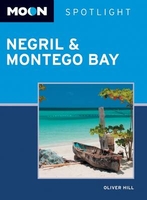
Negril & Montego Bay Spotlight Moon

Moon Spotlight Negril & Montego Bay is a 75-page compact guide covering Negril, Montego Bay, and the remainder of West and Northwest Jamaica. Former Jamaica resident Oliver Hill offers his firsthand advice on must-see attractions and activities, and sightseeing highlight maps make planning your time easy. This lightweight guide is packed with recommendations on sights, entertainment, shopping, recreation, accommodations, food, and transportation, as well as helpful maps, making navigating these diverse, tropical areas uncomplicated and enjoyable. This Spotlight guidebook is excerpted from Moon Jamaica.
RIP - This product is no longer available on our network. It was last seen on 25.09.2019

This page now acts as a permanent archive for this product. Add more information using the comments box below to ensure it can still be found by future generations.

Use our search facility to see if it is available from an alternative contributor.
  • Availability: Out Of Stock
  • Supplier: Stanfords
  • SKU: 9781631214622
Availability: In Stock
£6.99

Product Description

Moon Spotlight Negril & Montego Bay is a 75-page compact guide covering Negril, Montego Bay, & the remainder of West & Northwest Jamaica. Former Jamaica resident Oliver Hill offers his firsthand advice on must-see attractions & activities, & sightseeing highlight maps make planning your time easy. This lightweight guide is packed with recommendations on sights, entertainment, shopping, recreation, accommodations, food, & transportation, as well as helpful maps, making navigating these diverse, tropical areas uncomplicated & enjoyable. This Spotlight guidebook is excerpted from Moon Jamaica.

Reviews/Comments

Add New

Intelligent Comparison

Oooops!
We couldn't find anything!
Perhaps this product's unique.... Or perhaps we are still looking for comparisons!
Click to bump this page and we'll hurry up.

Price History

Vouchers

No voucher codes found.
Do you know a voucher code for this product or supplier? Add it to Insights for others to use.

Facebook

Jargon Buster

Jamaica - A small island situated in the Caribbean
compact - Carefuly designed to ensure an item has a minimal physical size
Entertainment - Something that provides amusement
Compact - something that has a lot combined within a small space.
Tropical - Coming fro the work "tropics" a hot and humid area of the world.

Supplier Information

Stanfords
Stanfords was established in 1853 and opened their iconic Covent Garden flagship store in 1901. They have become the top retailer of maps, travel books and accessories in the UK and arguably offer the largest selection of maps and travel books worldwide. Famous names such as Captain Robert Falcon Scott, Ranulph Fiennes and Michael Palin have purchased from Stanfords. They now have a shop in Bristol and both stores together with other venues operate a calendar of events including talks, book signings and exhibitions. As a specialist map retailer, the map selection is comprehensive and includes road maps, street maps and walking maps from worldwide destinations, as well as a selection of world atlases and wall maps. Books include travel guides and travel literature. Stanfords also stock globes, from miniatures made of blue marble to magnificent floor-standing globes. The website features a selection of interesting articles on travel topics.
Page Updated: 2023-11-12 20:15:36

Community Generated Product Tags

Oh No! The productWIKI community hasn't generated any tags for this product yet!
Menu