More From Contributor
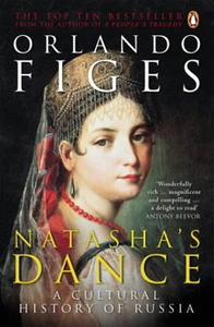
£16.99
Mountain areas of central & northern Sweden on waterproof & tear-resistant, GPS compatible topographic “ Fjällkartan” maps at 1:100, 000 & 1:50, 000 from Lantmäteriet
- the country’s national survey organization, with hiking & ski routes, campsites & youth hostels, etc. Relief is shown by contours at 20m intervals & enhanced by relief shading, plus colouring and/or graphics to indicate different types of vegetation or land use. An overprint shows trails for hiking & cross-country skiing, indicating waymarked or unmarked & summer or winter only routes. Also shown are mandatory & recommended trails for snowmobiles & areas prohibited for cross-country vehicles. Symbols indicate locations of campsites, youth hostels, huts & wind shelters, mountain lodges & other types of tourist accommodation, emergency telephones, etc. The maps have both a 1-km UTM grid & a latitude/longitude grid in steps of 10`. Map legend

Includes::
English. On the reverse there are descriptions of the area in Swedish only, GPS coordinates for selected locations, etc. Most sheets also include a brief note in English on public access regulations. To see the list of titles in this series please click on the series link.


...
Archived Product
£5.99
Nashville in the Moon Spotlight guide series; covering a range of specific local cities, districts, areas & regions in North, Central & South America & targeted at those seeking to travel to a specific area within a country. Each of the guides has been extracted in full from the relevant country Moon Handbook & individual titles focus on a particular city, region or notable area of the destination. Many of the guides in the series are unique in their coverage, although are limited in putting the destination into its wider geographical context that a more comprehensive guide would provide. Stylistically, Moon ...
Archived Product
£6.50
Nashville in Tennessee on an indexed street plan from Rand Mc Nally in their extensive range of maps covering cities in the United States. Communities covered by this map include Belle Meade, Berry Hill, Forest Hills, Goodlettsville & Oak Hill. Rand Mc Nally street plans provide coverage of cities with their outer suburbs, clearly indicating main traffic arteries: highways (distinguishing between free & toll access), plus primary & secondary routes. Road numbers and/or names are clearly displayed & exit numbers are indicated. Locations of service & rest areas are marked & one way streets are shown. Longer streets are annotated with block numbers for easier identification of addresses. The maps show railway, bus &, where appropriate, metro stations. A range of symbols indicate various places of interest including cultural & academic institutions, various municipal facilities, golf courses, etc. The plans have extensive street indexes, supplemented by lists of points of interest, parks & recreational areas, shopping malls, stations, schools, etc. ...
Archived Product
£7.99
Nashville in Tennessee on an indexed street plan from Rand Mc Nally in their extensive range of maps covering cities in the United States. An enlargement shows the downtown area in greater detail, accompanied by an index of places of interest. Communities covered by this map include Belle Meade, Bellevue, Berry Hill, Brentwood, Forest Hills, Franklin, Goodlettsville Hendersonville, Lakewood, La Vergne, Mt. Juliet, Nolensville, Oak Hill & Smyrna.NEW STREET PLAN CARTOGRAPHY FROM RAND Mc NALLY: Rand Mc Nally are currently changing the cartography of their street plans to a more “ European” style. In many titles streets are now shown by parallel lines, providing a much clearer, easier to read presentation. Better use of colouring indicates different types of land use and/or institutions (parks, shopping centres, academic institutions, etc) &, in most titles, different administrative units. More streets are annotated with block numbers. Some new editions still retain the traditional American presentation of streets by a single line, but with more prominent marking for various institutions, facilities & places of interest. Our cartography sample indicates which style is used in this title.COVERAGE: Rand Mc Nally street plans cover cities with their outer suburbs, prominently highlighting principal traffic arteries & connecting main streets. Railway & subway stations are marked. ...
Archived Product
£17.99
The 1:50 000 topographic map gives a more general picture of the ground features than a basic map. It shows settlements, houses, roads, cultivated areas, waterways, cutting areas, mires, rock exposures, & relief. One map sheet covers an area of 30 x 40 km & one centimetre corresponds to 500 metres on the ground. The 1:50, 000 topographic map is also an ideal complement to nautical charts as it provides useful information about the land areas adjacent to waterways. For example, all Finnish sea areas are covered by 1:50 000 topographic map sheets. ...
Archived Product
£25.00
Recently awarded two coveted Michelin stars for his eponymous fish restaurant in Rock, Cornwall, Nathan Outlaw is one of the most exciting upcoming chefs in Britain today. British seafood is his passion. His style of cooking is unique & simple, allowing the individual flavours of the ingredients to shine through. Sourcing sustainable fish & local produce in season, he uses his considerable flair to take simple fish cooking to new heights. In Modern British Seafood Nathan shares the secrets of his unique approach & provides a tempting collection of original recipes. Beginning with a guide to sourcing & buying, followed by a step-by-step guide to preparing all types of fish & shellfish, he then explains cooking techniques, showing how to pan-fry, grill, bake, steam, barbecue & deep-fry fish to perfection, avoiding the pitfalls of overcooking. The core of the book is divided into the four main groups: flat, round, oily & shell fish, & within this structure 30 fish are dealt with individually. The descriptive text for each tells you the optimum size to buy & eat, the best cooking methods & which herbs, seasonings & sauces go with each fish, allowing you to create a dish quickly & simply. Then, for each fish, Nathan gives 2-3 recipes, ranging from everyday quick dishes he cooks at home, through recipes for leisurely lunches or dinners with family or friends, to signature dishes from his restaurant
- the sort you might cook for a dinner party. In all there are over 100 recipes, all easy to replicate at home. Photographed on location in Cornwall, this superb new fish bible also has a real sense of place.
...
Archived Product
£25.00
The era from 1830 to 1910 witnessed massive transformations in how people lived, worked, thought about themselves, & struggled to live & thrive. It also witnessed the birth of economic & political institutions that still shape our world. America`s population grew more than ten-fold. The country expanded to the Pacific coast & then out into the Pacific itself. Civil warfare erupted. Three centuries of slavery ended. Native peoples were suppressed & remanded to reservations. Massive waves of immigrants from Europe & Asia arrived. From an agricultural society with a weak central government, the US became an urban & industrial society in which government assumed a greater & greater role in the framing of social & economic life. A Nation Without Borders`s signature achievement is to place this history in a wholly new light, by capturing the tensions & contradictions between nation & empire. His new interpretations include the fact that slavery was national not sectional, that Jim Crow racism initially emerged in the Northeast & Midwest, that ”sectionalism” was less a fact of politics than an important political construct in the battle over slavery`s future, & that the principle struggle of the period was not between the North & South but rather between the Northeast & the Mississippi Valley for control of the continent & hemisphere. Hahn`s strikingly original thesis resets the familiar framework of that of a country expanding from colony. He shows how, the United States had, from its colonial origins & birth as a union, significant imperial ambitions on the continent & in the hemisphere, & that the United States only became a nation, a nation-state
- as many others did
- in the midst of a massive political & military struggle in the 1860s. A nation is understood to have clearly defined borders, which delineate sovereignty & belonging. Empires, though they may expand & contract, lack real borders; they are more about vectors, claims, & alliances. By 1910, as the ”long” nineteenth century came to a close, the United States stood as one of the most formidable empires on the globe.

...
Archived Product
£14.99
The three peaks which are part of the National Three Peaks Challenge: Ben Nevis, Scafell Pike & Snowdon shown on handy size, waterproof & tear-resistant extracts from the Ordnance Survey 1:25, 000 Explorer series. The three maps are sold together in a presentation wallet which also

Includes::
brief descriptions & spaces for recording your timings for each route. The maps, folded to only 10x 15cm, are centred on the peak, cover an area of 7 x 6.25km (4.2 x 4 miles approx), & have British National Grid lines & coordinates. Each map has its own protective envelope & the route description is provided on a separate, credit card size slip.

...
Archived Product
£25.00
Birds are one of the most popular & visible forms of all wildlife & are inextricably linked with the development of human cultures all around the world. Over the years some of the most eye-catching species of bird have been officially or unofficially adopted by countries as symbols of their national identity; there are now almost 100 national birds spanning every imaginable group from condors to parrots, trogons to frigatebirds. Both a comprehensive listing & guide book, National BIrds provides a range of information from species data to how these birds have been used & abused through the ages. It recounts tales of how they came to be adopted & presents a wide range of official & cultural contexts where they appear from feathers in tribal costumes to stamps & currency. ...
Archived Product
£6.99
TTK’s road guide to Delhi shows district boundaries, district & taluk headquarters, all important towns & places of tourist interest & all types of roads with distances between towns. Railway lines & airports are also shown on the map, each district is shown in a different colour. The guide also

Includes::
a fold out map of Delhi at 1:51, 000 scale. About this series: Maps of the states of India are the chief feature of these guidebooks. Each guidebook provides information about each state &

Includes::
a brief introduction, vital statistical data, where & when to visit, what to see & where to stay, & a detailed multicolour map. The state guidebooks enable a traveller to plan his visit & learn more about the places he visits.


...
Archived Product

Natasha`s Dance

This encyclopedic cultural history of Russia is epic in its intentions. Figes delves into Russian culture and examines the characters that helped shape it, discovering that Russia`s identity is embodied in its dazzling culture. In the absence of a free press or parliament, poetry, music, books and art have all served as an arena for political and religious debate and have helped to bind this vast country together, giving it a sense of self. Figes` unparalleled exploration of Russia is gloriously vivid and shot through with remarkable stories and individuals. Beautifully written, it balances big ideas with personal histories to create a compelling argument for Russia`s greatness. Review by Alex Stewart, International Books Buyer, Stanfords Covent Garden
RIP - This product is no longer available on our network. It was last seen on 25.09.2019

This page now acts as a permanent archive for this product. Add more information using the comments box below to ensure it can still be found by future generations.

Use our search facility to see if it is available from an alternative contributor.
  • External links may include paid for promotion
  • Availability: Out Of Stock
  • Supplier: Stanfords
  • SKU: 9780140297966
Availability: In Stock
£12.99

Product Description

This encyclopedic cultural history of Russia is epic in its intentions. Figes delves into Russian culture & examines the characters that helped shape it, discovering that Russia`s identity is embodied in its dazzling culture. In the absence of a free press or parliament, poetry, music, books & art have all served as an arena for political & religious debate & have helped to bind this vast country together, giving it a sense of self. Figes` unparalleled exploration of Russia is gloriously vivid & shot through with remarkable stories & individuals. Beautifully written, it balances big ideas with personal histories to create a compelling argument for Russia`s greatness. Review by Alex Stewart, International Books Buyer, Stanfords Covent Garden

Reviews/Comments

Add New

Intelligent Comparison

Oooops!
We couldn't find anything!
Perhaps this product's unique.... Or perhaps we are still looking for comparisons!
Click to bump this page and we'll hurry up.

Price History

Vouchers

No voucher codes found.
Do you know a voucher code for this product or supplier? Add it to Insights for others to use.

Facebook

Jargon Buster

Garden - An outside area with grass and foliage
garden - A planned space used for the display, cultivation and enjoyment of plants and other forms of nature.
History - Anything that happens in the past. An acedemic subject.
Personal - Something that belongs more to an individual due to it affecting them more by relating to them.

Supplier Information

Stanfords
Stanfords was established in 1853 and opened their iconic Covent Garden flagship store in 1901. They have become the top retailer of maps, travel books and accessories in the UK and arguably offer the largest selection of maps and travel books worldwide. Famous names such as Captain Robert Falcon Scott, Ranulph Fiennes and Michael Palin have purchased from Stanfords. They now have a shop in Bristol and both stores together with other venues operate a calendar of events including talks, book signings and exhibitions. As a specialist map retailer, the map selection is comprehensive and includes road maps, street maps and walking maps from worldwide destinations, as well as a selection of world atlases and wall maps. Books include travel guides and travel literature. Stanfords also stock globes, from miniatures made of blue marble to magnificent floor-standing globes. The website features a selection of interesting articles on travel topics.
Page Updated: 2023-11-12 20:15:36

Community Generated Product Tags

Oh No! The productWIKI community hasn't generated any tags for this product yet!
Menu