
 United Kingdom
 France
 Germany
 Netherlands
 Sweden
 USA
USA
 Italy
Italy
 Spain
Spain
More From Contributor


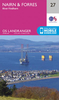


Nairn And Forres OS ACTIVE Map
Map No. 27, Nairn and Forres, in the waterproof and tear-resistant OS Active version of the Ordnance Survey Landranger series at 1:50, 000, including Invergordon, Cromaty, Balblair, Fortrose, Raddery, Avoch, Ardersier, Croy, Cawdor, Auldearn, Dyke, Findhorn, Kinloss, Moor of Granary, Logie, Littlemill, Culloden, Daviot, Moy, Ruthven, Cottartown and Ferness, with the River Findhorn, Beinn Bhuide Mh
Product Description
Reviews/Comments
Add New
Vouchers
No voucher codes found.
Do you know a voucher code for this product or supplier? Add it to Insights for others to use.
Do you know a voucher code for this product or supplier? Add it to Insights for others to use.
 Denmark