
 United Kingdom
 France
 Germany
 Netherlands
 Sweden
 USA
USA
 Italy
Italy
 Spain
Spain
More From Contributor


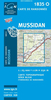
Musselburgh 1893
Musselburgh area of Edinburgh in 1893 in a fascinating series of reproductions of old Ordnance Survey plans in the Alan Godfrey Editions, ideal for anyone interested in the history of their neighbourhood or family. Selected towns in Great Britain and Ireland are covered by maps showing the extent of urban development in the last decades of the 19th and early 20th century.In this title: the map is double-sided. The main map covers the southern part of the town, with coverage from the High Street southward to Monktonhall House, and from Stoneyhill House eastward to Pinkiehill. Features include River Esk, Inveresk Mills, Musselburgh Wire Mill, NBR branch with Musselburgh terminus, Inveresk Combination Poorhouse, small stretch of main line with Inveresk station, Pinkieburn, Pinkie
House, Market Street, High Street (on both sides of Esk), Esk Net Mills, Fisherrow area, Town Hall, etc. On the reverse is the adjacent sheet 4.07, covering the area to the north, including the waterfront. Features here include Fisherrow Harbour, New Street, Fisherrow Links, part of Musselburgh Links and race course, Loretto School, Jubilee Bridge, Gravelbank House, etc. About the Alan Godfrey Editions of the 25
House, Market Street, High Street (on both sides of Esk), Esk Net Mills, Fisherrow area, Town Hall, etc. On the reverse is the adjacent sheet 4.07, covering the area to the north, including the waterfront. Features here include Fisherrow Harbour, New Street, Fisherrow Links, part of Musselburgh Links and race course, Loretto School, Jubilee Bridge, Gravelbank House, etc. About the Alan Godfrey Editions of the 25
Product Description
Reviews/Comments
Add New
Vouchers
No voucher codes found.
Do you know a voucher code for this product or supplier? Add it to Insights for others to use.
Do you know a voucher code for this product or supplier? Add it to Insights for others to use.
 Denmark