
 United Kingdom
 France
 Germany
 Netherlands
 Sweden
 USA
USA
 Italy
Italy
 Spain
Spain
More From Contributor


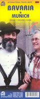
Munich & Bavaria ITMB
Waterproof and tear-resistant, indexed street plan of Munich from ITMB, prominently showing the city’s public transport network including tram lines with stops, plus on the reverse a road map of Bavaria, also with an index. Coverage extends north to include the Olympiastadion, the BMW museum and Schwabing.The plan very clearly shows the city’s public transport network: U-Bahn and S-Bahn stations plus tram routes with stops and line numbers. One way streets are marked and numerous places of interest are highlighted, including selected hotels shown with names. The plan is indexed and includes a diagram of the public transport network and a road map of its environs including access to the international airport.On the reverse is an indexed road map of Bavaria at 1:500, 000,
extending west to Stuttgart and north to Frankfurt. The map shows Bavaria’s network main roads, with selected smaller local roads, plus railways.
extending west to Stuttgart and north to Frankfurt. The map shows Bavaria’s network main roads, with selected smaller local roads, plus railways.

Product Description
Reviews/Comments
Add New
Vouchers
No voucher codes found.
Do you know a voucher code for this product or supplier? Add it to Insights for others to use.
Do you know a voucher code for this product or supplier? Add it to Insights for others to use.
 Denmark