More From Contributor
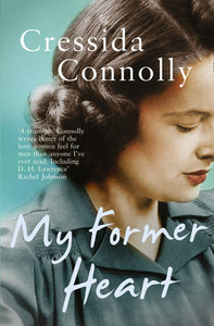
£9.99
Mt Everest region at 1:100, 000 from ITMB on a contoured map with tourist information but with somewhat unusual choice of colouring which makes the whole area appear more like a desert rather the highest mountain range covered in glaciers! Coverage extends from Lukla to beyond the North Base Camp on the Tibetan side. The map has contour lines at 100m intervals, plus additional altitude colouring & graphics for glaciers, moraine, scree, rock & vegetation. Numerous mountain ranges, glaciers, peaks & passes are named. Main Everest trekking routes are marked & symbols highlight various places of interest & tourist facilities. The map has latitude & longitude lines at intervals of 5’ & an indexed of settlements. ...
Archived Product
£24.95
Very attractive, coloured satellite image covering the high peaks of eastern Nepal with Mt Everest & the ranges of Khumbu Himal, Rolwaling Himal & Khumbakarna Himal. The image is annotated with names of numerous peaks & passes (with altitudes), glaciers, ridges, rivers, lakes, etc. Also shown are lines of latitude & longitude at intervals of 15 ...
Archived Product
£4.99
This title is suitable for ages 0-2 years. In this delightful series of books, under GMC`s exciting new imprint, Button Books, Alain Gree`s stunning vintage illustrations leap out from every page. With three titles, ” Numbers”, ” Animals” & ” Colours”, aimed at children aged 0-2 & three further titles, ” Alphabet”, ” Transport” & ” Nature”, aimed at 2-4 years, children will love to be taught their first words with the aid of such absorbing & vibrant illustrations. Despite their simplicity there is a richness of content that children will be fascinated by, & this wealth of information will be a joy for adults to share & discuss, making the potential for learning endless. As an educational tool & a pleasure to own, this fabulous series of books is a wonderful investment for families. ...
Archived Product
£7.50
Mt Gherania in a series of waterproof & tear-resistant hiking maps at scales varying from 1:50, 000 to 1:10, 000, with a UTM grid for GPS users. Contour interval varies depending on the scale, on most maps it is 20m. Relief shading, spot heights, springs, seasonal streams &, in most titles, landscape/l&-use variations, e.g. forests, orchards, or vineyards provide additional information on the terrain. Place names are given in both Greek & Latin script. Local footpaths, hostels & mountain huts are clearly marked. For road users intermediate driving distances & petrol stations are shown. Symbols highlight places of interest, including archaeological sites, churches & monasteries, etc. The maps have a UTM grid & margin ticks for latitude & longitude. Map legend

Includes::
English.* In this title:* the Gherania mountain ridge & neighboring highlands, north-east of Korinthos. The map extends north to Eghirouses on the coast, south to Loutraki, west to Perachora & east to the outskirts of Kineta. On the reverse is a simplified version of a large section of the same map (excluding the eastern extremity) with the topographic detail more subdued, highlighting roads & hiking routes. Annotations in Greek & English give brief hints for walkers. A simple inset shows the headland west of the main map, which

Includes::
the Vouliaghmenis Lagoon & terminates at the archeological site of Ireon.


...
Archived Product
£9.50
Mt Hymettus at 1:25, 000 in a series of contoured maps from Road Editions covering popular hiking areas of Greece. All the maps have altitude coloring & spot heights
- contour interval varies, as indicated in the descriptions of individual titles. Local footpaths are marked &, for road users the maps show picturesque routes, intermediate driving distances on minor roads, & locations of petrol stations & tyre repairs workshops. Boundaries of national parks & administrative regions are marked, & symbols show campsites, hotels & mountain refuges, & various landmarks & places of interest, e.g. archaeological sites, churches, etc. All place names are in both Greek & Latin alphabet. All the titles have latitude & longitude margin ticks, many also show GPS waypoints. Some maps come with a booklet or notes on the reverse side giving further information about the area and/or descriptions of hiking routes. Map legends include English. Please note: Items from this publisher can have long delivery times. If your selected item is displayed as not in stock & you need the item within 4 weeks, to avoid disappointment we suggest you order a similar item from an alternative publisher.
...
Archived Product
£9.99
Mt Hymettus on Attica south-east of Athens at 1:10, 000 on a contoured & GPS compatible map in an expanding recreational series from Terrain Editions, printed on light, waterproof & tear-resistant synthetic paper. Contours are at 10m intervals. Hiking trails & local footpath are, as the areas road network annotated with distance. The map also shows climbing crags, numerous caves, & a downhill route. Roads indicate scenic sections. Symbols mark various points of interest, including campsites, archaeological remains, etc. The map has a UTM grid plus latitude & longitude margin ticks at 1’. Map legend

Includes::
English. Some of the accompanying notes are in Greek only. To see the other titles in this series please click on the series link.

...
Archived Product
£9.99
Map No. 819, Mt Jefferson
- Mt Washington Wilderness in Oregon, in an extensive series of GPS compatible, contoured hiking maps
...
Archived Product
£6.95
Mt Kaimaktsalan in a series of waterproof & tear-resistant hiking maps at scales varying from 1:50, 000 to 1:10, 000, with a UTM grid for GPS users. Contour interval varies depending on the scale, on most maps it is 20m. Relief shading, spot heights, springs, seasonal streams &, in most titles, landscape/l&-use variations, e.g. forests, orchards, or vineyards provide additional information on the terrain. Place names are given in both Greek & Latin script. Local footpaths, hostels & mountain huts are clearly marked. For road users intermediate driving distances & petrol stations are shown. Symbols highlight places of interest, including archaeological sites, churches & monasteries, etc. The maps have a UTM grid & margin ticks for latitude & longitude. Map legend

Includes::
English. In this title: the region around Mt Kaimaktsalan (Mt Voras) on the Greek/ Macedonian border. The map extends north to Promachi, south to Neos Aghios Athanasios, east to Chrisa & west to a distance of about 10 km from Mt Kaimaktsalan. On the reverse is a smaller, simplified version of the same map without the topographic detail, simply highlighting roads & suggested hiking routes.

...
Archived Product

Mt Former Heart

`Unusual and brilliant.. .It has similarities to Alan Hollinghurst`s The Stranger`s Child.` Deborah Orr, Guardian A beautifully written novel, which tells a story of love and loss through three generations of a family. When she grew up, Ruth would say that she could place the day that her mother had decided to go away. She didn`t know the actual date, but she recalled the occasion: it was on the afternoon of a wet day, early in 1942, during a visit to the cinema. She thought she could even pinpoint the exact moment at which Iris had made up her mind to go, leaving her only child behind. Neither of them could have guessed then that they would never live together again. Spanning the second half of the last century, ”My Former Heart”, Cressida Connolly`s mesmerising first novel,
charts the lives of three generations of Iris`s family, the mother who walked away from her child. Ruth will be deserted again, many years later, by a husband she loves, but not before she has had two children by him. She leaves London to live with her uncle, where she creates a new life for herself with another woman.And we follow the lives of her two children, trying to make a place for themselves in the world in the shadow of the family that precedes them. With its large cast of fascinating characters, this is an outstanding novel about families and their ability to adapt. It surely marks the beginning of long career as a novelist for Cressida Connolly.
RIP - This product is no longer available on our network. It was last seen on 25.09.2019

This page now acts as a permanent archive for this product. Add more information using the comments box below to ensure it can still be found by future generations.

Use our search facility to see if it is available from an alternative contributor.
  • External links may include paid for promotion
  • Availability: Out Of Stock
  • Supplier: Stanfords
  • SKU: 9780007356355
Availability: In Stock
£7.99

Product Description

` Unusual & brilliant.. . It has similarities to Alan Hollinghurst`s The Stranger`s Child.` Deborah Orr, Guardian A beautifully written novel, which tells a story of love & loss through three generations of a family. When she grew up, Ruth would say that she could place the day that her mother had decided to go away. She didn`t know the actual date, but she recalled the occasion: it was on the afternoon of a wet day, early in 1942, during a visit to the cinema. She thought she could even pinpoint the exact moment at which Iris had made up her mind to go, leaving her only child behind. Neither of them could have guessed then that they would never live together again. Spanning the second half of the last century, ” My Former Heart”, Cressida Connolly`s mesmerising first novel, charts the lives of three generations of Iris`s family, the mother who walked away from her child. Ruth will be deserted again, many years later, by a husband she loves, but not before she has had two children by him. She leaves London to live with her uncle, where she creates a new life for herself with another woman. And we follow the lives of her two children, trying to make a place for themselves in the world in the shadow of the family that precedes them. With its large cast of fascinating characters, this is an outstanding novel about families & their ability to adapt. It surely marks the beginning of long career as a novelist for Cressida Connolly.

Reviews/Comments

Add New

Intelligent Comparison

Oooops!
We couldn't find anything!
Perhaps this product's unique.... Or perhaps we are still looking for comparisons!
Click to bump this page and we'll hurry up.

Price History

Vouchers

No voucher codes found.
Do you know a voucher code for this product or supplier? Add it to Insights for others to use.

Facebook

Jargon Buster

Iris - A flowering plant
Iris - The part where the colour can be found in the eye
Date - A day on a calendar
Date - A social activity whith a current or potential partner
World - A physical grouping, commonly used to describe earth and everything associated with ti
Day - The time it takes a planet or other space objects to complete one rotation.
Heart - An organ that pumps blood around the body. Usually related to love.
Love - Someone who shows deep affection for someone else.
Large - something that takes up more space than normal.
Unusual - Something unique and different.
Children - A young life form within the early stages of physical development,
Occasion - A particular time which an event occurs e.g. a birthday
Family - A group of people that live together made up from parents and children.
Shadow - A dark shape crated by something being in the way of light reaching a surface.

Supplier Information

Stanfords
Stanfords was established in 1853 and opened their iconic Covent Garden flagship store in 1901. They have become the top retailer of maps, travel books and accessories in the UK and arguably offer the largest selection of maps and travel books worldwide. Famous names such as Captain Robert Falcon Scott, Ranulph Fiennes and Michael Palin have purchased from Stanfords. They now have a shop in Bristol and both stores together with other venues operate a calendar of events including talks, book signings and exhibitions. As a specialist map retailer, the map selection is comprehensive and includes road maps, street maps and walking maps from worldwide destinations, as well as a selection of world atlases and wall maps. Books include travel guides and travel literature. Stanfords also stock globes, from miniatures made of blue marble to magnificent floor-standing globes. The website features a selection of interesting articles on travel topics.
Page Updated: 2023-11-12 20:15:36

Community Generated Product Tags

Oh No! The productWIKI community hasn't generated any tags for this product yet!
Menu