
 United Kingdom
 France
 Germany
 Netherlands
 Sweden
 USA
USA
 Italy
Italy
 Spain
Spain
More From Contributor


Moseley 1913
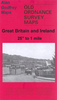
Moseley in 1913 in a fascinating series of reproductions of old Ordnance Survey plans in the Alan Godfrey Editions, ideal for anyone interested in the history of their neighbourhood or family. Selected towns in Great Britain and Ireland are covered by maps showing the extent of urban development in the last decades of the 19th and early 20th century.In this title: the map covers the area of south Birmingham that includes much of Moseley, part of Balsall Heath and Cannon Hill Park. Coverage stretches from Cannon Hill Park eastward to Dennis Road, and from Colville Road southward to Wake Green Road. Features include Midland Railway with Moseley and Brighton Road stations, tramways and depot, Moseley Hall Convalescent Hospital, Moseley Park, St Mary's church, Balsall Heath Park, St
Anne's church, St Barnabas church, County Cricket Ground, Edgbaston Mill Farm, Moor Green Hall, Pitmaston, Cannon Hill Park etc. On the reverse is a selection of street directory entries, including Alcester Road, Chantry Road, Church Road, Edgbaston Road, Moseley Village, Salisbury Road, Willows Road, Woodbridge Road, Wake Green Road.About the Alan Godfrey Editions of the 25
Anne's church, St Barnabas church, County Cricket Ground, Edgbaston Mill Farm, Moor Green Hall, Pitmaston, Cannon Hill Park etc. On the reverse is a selection of street directory entries, including Alcester Road, Chantry Road, Church Road, Edgbaston Road, Moseley Village, Salisbury Road, Willows Road, Woodbridge Road, Wake Green Road.About the Alan Godfrey Editions of the 25
Product Description
Reviews/Comments
Add New
Vouchers
No voucher codes found.
Do you know a voucher code for this product or supplier? Add it to Insights for others to use.
Do you know a voucher code for this product or supplier? Add it to Insights for others to use.
 Denmark