More From Contributor
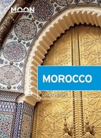
£3.99
The Lonely Planet Moroccan Arabic Phrasebook is not only an extensive list of useful phrases, but also an ideal tool to start getting to grips with a language & beginning two-way communication. Containing excellent sections on language basics such as numbers, question phrases, dates, phrase construction, grammar & pronunciation, as well as containing concise but well-rounded two-way dictionaries, Lonely Planet phrasebooks enable you to quickly & confidently construct your own phrases in addition to those given. The given phrases cover all the essential travel & tourism categories such as transport, communications, business meetings & accommodation, as well as in-depth categories such as health, food & social interaction. The phrasebooks are designed to enable more than just simple question-answer communication, allowing the start of two-way conversations ...
Archived Product
£14.99
Moroccan Atlas in Trailblazer’s Trekking Guide series, with 73 detailed trekking maps, showing route times, places to stay & points of interests, including 13 town & village guides with town plans including Marrakech, Imlil, Ouarzazate & Azilal. Traiblazer’s guides are highly practical, informative & portable guides designed with the adventurous hiker & trekker in mind, & produced by one of the leading outdoor guide-book publishers. Each title in the series explores a range of popular trekking routes in some of the world’s most challenging terrain, encompassing areas such as the Alps, Atlas Mountains, Himalaya & New Zeal&. Designed with practicality in mind, each guide describes the entire trekking route in clearly defined stages, allowing trekkers to plan their route accordingly. Strong on both practical content & cultural & historical background, Trailblazer Guides include extensive commentary on sites along the way, including town guides & maps where relevant, in addition to cultural & social background, as trekkers hike through the landscape. in addition, there are detailed descriptions of camping & accommodation facilities & places to eat & drink en route, as well as boxed insets exploring a local tradition or custom. Detailed, large-scale trekking maps are included in each title – a unique feature of Trailblazer guides – which include important information on walking times, directions, tricky junctions, places to stay & eat & general points of interest. The guides are arranged in 4 main sections – Planning Your Trip, a country or region fact-file, Minimum Impact Trekking & Route Guides & Maps, & there are also mini village, town & city guides where appropriate. There is detailed advice & guidance on the route itself, practical information for the walker, budgeting, when to go, itineraries, what to take & getting to & from the route. in addition, informative sections on the environment, flora & fauna & walking safety seek to improve walkers’ experiences of the routes & get the most from their trip. A Minimum Impact Trekking section also informs readers of the economic, environmental & cultural impact of walking. Appendices give information on local language, health issues & a brief glossary of trekking terminology. ...
Archived Product
£10.99
Paula Wolfert, one of America`s leading food writers, spent two years travelling extensively in Morocco collecting recipes from private kitchens & restaurants, to fill this informative & mouth-watering book. She spent hours talking to ordinary cooks in kitchens which were often remote & primitive, coaxing the exact details of traditional recipes out of men & women whose knowledge had been handed down through generations. ...
Archived Product
£69.00
Morocco has long been a mythic l&, firmly rooted in the European colonial imagination. For more than a century it has been appropriated by travellers, explorers, writers & artists. It is just these images & imaginings that are now being reconstructed for nostalgic consumption. In Moroccan Dreams, Claudio Minca examines this aestheticised re-enactment of the colonial, exploring the ways in which Moroccans themselves have become complicit in the re-writing of their homes & lives. Richly illustrated, the book provides a fascinating journey that will engage & delight all those enamoured of Morocco & its extraordinary geographies. ...
Archived Product
£15.00
This is the first English-language guide to winter walking, climbing, scrambling right across the Moroccan High Atlas of North Africa from Taroudant in the south-west to Midelt in the north-east, all accessible from Marrakech. Covers 40 peaks over 3000m, including Jbel Toubkal in the central area, Ighil Mgoun in the east & Jbel Tinergwet in the west. Routes suitable for experienced winter walkers only. The High Atlas mountains of Morocco have mountaineering potential galore. With 7 peaks over 4000m, & myriad other remote, little-climbed & poorly mapped summits, the region offers countless challenges for experienced winter climbers & scramblers looking for adventure. This guide outlines 50 routes on 40 peaks, all over 3000m, graded for remoteness, navigational difficulty & commitment. All routes are illustrated with colour sketch maps & photo-diagrams & also included are a basic English-Berber glossary & full information about the mountain refuges. ...
Archived Product
£5.99
A rather large map, principally showing most of the country, with more detailed insets of four popular regions & a more generalized map of the whole country
- including Western Sahara. A wealth of road information is here: surface condition & usability in bad weather, difficult or dangerous sections, gradients, high passes, impassable sections, scenic routes, fords, bridge load & height limits. Intermediate road distances are shown on most routes. Railways, ferries, airports & airfields are also marked. Relief is shown by hill-shading, with peak heights marked. National parks & forests are shown & symbols indicate a range of tourism features & landmarks eg. hotels, locations with fuel & repair facilities, custom posts, ruins, forts, religious buildings, mountain refuges, winter sport sites, viewpoints, palm groves, water holes, etc. Administratiev boundaries are indicated & mines, oil pipelines & wells are included in the detail. There are no latitude & longitude lines & the map is not indexed. The whole of the country is represented in an inset at 1:4, 000, 000 scale, & four regions are shown in more detail at 1:600, 000. These are Marrakesh & the High Atlas; the Mid Atlas (from El Kelaa des Sraghna to Boulemane); Meknes, Fes & the Rif; the region of Casablanca & Rabat. There is information on climate & a glossary of useful words. Legend is in French, English, German, Spanish & Arabic.
...
Archived Product
£5.99
Clear & attractive road map with street plans of Marrakesh, Agadir, Rabat, & Casablanca. Relief shading & spot heights indicate the topography. Road network is very clearly presented, although lacking some of the information which may be useful in areas such as the High Atlas, e.g. gradients or opening times of mountain passes. Places of interest, including national parks, oasis, etc. are very clearly marked (some of the symbols are not explained in the map legend!). The map has no geographical coordinates. The coastline south of Agadir is shown as an inset at the same scale as the main map, plus the Western Sahara at 1:5, 000, 000. The map

Includes::
street plans of Marrakesh, Agadir, Rabat, & Casablanca which highlight main places of interest (disappointingly perhaps, the bar where Sam played it again is not included). Both the main map & the four street plans are indexed.

...
Archived Product
£13.59
Morocco in the Countries & Regions series from Lonely Planet, market-leading comprehensive guides aimed at independent travellers & serving a large range of international destinations. Frank & informal in style, the guides explore an extensive range of sights, activities, accommodation, restaurants & nightlife & are designed for practical use while travelling on the road. Written & researched by a team of experts, each book is independent in its recommendations & suggestions, often offering individual takes on individual destinations. Widely recognised for their reliability, each Lonely Planet country & region guide has the same layout. Introductory sections profile the destination with individual chapters on particular highlights, getting started, (including when to go) itineraries, history, culture, arts, food & drink & the environment. Each guide is organised geographically by region, with individual sections detailing an extensive range of sights, places of interest, attractions, restaurants, nightlife, accommodation & any local activities. The guides have detailed explanations of historical context where relevant. There is also practical guidance on ...
Archived Product
£12.79
Morocco in the Countries, Regions & Cities series from Rough Guides; comprehensively detailed guidebooks specifically designed for independent travellers & serving a range of worldwide destinations. Widely recognised for their free editorial style, Rough Guide authors are allowed to express their personal opinions on a range of subjects. Although sometimes controversial, this editorial stance allows readers to experience more detailed & personal takes on each destination, a feature often more limited in other guidebooks. Cultural & historical nuances are explored in significant depth throughout the text & descriptions on the ambience of individual settings alongside personal recommendations, particularly in cities, are notably prevalent. Each Rough Guide in the Countries, Regions & Cities series has a similar layout. A ...
Archived Product
£16.99
Morocco Baedeker is divided into four main categories
- background, practicalities, tours & A-Z of sites. The guide is introduced
...
Archived Product

Morocco

Morocco at 1:1, 170, 000 on an indexed, double-sided, waterproof paper and tear-resistant map from ITMB, with street plans of central Tangier, Rabat, Marrakesh and Casablanca. Relief is depicted by altitude tinting and spot heights in highland regions. Sand dunes, wadis, salt flats, oasis and waterholes are also shown. Road network includes selected minor roads and tracks, with locations of petrol stations and intermediate distances indicated on main routes. District boundaries (but not names) are shown and a range of small symbols denote landmarks and tourism features, e.g. sites of interest, antiquities, forts, mosques, parks and reserves, etc. The country is presented as east and west sections, with a generous overlap, and includes Western Sahara and the Canary Islands.
Latitude and longitude lines are drawn at 1
RIP - This product is no longer available on our network. It was last seen on 25.09.2019

This page now acts as a permanent archive for this product. Add more information using the comments box below to ensure it can still be found by future generations.

Use our search facility to see if it is available from an alternative contributor.
  • External links may include paid for promotion
  • Availability: Out Of Stock
  • Supplier: Stanfords
  • SKU: 9781553413349
Availability: In Stock
£9.95

Product Description

Morocco at 1:1, 170, 000 on an indexed, double-sided, waterproof paper & tear-resistant map from ITMB, with street plans of central Tangier, Rabat, Marrakesh & Casablanca. Relief is depicted by altitude tinting & spot heights in highland regions. Sand dunes, wadis, salt flats, oasis & waterholes are also shown. Road network

Includes::
selected minor roads & tracks, with locations of petrol stations & intermediate distances indicated on main routes. District boundaries (but not names) are shown & a range of small symbols denote landmarks & tourism features, e.g. sites of interest, antiquities, forts, mosques, parks & reserves, etc. The country is presented as east & west sections, with a generous overlap, &

Includes::
Western Sahara & the Canary Islands. Latitude & longitude lines are drawn at 1

Reviews/Comments

Add New

Price History

Vouchers

No voucher codes found.
Do you know a voucher code for this product or supplier? Add it to Insights for others to use.

Facebook

Jargon Buster

Paper - A thin sheet mainly used for writing. Available in a variety of colours. Made mainly from wood pulp.
Waterproof - Resistant to water, usualy specified by depth in metres
Network - A link and communication between things. Often computers or people.
Small - something that takes up less space than normal.
Road - a manmade lane or a path that is used to speed up travel.
Resistant - Something that can repel against something.
Altitude - Something that can be quite high in relation to sea or ground level.

Supplier Information

Stanfords
Stanfords was established in 1853 and opened their iconic Covent Garden flagship store in 1901. They have become the top retailer of maps, travel books and accessories in the UK and arguably offer the largest selection of maps and travel books worldwide. Famous names such as Captain Robert Falcon Scott, Ranulph Fiennes and Michael Palin have purchased from Stanfords. They now have a shop in Bristol and both stores together with other venues operate a calendar of events including talks, book signings and exhibitions. As a specialist map retailer, the map selection is comprehensive and includes road maps, street maps and walking maps from worldwide destinations, as well as a selection of world atlases and wall maps. Books include travel guides and travel literature. Stanfords also stock globes, from miniatures made of blue marble to magnificent floor-standing globes. The website features a selection of interesting articles on travel topics.
Page Updated: 2023-11-12 20:15:36

Community Generated Product Tags

Oh No! The productWIKI community hasn't generated any tags for this product yet!
Menu