More From Contributor
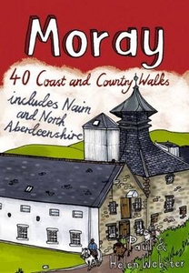
£7.99
Morality for Beautiful Girls by Alexander Mc Call Smith sees the No.1 Ladies’ Detective Agency in financial difficulty & Mma Ramotswe forced to make the tricky decision to share offices with her fiancé, Mr J. L. B. Matekoni. Although Tlokweng Road Speedy Motors could do with a little help, it is Mr Matekoni himself who really requires her attention. If that weren’t enough, the agency is handling some highly puzzling cases: the government official whose sister-in-law is trying to poison his brother; the beauty pageant whose contestants aren’t as good as their looks; & the strange young boy, found naked & wild, & smelling of lion. ...
Archived Product
£8.99
`I`ve lived through ten i OS upgrades on my Mac
- & that`s just something I use to muck about on Twitter. Surely capitalism is
...
Archived Product
£9.99
Eastern Moravia
- Western Slovakia in Mair Dumont`s Marco Polo regional series of the Czech Repoublic at 1:200, 000, with special
...
Archived Product
£6.95
Map No. 150, Moravska brana, in a series of GPS compatible topographic maps of the Czech Republic at 1:75.000 from Shocart highlighting both signposted cycling routes & other local cycling paths, with route profiles & additional tourist information. Relief is shown by contour lines, spot heights, & subtle hill-shading. The maps show roads, tracks, railways, cable cars, chairlifts, & a range of natural landscape features & landmarks. Coloured symbols depict plenty of additional tourist features e.g. information centres, places of interest, antiquities, shelters, campsites, accommodation, bicycle services etc. An overprint highlights both signposted routes & other recommended routes which have no terrain markers. For all bike routes intermediate distances are shown. Hiking paths are also highlighted. Latitude & longitude margin ticks are at 5' intervals. Each map is accompanied by a booklet containing general information on the Czech cycle route network, elevation profile diagram for selected routes, plus an index for locations of historical & geographical interest, bicycle service workshops, information centres, & tourist attractions. Map legend & text are in English, German & Czech. ...
Archived Product
£6.95
Map No. 154, Moravskoslezske Beskydy, in a series of GPS compatible topographic maps of the Czech Republic at 1:75.000 from Shocart highlighting both signposted cycling routes & other local cycling paths, with route profiles & additional tourist information. Relief is shown by contour lines, spot heights, & subtle hill-shading. The maps show roads, tracks, railways, cable cars, chairlifts, & a range of natural landscape features & landmarks. Coloured symbols depict plenty of additional tourist features e.g. information centres, places of interest, antiquities, shelters, campsites, accommodation, bicycle services etc. An overprint highlights both signposted routes & other recommended routes which have no terrain markers. For all bike routes intermediate distances are shown. Hiking paths are also highlighted. Latitude & longitude margin ticks are at 5' intervals. Each map is accompanied by a booklet containing general information on the Czech cycle route network, elevation profile diagram for selected routes, plus an index for locations of historical & geographical interest, bicycle service workshops, information centres, & tourist attractions. Map legend & text are in English, German & Czech. ...
Archived Product
£10.99
The Moray Coast Trail
- a 70km/44 miles trail along the eastern coast of Scotl&, plus the Dava Way – 37km/23 mile route from Grantown-on-Spey
...
Archived Product
£12.99
Topographic survey of France at 1:25, 000 in IGN`s excellent TOP25 / Série Bleue series. All the maps are GPS compatible, with a 1km UTM grid plus latitude & longitude lines at 5’ intervals. Contours are at 5m intervals except for mountainous areas where the maps have contours at 10m intervals, vividly enhanced by hill shading & graphics for rocky terrain. Colouring with graphics indicates different types of vegetation or land use (deciduous or coniferous forests, moors, orchards, vineyards, etc). PLEASE NOTE: coverage of France at this scale is currently being revised – the format & the presentation of each title are indicated by the letters at the end of its Sheet Reference number (e.g. 0416ET, 3531ETR, 1923SB, etc.)MAPS WITH FULL TOURIST OVERPRINT & AN ENGLISH MAP LEGEND: all TOP25 maps & the SB editions of Série Bleue have an overprint highlighting waymarked walking trails including long-distance GR routes &, where appropriate, ski routes. Symbols indicate campsites, gîtes d’etape, refuges, equestrian centres & other recreational facilities or sites, tourist information centres, cultural heritage, etc. Towns & locations of particular interest are highlighted.- ET or OT = single-sided TOP25 map covering approx. 29x 21 km / 18x 13 miles.- ETR or OTR = waterproof & tear resistant TOP25 map covering the same area as the corresponding ET or OT number, but double-sided, printed on a smaller size sheet with a good overlap between the sides.- SB = Série Bleue map with full tourist overprint; these maps, first introduced in summer 2014, each cover approx. 29x 24km / 18x 15 miles.SÉRIE BLEUE maps with numbers ending in E (Est) or O (Ouest): most editions now indicate the GR routes, but do not show any other tourist information. Map legend is in French only. Each map covers approx. 14x 20km / 9x 12 miles. ...
Archived Product
£3.50
Morden in 1894 in a fascinating series of reproductions of old Ordnance Survey plans in the Alan Godfrey Editions, ideal for anyone interested in the history of their neighbourhood or family. Morden is today perhaps best known for being the terminus of the Northern Line
- the map captures it when it was still a straggling village. Coverage stretches from Mordenhall Farm southward to Morden Park, & other features include Morden Hall, deer park, Morden House, Ravensbury Mills, Ravensbury Farm & a scattering of villas among the fields. On the reverse are directories of Morden for 1903 & 1934. About the Alan Godfrey Editions of the 25” OS Series: Selected towns in Great Britain & Ireland are covered by maps showing the extent of urban development in the last decades of the 19th & early 20th century. The plans have been taken from the Ordnance Survey mapping & reprinted at about 15 inches to one mile (1:4, 340). On the reverse most maps have historical notes & many also include extracts from contemporary directories. Most maps cover about one mile (1.6kms) north/south, one & a half miles (2.4kms) across; adjoining sheets can be combined to provide wider coverage.FOR MORE INFORMATION & A COMPLETE LIST OF ALL AVAILABLE TITLES PLEASE CLICK ON THE SERIES LINK.
...
Archived Product
£5.99
” Bears like Paddington are very rare, ” says Mrs Bird, ”and a good thing too, or it would cost us a small fortune in marmalade.” Classic adventures of the bear from Darkest Peru. As Paddington says himself, ” Things happen to me
- I`m that sort of bear.” With his attempts at home decorating, detective work & photography, the Brown family soon find that Paddington causes his own particular brand of chaos.
...
Archived Product
£11.99
More Cotswolds in the Pathfinder Guides series, produced in association with Ordnance Survey & published by Crimson; comprising a range of walking guides to popular British destinations. Each Pathfinder guide

Includes::
28 varied walks ranging from easy strolls to exhilarating hikes & is accompanied by 1:25, 000 Ordnance Survey mapping with marked, colour-coded routes. Introductory sections profile the county or region covered, with recommendations on the best time to visit & a brief explanation of GPS. An ‘at-a-glance’ table gives an overview of the walks covered in the guide, with information on the starting point, National Grid reference, distance, time, highest point & general brief comments. Each walk described in the guide has a dedicated information box profiling the walk, with useful information such as the starting point, distance, approximate time, parking, refreshments & the relevant Ordnance Survey map for navigation. Clear & easy to follow directions are provided & are accompanied by practical information about the route, including the location of toilets, refreshment areas & picnic sites, as well as colour photography illustrating some of the highlights of the walk. A Further Information section contains information on walking safety & responsible walking, as well as a list of useful contacts.

...
Archived Product

Moray

The Moray coastline has a string of superb sandy beaches, and towns such as Buckie, Lossiemouth and Nairn (historically part of Morayshire) have long been popular for family holidays. For the walker there are cliffs, arches and stacks as well as sand and dunes, whilst offshore it may be possible to glimpse the famous Moray Firth dolphins. Set back from the coast are fine stone-built towns such as Forres and the small Cathedral city of Elgin. From here heading southwards the character of the countryside changes to one of wide, spacious glens and sweeping, purple heather moors and hills. This is Speyside - Malt whisky country par excellence. The main centres here are Keith, Aberlour and attractive Dufftown, as the hills slowly merge into the Cairngorms National Park. This latest
pocket guide features 40 of the best walks in this popular area in an attractive and accessible format.
RIP - This product is no longer available on our network. It was last seen on 25.09.2019

This page now acts as a permanent archive for this product. Add more information using the comments box below to ensure it can still be found by future generations.

Use our search facility to see if it is available from an alternative contributor.
  • External links may include paid for promotion
  • Availability: Out Of Stock
  • Supplier: Stanfords
  • SKU: 9781907025136
Availability: In Stock
£6.99

Product Description

The Moray coastline has a string of superb sandy beaches, & towns such as Buckie, Lossiemouth & Nairn (historically part of Morayshire) have long been popular for family holidays. For the walker there are cliffs, arches & stacks as well as sand & dunes, whilst offshore it may be possible to glimpse the famous Moray Firth dolphins. Set back from the coast are fine stone-built towns such as Forres & the small Cathedral city of Elgin. From here heading southwards the character of the countryside changes to one of wide, spacious glens & sweeping, violet heather moors & hills. This is Speyside
- Malt whisky country par excellence. The main centres here are Keith, Aberlour & attractive Dufftown, as the hills slowly merge into the Cairngorms National Park. This latest pocket guide features 40 of the best walks in this popular area in an attractive & accessible format.

Reviews/Comments

Add New

Intelligent Comparison

Oooops!
We couldn't find anything!
Perhaps this product's unique.... Or perhaps we are still looking for comparisons!
Click to bump this page and we'll hurry up.

Price History

Vouchers

No voucher codes found.
Do you know a voucher code for this product or supplier? Add it to Insights for others to use.

Facebook

Jargon Buster

Purple - A colour between red and blue. Commonly associated with Cadburys
Stone - Or Rock is a naturally occuring mineral categorised into three types, Igneous, Sedimentary and Metamorphic
Set - a group of items usually related to one another. Some objects cannot function without the complete set of items.
Small - something that takes up less space than normal.
Wide - Something with a large width.
Popular - Something that is admired and liked by many people.
Pocket - A bag shaped insert in clothing used to carry items
Family - A group of people that live together made up from parents and children.

Supplier Information

Stanfords
Stanfords was established in 1853 and opened their iconic Covent Garden flagship store in 1901. They have become the top retailer of maps, travel books and accessories in the UK and arguably offer the largest selection of maps and travel books worldwide. Famous names such as Captain Robert Falcon Scott, Ranulph Fiennes and Michael Palin have purchased from Stanfords. They now have a shop in Bristol and both stores together with other venues operate a calendar of events including talks, book signings and exhibitions. As a specialist map retailer, the map selection is comprehensive and includes road maps, street maps and walking maps from worldwide destinations, as well as a selection of world atlases and wall maps. Books include travel guides and travel literature. Stanfords also stock globes, from miniatures made of blue marble to magnificent floor-standing globes. The website features a selection of interesting articles on travel topics.
Page Updated: 2023-11-12 20:15:36

Community Generated Product Tags

Oh No! The productWIKI community hasn't generated any tags for this product yet!
Menu