More From Contributor
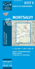
£12.99
Topographic survey of France at 1:25, 000 in IGN`s excellent TOP25 / Série Bleue series. All the maps are GPS compatible, with a 1km UTM grid plus latitude & longitude lines at 5’ intervals. Contours are at 5m intervals except for mountainous areas where the maps have contours at 10m intervals, vividly enhanced by hill shading & graphics for rocky terrain. Colouring with graphics indicates different types of vegetation or land use (deciduous or coniferous forests, moors, orchards, vineyards, etc). PLEASE NOTE: coverage of France at this scale is currently being revised – the format & the presentation of each title are indicated by the letters at the end of its Sheet Reference number (e.g. 0416ET, 3531ETR, 1923SB, etc.)MAPS WITH FULL TOURIST OVERPRINT & AN ENGLISH MAP LEGEND: all TOP25 maps & the SB editions of Série Bleue have an overprint highlighting waymarked walking trails including long-distance GR routes &, where appropriate, ski routes. Symbols indicate campsites, gîtes d’etape, refuges, equestrian centres & other recreational facilities or sites, tourist information centres, cultural heritage, etc. Towns & locations of particular interest are highlighted.- ET or OT = single-sided TOP25 map covering approx. 29x 21 km / 18x 13 miles.- ETR or OTR = waterproof & tear resistant TOP25 map covering the same area as the corresponding ET or OT number, but double-sided, printed on a smaller size sheet with a good overlap between the sides.- SB = Série Bleue map with full tourist overprint; these maps, first introduced in summer 2014, each cover approx. 29x 24km / 18x 15 miles.SÉRIE BLEUE maps with numbers ending in E (Est) or O (Ouest): most editions now indicate the GR routes, but do not show any other tourist information. Map legend is in French only. Each map covers approx. 14x 20km / 9x 12 miles. ...
Archived Product
£13.99
Monts d` Ardèche, including the Gorges of the Ardèche, at 1:60, 000 on a contoured & GPS compatible map from Didier Richard with a base derived from IGN’s topographic survey, highlighting both local hiking routes & the GR network of long-distance paths, gîtes, interesting natural & cultural sites, etc. Coverage extends from Saint-Agrève & Lamastre southwards to the gorges of the Ardèche, &

Includes::
le Cheylard, Privas, Aubenas, Vallon Pont-d’ Arc, Ruoms, Thueyts, Les Vans, etc. Relief is portrayed by contours at 50m intervals with additional hill shading & colouring for different types of vegetation. An overprint highlights local hiking trails, indicating routes which are part of the GR network. Bold symbols show gîtes d’etape & special lodgings within the area of the regional park, climbing sites, canoeing & mountain bike centres, interesting cultural or natural sites, etc. The map has a UTM grid. Map legend

Includes::
English. To see the list of all the titles in this series please click on the series link.


...
Archived Product
£11.50
Topographic survey of France at 1:25, 000 in IGN`s excellent TOP25 / Série Bleue series. All the maps are GPS compatible, with a 1km UTM grid plus latitude & longitude lines at 5’ intervals. Contours are at 5m intervals except for mountainous areas where the maps have contours at 10m intervals, vividly enhanced by hill shading & graphics for rocky terrain. Colouring with graphics indicates different types of vegetation or land use (deciduous or coniferous forests, moors, orchards, vineyards, etc). PLEASE NOTE: coverage of France at this scale is currently being revised – the format & the presentation of each title are indicated by the letters at the end of its Sheet Reference number (e.g. 0416ET, 3531ETR, 1923SB, etc.)MAPS WITH FULL TOURIST OVERPRINT & AN ENGLISH MAP LEGEND: all TOP25 maps & the SB editions of Série Bleue have an overprint highlighting waymarked walking trails including long-distance GR routes &, where appropriate, ski routes. Symbols indicate campsites, gîtes d’etape, refuges, equestrian centres & other recreational facilities or sites, tourist information centres, cultural heritage, etc. Towns & locations of particular interest are highlighted.- ET or OT = single-sided TOP25 map covering approx. 29x 21 km / 18x 13 miles.- ETR or OTR = waterproof & tear resistant TOP25 map covering the same area as the corresponding ET or OT number, but double-sided, printed on a smaller size sheet with a good overlap between the sides.- SB = Série Bleue map with full tourist overprint; these maps, first introduced in summer 2014, each cover approx. 29x 24km / 18x 15 miles.SÉRIE BLEUE maps with numbers ending in E (Est) or O (Ouest): most editions now indicate the GR routes, but do not show any other tourist information. Map legend is in French only. Each map covers approx. 14x 20km / 9x 12 miles. ...
Archived Product
£12.99
Topographic survey of Catalonia at 1:25, 000 from the Institut Cartogràfic i Geològic de Catalunya, an attractive alternative to Spain’s national topographic survey at this scale, offering a much larger area per sheet with extensive tourist information & vivid presentation of vegetation & land use. These large, detailed maps have contours at 10m intervals enhanced by hill shading & fine colouring and/or graphics to portray of vegetation or land use (different types of woodlands, marshl&, vineyards, crops, etc). An overprint highlights waymarked local & long-distance GR footpaths plus CT cycling routes. Also highlighted are picturesque locations such as villages, isolated buildings or natural features. A very wide range of symbols indicate various facilities, places of interest & recreational sites: tourist information centres, campsites & other rural accommodation, cultural heritage, vineries, wildlife observation areas, viewpoints & beauty spots, sites for recreational pursuits including horse riding, water sports, paragliding, etc The maps are divided by the publishers into three types: Administrative Units, Natural Protected Areas, & Geographical Areas, as shown on our grid for this series. Coverage by each sheet varies; most maps present an area of 30 x 23km (19 x 14km approx). The maps have a 1km UTM grid, with latitude & longitude values shown for the map corners. Excellently presented topographic map legend is in Catalan only but the legend for the tourist information & the road network

Includes::
English. To see the list of all the titles in this series please click on the series link.

...
Archived Product
£13.99
Montseny in an extensive & very popular series of walking maps from Editorial Alpina covering the Pyrenees, Catalonia & other selected hiking areas in Spain, including Picos de Europa, Sierra Nevada & parts of Andalucía, Majorca, etc. Scales vary from 1:50, 000 to 1:10, 000, with the majority of the titles at 1:25, 000. The maps have contours, usually at 20m or 10m intervals, with additional hill shading & spot heights. An overprint highlights hiking trails, long-distance footpaths, campsites, mountain huts, refuges, etc. Many maps also show climbing sites, potholing caves, mountain bike routes, equestrian & ski centres. All the latest editions have a UTM grid, plus margin ticks for latitude & longitude at intervals of 1’. Map legend in most titles

Includes::
English. Each title has a separate booklet with general information on the area, descriptions of selected hiking routes, a list of accommodation with addresses, etc. In several titles the booklet now

Includes::
English.* In this title:* contours are at 10m intervals, relief shading & vegetation colouring. The map has a 1-km UTM grid. In addition to local footpaths, the overprint also highlights long distance routes such as GR2, Meridia Verd & Els Tres Monts, plus shows adventure parks & climbing areas, various types of accommodation (hotels, campsites, etc.), information centres, places of interest, locations of petrol stations on local roads, etc. Map legend

Includes::
English. The accompanying booklet

Includes::
35 pages with * English language* descriptions of 15 hiking trails, 10 mountain bike routes, lists of accommodation with contact details, & other useful tourist information.


...
Archived Product
£14.99
Montserrat Natural Park in Catalonia on a double-sided, contoured & GPS compatible map from Editorial Alpina, showing on one side the whole area at 1:10, 000, with on the reverse the central part of the park at more detailed scale of 1:5, 000. On both sides vivid presentation of the topography is provided by contours at 5m intervals enhanced by numerous spot heights, relief shading & colouring to indicate vegetation. Local & long-distance waymarked trails are highlighted, indicating difficult sections. Symbols show refuges, camping areas, hotels & other tourist accommodation, restaurants, information centres, viewpoints, etc. Road network indicates locations of petrol stations & car parks. The map has a 1km UTM grid, plus margin ticks for latitude & longitude at 1’ intervals. Map legend

Includes::
English. The accompanying booklet has 23 pages in English with descriptions of 5 easy hikes & 24 medium or more difficult routes. General information about the area is supplemented by a list of 104 local caves for potholing, advice for other adventure sports, plus contact details for local accommodation options & other useful numbers & web addresses. To see the list of titles in this Editorial Alpina series which provides coverage of most popular hiking areas of Spain please click on the series link.

...
Archived Product
£25.00
We are able to source a wide range of courtesy flags. Flags are available in many sizes & can be sewn or printed on 100% Ministry Of Defence Standard Woven & Knitted Polyester. Flags are supplied with rope & toggle. If you would like more information, have a custom size request or cannot find a desired product, please email us at maritime@stanfords.co.uk. We will be glad to help! ...
Archived Product
£10.99
Topographic survey of Catalonia at 1:50, 000 from the Institut Cartogràfic de Catalunya, with vivid presentation of the terrain & an overprint for long-distance GR hiking trails. The series provides an excellent alternative to the much smaller sheets in the civilian or military surveys produced for the whole of Spain. The Catalan 50K series has not only a much larger area per sheet (each map covers one comarca, an administrative division of a province) than the maps from the national surveys, but also has more colourful, elegant & clear cartography with contours at 20m intervals, hill shading & fine graphics to portray the relief, vegetation types & landmarks. Most maps also have more tourist-related information, with an overprint highlighting long-distance GR trails & the Via Verde routes. Mountain refuges are marked & a range symbols indicate various places of interest including historical monuments, sport & recreational facilities, etc. Four different types of interesting locations are highlighted: picturesque towns or villages, individual isolated building or monuments, natural sites, & hydrographic features such as waterfalls. The maps have a 5km UTM grid, with latitude & longitude values shown for the map corners. Map legend is in Catalan only. To see other titles in this series please click on the series link. ...
Archived Product

Montsec De L`Estall

Montsec de L`Estall area at 1:25, 000 in a series of GPS compatible maps from Editorial Piolet with cartography based on Spain’s civilian topographic survey overprinted with hiking routes and other tourist information. Multilingual notes include brief English language descriptions of 17 local hiking routes.Hiking maps in the Editorial Piolet series, unless indicated to the contrary in the individual description, have contours at 10m intervals, enhanced by relief shading and/or altitude colouring, and provide very detailed presentation of the terrain and local road network. An overprint highlights hiking routes, distinguishing between short local routes, longer PR paths and long-distance GR routes. Symbols mark campsites and mountain huts or refuges, various places of interest,
climbing or other recreational areas, etc. Each title has a UTM grid. Map legend includes English.To see other titles in this series please click on the series link.
RIP - This product is no longer available on our network. It was last seen on 25.09.2019

This page now acts as a permanent archive for this product. Add more information using the comments box below to ensure it can still be found by future generations.

Use our search facility to see if it is available from an alternative contributor.
  • External links may include paid for promotion
  • Availability: Out Of Stock
  • Supplier: Stanfords
  • SKU: 9788495945273
Availability: In Stock
£12.99

Product Description

Montsec de L` Estall area at 1:25, 000 in a series of GPS compatible maps from Editorial Piolet with cartography based on Spain’s civilian topographic survey overprinted with hiking routes & other tourist information. Multilingual notes include brief English language descriptions of 17 local hiking routes. Hiking maps in the Editorial Piolet series, unless indicated to the contrary in the individual description, have contours at 10m intervals, enhanced by relief shading and/or altitude colouring, & provide very detailed presentation of the terrain & local road network. An overprint highlights hiking routes, distinguishing between short local routes, longer PR paths & long-distance GR routes. Symbols mark campsites & mountain huts or refuges, various places of interest, climbing or other recreational areas, etc. Each title has a UTM grid. Map legend

Includes::
English. To see other titles in this series please click on the series link.

Reviews/Comments

Add New

Intelligent Comparison

Oooops!
We couldn't find anything!
Perhaps this product's unique.... Or perhaps we are still looking for comparisons!
Click to bump this page and we'll hurry up.

Price History

Vouchers

No voucher codes found.
Do you know a voucher code for this product or supplier? Add it to Insights for others to use.

Facebook

Jargon Buster

GPS - Global Positioning System - Global position using satellites
Hiking - An outdoor activity envolving walking in nature
Spain - A country within the EU.
Network - A link and communication between things. Often computers or people.
Language - the method of communication used in different areas. Humans and computers have many different languages.
Road - a manmade lane or a path that is used to speed up travel.
Altitude - Something that can be quite high in relation to sea or ground level.
Individual - A single separate item or person.
Language - The way humans communicate either written and spoken.

Supplier Information

Stanfords
Stanfords was established in 1853 and opened their iconic Covent Garden flagship store in 1901. They have become the top retailer of maps, travel books and accessories in the UK and arguably offer the largest selection of maps and travel books worldwide. Famous names such as Captain Robert Falcon Scott, Ranulph Fiennes and Michael Palin have purchased from Stanfords. They now have a shop in Bristol and both stores together with other venues operate a calendar of events including talks, book signings and exhibitions. As a specialist map retailer, the map selection is comprehensive and includes road maps, street maps and walking maps from worldwide destinations, as well as a selection of world atlases and wall maps. Books include travel guides and travel literature. Stanfords also stock globes, from miniatures made of blue marble to magnificent floor-standing globes. The website features a selection of interesting articles on travel topics.
Page Updated: 2023-11-12 20:15:36

Community Generated Product Tags

Oh No! The productWIKI community hasn't generated any tags for this product yet!
Menu