More From Contributor
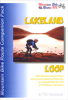
£13.99
The Central Fells of the Lake District include treasures such as the ever-popular Langdale Pikes, the supremely lovely foothills overlooking Borrowdale & the 'silent forests & gaunt crags' above the dark waters of Thirlmere. For walkers heading in this direction, & lovers of the Lakeland fells, this is the guide to take. This second edition of The Central Fells by the great fell walker A. Wainwright has been brilliantly revised by Chris Jesty, a trained cartographer who worked with Wainwright on some of the maps in his later large-format guides. All footpaths have been rewalked, all routes checked, all maps & text updated. Paths & routes have been picked out in red to make them easier to follow, & parking information has been added. This new edition of the classic walking guide is Wainwright for the 21st century. ...
Archived Product
£5.99
Lakeland Fells: Ambleside & the South (25 walks) is the Hillside mini guide to walking shorter, concisely described routes through all corners of the Lake District including Ambleside, Coniston, Grasmere, Great Langdale, Troutbeck, Kentmere & Little Langdale. Hillside Great Britain Mini Walking Guides series is a collection of mini guides by Paul Hannon to the walking country in Great Britain. Featured walks are presented with route detail text, relevant summit/ascent data, start position, distance, national grid references, Ordnance Survey map details, access information & simple black & white overview route maps. Guides feature a table of summits & walk log. ...
Archived Product
£5.99
Lakeland Fells: Buttermere & the West (25 walks) is the Hillside mini guide to walking shorter, concisely described routes, of between 3.5 & 10.5 miles, through all corners of the Lake District including Buttermere, Crummock Water, Vale of Lorton, Ennerdale, Wastwater, Eskdale & the Duddon Valley. Hillside Great Britain Mini Walking Guides series is a collection of mini guides by Paul Hannon to the walking country in Great Britain. Featured walks are presented with route detail text, relevant summit/ascent data, start position, distance, national grid references, Ordnance Survey map details, access information & simple black & white overview route maps. Guides feature a table of summits & walk log. ...
Archived Product
£5.99
Lakeland Fells: Keswick & the North (25 walks) is the Hillside mini guide to walking shorter, concisely described routes of between 3 & 10 miles, through all corners of the Lake District including Keswick, Bassenthwaite Lake, Borrowdale, Caldbeck, Newlands, Thirlmere & Derwentwater. Hillside Great Britain Mini Walking Guides series is a collection of mini guides by Paul Hannon to the walking country in Great Britain. Featured walks are presented with route detail text, relevant summit/ascent data, start position, distance, national grid references, Ordnance Survey map details, access information & simple black & white overview route maps. Guides feature a table of summits & walk log. ...
Archived Product
£5.99
Lakeland Fells: Patterdale & the East (25 walks) is the Hillside mini guide to walking shorter, concisely described routes, of between 4 & 10 miles, through all corners of the Lake District including Patterdale, Glenridding, Hartsop, Ullswater, Kirkstone, Howtown, Martindale & Haweswater. Hillside Great Britain Mini Walking Guides series is a collection of mini guides by Paul Hannon to the walking country in Great Britain. Featured walks are presented with route detail text, relevant summit/ascent data, start position, distance, national grid references, Ordnance Survey map details, access information & simple black & white overview route maps. Guides feature a table of summits & walk log. ...
Archived Product
£10.95
Lakeland North at 1:25, 000 on a waterproof & tear-resistant, GPS compatible map from Harvey Map Services in their Superwalker series covering popular hiking areas of Great Britain & Irel&, annotated with additional information for walkers. The maps have contours at 15m intervals, with additional graphics for various types of terrain (crags, large boulders, scattered rocks) & colouring for different kinds of land use or vegetation (pastures, bogs, forests or woodl&, etc). The maps show local hiking paths, indicating, where appropriate, long-distance routes & boundaries of national parks or other protected areas. Scottish titles also indicate Munro, Corbett & Graham hills. Some maps in addition highlight local cycle routes.A range of symbols mark various facilities for walkers including youth or independent hostels, campsites & caravan sites, information points, etc. Each map has a 1-km with British or Irish national grid. ...
Archived Product
£12.99
W. A. Poucher`s guides, first published in the 1960s, are some of the most popular books for fellwalkers, climbers & scramblers ever published. They are packed with guidance on clothing, equipment, accommodation, route finding, distances & times, all in an attractive pocket-sized format to slip into your rucksack. Aspiring landscape photographers will find a chapter of essential tips in each book to help them too. Since the author`s death in 1988, the guides have been updated in consultation with John Poucher, the author`s son. ...
Archived Product
£12.95
Aileen & Brian Evans’ practical Cicerone guide to North Lakeland is a comprehensive introduction to walking the lower fells of the beautiful Lake District. Dividing North Lakeland into six areas
- Borrowdale, the northern fells, Patterdale & Ullswater, Newlands & the north-west, Thirlmere & the eastern fells & dales, the authors have produced a detailed volume on one of Britain’s most favourite walking destinations. There are 57 short walks described between 4 & 8 miles, enough to fill a day & ideal for day visitors or family walkers. Some longer walks can be split; others combined. It is not suitable for those interested in high level fell walking; instead priority is given to the lower fells & dales, which are as rewarding as their higher brethren. Detailed route descriptions & precise hand drawn maps & evocative sketches make this volume ideal for anyone who wants to explore north Lakel&.
...
Archived Product
£12.95
Aileen & Brian Evans’ Cicerone guide to West Lakeland
- Short walks in Lakeland Book 3 is part of a trilogy of guides exploring
...
Archived Product
£12.95
Aileen & Brian Evans’ practical Cicerone guide to South Lakeland is a comprehensive introduction to walking the lower fells of the beautiful Lake District. Dividing South Lakeland into four areas
- the central fells, around Coniston Water & Windermere, the eastern fells & dales & the limestone fringe, the authors have produced a detailed volume on one of Britain’s most favourite walking destinations. There are 60 short walks described between 4 & 9 miles, enough to fill a day & ideal for day visitors or family walkers. Some longer walks can be split; others combined. It is not suitable for those interested in high level fell walking; instead priority is given to the lower fells & dales, which are as rewarding as their higher brethren. Detailed route descriptions & precise hand drawn maps & evocative sketches make this volume ideal for anyone who wants to explore south Lakel&.
...
Archived Product

Lakeland Loop

Mountain Bike Routes UK’s cycling guide to the Lakeland Loop comes in a clear plastic wallet with 10 removable route cards; each card breaks the route down into smaller sections, with distances, detailed directions and national grid references given regularly for GPS users. There are also four additional cards giving first aid information.A 44 page guide describes the area and the route from the point of view of author Tim Woodcocks’ personal recollections, going on to give the reader information on recommended fitness levels for the route, preparations, what you’ll need to take with you, relevant Ordnance Survey maps and more. Woodcock also explains how to get there, where to stay, and tips on riding, rights of way, and safety. An appendices lists youth hostel phone
numbers, nearby bike shops, and tourist information centers. Printed in black and white and written in an informal and honest style, Mountain Bike Route UK guides are recommended for those looking for a more personal approach to their cycling guide.
RIP - This product is no longer available on our network. It was last seen on 25.09.2019

This page now acts as a permanent archive for this product. Add more information using the comments box below to ensure it can still be found by future generations.

Use our search facility to see if it is available from an alternative contributor.
  • External links may include paid for promotion
  • Availability: Out Of Stock
  • Supplier: Stanfords
  • SKU: 9781902891026
Availability: In Stock
£6.99

Product Description

Mountain Bike Routes UK’s cycling guide to the Lakeland Loop comes in a clear plastic wallet with 10 removable route cards; each card breaks the route down into smaller sections, with distances, detailed directions & national grid references given regularly for GPS users. There are also four additional cards giving first aid information.A 44 page guide describes the area & the route from the point of view of author Tim Woodcocks’ personal recollections, going on to give the reader information on recommended fitness levels for the route, preparations, what you’ll need to take with you, relevant Ordnance Survey maps & more. Woodcock also explains how to get there, where to stay, & tips on riding, rights of way, & safety. An appendices lists youth hostel phone numbers, nearby bike shops, & tourist information centers. Printed in black & white & written in an informal & honest style, Mountain Bike Route UK guides are recommended for those looking for a more personal approach to their cycling guide.

Reviews/Comments

Add New

Intelligent Comparison

Oooops!
We couldn't find anything!
Perhaps this product's unique.... Or perhaps we are still looking for comparisons!
Click to bump this page and we'll hurry up.

Price History

Vouchers

No voucher codes found.
Do you know a voucher code for this product or supplier? Add it to Insights for others to use.

Facebook

Jargon Buster

GPS - Global Positioning System - Global position using satellites
Black - A colour which does not emit any colour of the spectrum. Black absorbs all frequencies of the spectrum.
Plastic - A generic term for a synthetic product used in the manufacture of products
White - A colour combining all colours
UK - United Kingdom - An island nation in Europe
phone - Short for telephone. A device that transmits sound allowing point to point communication over long distances
Safety - prevents damage being caused.
Personal - Something that belongs more to an individual due to it affecting them more by relating to them.

Supplier Information

Stanfords
Stanfords was established in 1853 and opened their iconic Covent Garden flagship store in 1901. They have become the top retailer of maps, travel books and accessories in the UK and arguably offer the largest selection of maps and travel books worldwide. Famous names such as Captain Robert Falcon Scott, Ranulph Fiennes and Michael Palin have purchased from Stanfords. They now have a shop in Bristol and both stores together with other venues operate a calendar of events including talks, book signings and exhibitions. As a specialist map retailer, the map selection is comprehensive and includes road maps, street maps and walking maps from worldwide destinations, as well as a selection of world atlases and wall maps. Books include travel guides and travel literature. Stanfords also stock globes, from miniatures made of blue marble to magnificent floor-standing globes. The website features a selection of interesting articles on travel topics.
Page Updated: 2023-11-12 20:15:36

Community Generated Product Tags

Oh No! The productWIKI community hasn't generated any tags for this product yet!
Menu