More From Contributor
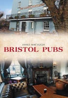
£24.50
Bristol Premier Wall Map, size 121 x 96cm, *paper version*, from Geographers` A-Z Map Company designed to cover the city within its administrative boundaries, with a separate comprehensive index booklet listing streets, places & areas, industrial estates, selected flats & walkways, service areas, stations, & selected places of interest, shown where appropriate with their postcodes. The city is covered at 4 inches to 1 mile (1:15, 840), with an enlargement showing the town centre in greater clarity at 8 inches to 1 mile (1:7, 920). Coverage
Includes:: Avonmouth, Cribb`s Causeway, Fail&, Filton, Kaynsham, Kingswood, Knowle, Mangotsfield, Oldl&, Pill & Whitchurch. Current edition of this title was published in 2011. The plans show A & B roads, plus longer street annotated with selected house numbers for easier identification of addresses. One way traffic, restricted access, pedestrianized streets, selected car parks & Park & Ride facilities are marked. Railway stations are shown with names. Colouring and/or symbols indicate public building, services & facilities, including shopping centres or market streets, industrial buildings, hospitals or healthcare, etc. Public toilets are marked, indicating those with facilities for the disabled. The map also shows local authority & postcode boundaries, plus national grid lines. The index is in a separate booklet &

Includes::
a list of hospitals, walk-in medical centres & hospices.* This title is also available encapsulated or as a folded map.


...
Archived Product
£5.50
Bristol Premier Street Plan from Geographers' A-Z Map Company designed to cover the city within its administrative boundaries, with a separate comprehensive index booklet listing streets, places & areas, industrial estates, selected flats & walkways, service areas, stations, & selected places of interest, shown where appropriate with their postcodes. The city is covered at 4 inches to 1 mile (1:15, 840), with an enlargement showing the town centre in greater clarity at 8 inches to 1 mile (1:7, 920). Coverage
Includes:: Avonmouth, Cribb's Causeway, Fail&, Filton, Kaynsham, Kingswood, Knowle, Mangotsfield, Oldl&, Pill & Whitchurch. Current edition of this title was published in 2009. The plans show A & B roads, plus longer street annotated with selected house numbers for easier identification of addresses. One way traffic, restricted access, pedestrianized streets, selected car parks & Park & Ride facilities are marked. Railway stations are shown with names. Colouring and/or symbols indicate public building, services & facilities, including shopping centres or market streets, industrial buildings, hospitals or healthcare, etc. Public toilets are marked, indicating those with facilities for the disabled. The map also shows local authority & postcode boundaries, plus national grid lines. The index is in a separate booklet attached to the map cover &

Includes::
a list of hospitals, walk-in medical centres & hospices. This title is also available as a wall map, on paper or encapsulated.


...
Archived Product
£5.50
Bristol Premier Street Plan from Geographers' A-Z Map Company designed to cover the city within its administrative boundaries, with a separate comprehensive index booklet listing streets, places & areas, industrial estates, selected flats & walkways, service areas, stations, & selected places of interest, shown where appropriate with their postcodes. The city is covered at 4 inches to 1 mile (1:15, 840), with an enlargement showing the town centre in greater clarity at 8 inches to 1 mile (1:7, 920). Coverage
Includes:: Avonmouth, Cribb's Causeway, Fail&, Filton, Kaynsham, Kingswood, Knowle, Mangotsfield, Oldl&, Pill & Whitchurch. Current edition of this title was published in 2011. The plans show A & B roads, plus longer street annotated with selected house numbers for easier identification of addresses. One way traffic, restricted access, pedestrianized streets, selected car parks & Park & Ride facilities are marked. Railway stations are shown with names. Colouring and/or symbols indicate public building, services & facilities, including shopping centres or market streets, industrial buildings, hospitals or healthcare, etc. Public toilets are marked, indicating those with facilities for the disabled. The map also shows local authority & postcode boundaries, plus national grid lines. The index is in a separate booklet attached to the map cover &

Includes::
a list of hospitals, walk-in medical centres & hospices. This title is also available as a wall map, on paper or encapsulated.


...
Archived Product
£24.99
Bristol Premier Wall Map, size 121 x 96cm, encapsulated version, from Geographers' A-Z Map Company designed to cover the city within its administrative boundaries, with a separate comprehensive index booklet listing streets, places & areas, industrial estates, selected flats & walkways, service areas, stations, & selected places of interest, shown where appropriate with their postcodes. The city is covered at 4 inches to 1 mile (1:15, 840), with an enlargement showing the town centre in greater clarity at 8 inches to 1 mile (1:7, 920). Coverage
Includes:: Avonmouth, Cribb's Causeway, Fail&, Filton, Kaynsham, Kingswood, Knowle, Mangotsfield, Oldl&, Pill & Whitchurch. Current edition of this title was published in 2009. The plans show A & B roads, plus longer street annotated with selected house numbers for easier identification of addresses. One way traffic, restricted access, pedestrianized streets, selected car parks & Park & Ride facilities are marked. Railway stations are shown with names. Colouring and/or symbols indicate public building, services & facilities, including shopping centres or market streets, industrial buildings, hospitals or healthcare, etc. Public toilets are marked, indicating those with facilities for the disabled. The map also shows local authority & postcode boundaries, plus national grid lines. The index is in a separate booklet &

Includes::
a list of hospitals, walk-in medical centres & hospices. This title is also available on paper or as a folded map.LAMINATED & ENCAPSULATED WALL MAPS:- laminated wall maps have a thin layer of plastic usually applied to the printed side only. They can be written on with suitable marker pens without any damage to the map but, unless laminated on both sides, they are not damp-proof.- encapsulated wall maps are sealed between two sheets of plastic. They are more rigid & heavier than laminated maps of the same size. They are damp-proof & do not crinkle in humid conditions. Encapsulation gives the map a shiny surface, similar to being displayed behind glass.- please note: many publishers & retailers often use these two terms interchangeably. Our map titles & descriptions follow the definitions provided above.


...
Archived Product
£6.99
Bristol Premier Wall Map, size 121 x 96cm, paper version, from Geographers' A-Z Map Company designed to cover the city within its administrative boundaries, with a separate comprehensive index booklet listing streets, places & areas, industrial estates, selected flats & walkways, service areas, stations, & selected places of interest, shown where appropriate with their postcodes. The city is covered at 4 inches to 1 mile (1:15, 840), with an enlargement showing the town centre in greater clarity at 8 inches to 1 mile (1:7, 920). Coverage
Includes:: Avonmouth, Cribb's Causeway, Fail&, Filton, Kaynsham, Kingswood, Knowle, Mangotsfield, Oldl&, Pill & Whitchurch. Current edition of this title was published in 2009. The plans show A & B roads, plus longer street annotated with selected house numbers for easier identification of addresses. One way traffic, restricted access, pedestrianized streets, selected car parks & Park & Ride facilities are marked. Railway stations are shown with names. Colouring and/or symbols indicate public building, services & facilities, including shopping centres or market streets, industrial buildings, hospitals or healthcare, etc. Public toilets are marked, indicating those with facilities for the disabled. The map also shows local authority & postcode boundaries, plus national grid lines. The index is in a separate booklet &

Includes::
a list of hospitals, walk-in medical centres & hospices. This title is also available encapsulated or as a folded map.


...
Archived Product
£3.50
Bristol Redland in 1902 in a fascinating series of reproductions of old Ordnance Survey plans in the Alan Godfrey Editions, ideal for anyone interested in the history of their neighbourhood or family. The map covers a busy area of north-west Bristol, including much of Redl&, Westbury Park & Bishopston. Coverage stretches from Durham Down eastward to Effingham Road, & from Chandos Road northward to Bishop Road. Features include Redland area, Bishopston area, Westbury Park area, Woolcott Park area, Clifton Extension Railway with Redland station, tramways, Redland Chapel, Redland Green, St John`s church, Redlandhill House, New Clifton area, Downside, St Alban`s church, Colstan`s School, St Katharine`s church, St Bonaventure`s RC church, Redland Court school, Queen Victoria Convalescent Home, etc. On the reverse are street directory entries for Berkeley Road, Clarendon Road, Clyde Park/ Road, Egerton Road, Elgin Park, Elliston Road, Redland Grove/ Hill/ Park Villa/ Road/ Terrace & Woodstock Road. About the Alan Godfrey Editions of the 25” OS Series Selected towns in Great Britain & Ireland are covered by maps showing the extent of urban development in the last decades of the 19th & early 20th century. The plans have been taken from the Ordnance Survey mapping & reprinted at about 15 inches to one mile (1:4, 340). On the reverse most maps have historical notes & many also include extracts from contemporary directories. Most maps cover about one mile (1.6kms) north/south, one & a half miles (2.4kms) across; adjoining sheets can be combined to provide wider coverage.FOR MORE INFORMATION & A COMPLETE LIST OF ALL AVAILABLE TITLES PLEASE CLICK ON THE SERIES LINK. ...
Archived Product
£3.50
Bristol Shirehampton in 1912 in a fascinating series of reproductions of old Ordnance Survey plans in the Alan Godfrey Editions, ideal for anyone interested in the history of their neighbourhood or family. The map covers the village of Shirehampton, north-west of Bristol. Features in the village include St Mary`s church, George Inn, Oldfield House, The Priory, etc. Coverage extends eastward to part of Shirehampton Park, northward to King`s Weston House, westward to West Town. To the south is the Great Western & Midland Joint Railway with Shirehampton station, the River Avon, & part of Pill, including Crockern Pill & (at foot of map) the station. On the reverse are a directory of Shirehampton & a timetable for the Clifton Down to Avonmouth Dock railway. About the Alan Godfrey Editions of the 25” OS Series Selected towns in Great Britain & Ireland are covered by maps showing the extent of urban development in the last decades of the 19th & early 20th century. The plans have been taken from the Ordnance Survey mapping & reprinted at about 15 inches to one mile (1:4, 340). On the reverse most maps have historical notes & many also include extracts from contemporary directories. Most maps cover about one mile (1.6kms) north/south, one & a half miles (2.4kms) across; adjoining sheets can be combined to provide wider coverage.FOR MORE INFORMATION & A COMPLETE LIST OF ALL AVAILABLE TITLES PLEASE CLICK ON THE SERIES LINK. ...
Archived Product
£3.50
Bristol Sneyd Park in 1912 in a fascinating series of reproductions of old Ordnance Survey plans in the Alan Godfrey Editions, ideal for anyone interested in the history of their neighbourhood or family. The map covers the Sneyd Park area north-west of Bristol. Most of Sneyd Park is covered, including Rockleaze, Downleaze, Stoke House, several villas, Old Sneed Park, Seamills, railway with Sea Mills station, River Avon with part of GWR Portishead Branch. On the reverse is a directory of Stoke Bishop plus timetables for the Bristol to Avonmouth Dock line. About the Alan Godfrey Editions of the 25” OS Series Selected towns in Great Britain & Ireland are covered by maps showing the extent of urban development in the last decades of the 19th & early 20th century. The plans have been taken from the Ordnance Survey mapping & reprinted at about 15 inches to one mile (1:4, 340). On the reverse most maps have historical notes & many also include extracts from contemporary directories. Most maps cover about one mile (1.6kms) north/south, one & a half miles (2.4kms) across; adjoining sheets can be combined to provide wider coverage.FOR MORE INFORMATION & A COMPLETE LIST OF ALL AVAILABLE TITLES PLEASE CLICK ON THE SERIES LINK. ...
Archived Product
£3.50
Bristol South West & Bedminster in 1902 in a fascinating series of reproductions of old Ordnance Survey plans in the Alan Godfrey Editions, ideal for anyone interested in the history of their neighbourhood or family. The map covers a very busy area of Bristol, including part of the city centre & much of Bedminster. Coverage stretches from Bedminster Park eastward to Bedminster Bridge & St Mary Redcliff church, & from College Green & the Cathedral southward to Pearl Street & Windmill Hill. Major features include tramways, Queen Square, Canon`s Marsh, Floating Harbour, River Avon, Bathurst Basin, Royal Hotel, Bathurst Wharf, Prince`s Wharf, Great Western Dockyard, gas works, Cumberland Basin, Clifton Wood, Mardyke, Merchants Dock, Hotwells, GWR Harbour Railway. South of the river features include Ashton Gate, Clift House Hospital, Virgina Cavendish Works, tobacco factory, tannery, St John the Baptist church, Deanlane Colliery, tram depot, St Paul`s church, small stretch of GWR with Bedminster station, much of Bedminster, etc. On the reverse is a selection of street directory entries, including Bedminster Parade, Dowry Parade & Square, East Street, King Street, Redcliff Hill & Street, Stackpool Road, Welsh Back & Whitehouse Street. About the Alan Godfrey Editions of the 25” OS Series Selected towns in Great Britain & Ireland are covered by maps showing the extent of urban development in the last decades of the 19th & early 20th century. The plans have been taken from the Ordnance Survey mapping & reprinted at about 15 inches to one mile (1:4, 340). On the reverse most maps have historical notes & many also include extracts from contemporary directories. Most maps cover about one mile (1.6kms) north/south, one & a half miles (2.4kms) across; adjoining sheets can be combined to provide wider coverage.FOR MORE INFORMATION & A COMPLETE LIST OF ALL AVAILABLE TITLES PLEASE CLICK ON THE SERIES LINK. ...
Archived Product
£3.50
Bristol South-East in 1902 in a fascinating series of reproductions of old Ordnance Survey plans in the Alan Godfrey Editions, ideal for anyone interested in the history of their neighbourhood or family. The map covers a very busy area of Bristol, stretching from Langton Street & Victoria Park eastward to Sandholme Road & Bloomfield Road. A major feature is Temple Meads station & the map

Includes::
much railway information, including engine sheds, Pylle Hill Goods Depot, Temple Meads Goods Depot, Midland Railway Coal Branch, GWR Relief Line, Kingsland Road Sidings, GWR Bristol & North Somerset line, Marsh Junction. Other features include tramways, Great Western Colliery (disused), Avonside Tannery, Netham Constructional Steel Works, Brislington Tramway Depot, Arno`s Vale, Arno`s Court, Arno`s Vale Cemetery, Corporation Depot, River Avon, St Phillip`s Marsh, The Feeder cut, part of harbour, Totterdown, cattle market, Holy Cross church, Caxton Printing Works, Avonside Paper Mills, Great Western Cotton Works, glass bottle works etc. A selection of street directory entries is on the reverse, including Bath Road, Feeder Road, Oxford Street, Temple Gate, Temple Meads, Temple Street, Victoria Street & Wells Road. About the Alan Godfrey Editions of the 25” OS Series Selected towns in Great Britain & Ireland are covered by maps showing the extent of urban development in the last decades of the 19th & early 20th century. The plans have been taken from the Ordnance Survey mapping & reprinted at about 15 inches to one mile (1:4, 340). On the reverse most maps have historical notes & many also include extracts from contemporary directories. Most maps cover about one mile (1.6kms) north/south, one & a half miles (2.4kms) across; adjoining sheets can be combined to provide wider coverage.FOR MORE INFORMATION & A COMPLETE LIST OF ALL AVAILABLE TITLES PLEASE CLICK ON THE SERIES LINK.

...
Archived Product

Bristol Pubs

Ever since the days when it was the starting point for voyages of discovery to the New World, the old port of Bristol has boasted a wealth of taverns, inns, alehouses, and public houses. Most of the older drinking establishments that have survived have stories to tell; frequently quirky or surprising, always interesting and often with nautical links. Some involve real historical figures such as Daniel Defoe and Alexander Selkirk, the model for Robinson Crusoe, while others are connected with fictional characters like Long John Silver. And some were used by smugglers, press gangs, privateers and out-and-out pirates. Local author, James MacVeigh takes the reader on a fascinating journey through some of Bristol`s oldest and most notorious watering holes. He explores their histories
and hidden secrets and tells of the many characters that have frequented or run the city`s public houses. Bristol Pubs reveals many fascinating tales and will make locals and visitors alike want to visit one of the city`s venerable old taverns.
RIP - This product is no longer available on our network. It was last seen on 25.09.2019

This page now acts as a permanent archive for this product. Add more information using the comments box below to ensure it can still be found by future generations.

Use our search facility to see if it is available from an alternative contributor.
  • Availability: Out Of Stock
  • Supplier: Stanfords
  • SKU: 9781445661681
Availability: In Stock
£14.99

Product Description

Ever since the days when it was the starting point for voyages of discovery to the New World, the old port of Bristol has boasted a wealth of taverns, inns, alehouses, & public houses. Most of the older drinking establishments that have survived have stories to tell; frequently quirky or surprising, always interesting & often with nautical links. Some involve real historical figures such as Daniel Defoe & Alexander Selkirk, the model for Robinson Crusoe, while others are connected with fictional characters like Long John Silver. & some were used by smugglers, press gangs, privateers & out-&-out pirates. Local author, James Mac Veigh takes the reader on a fascinating journey through some of Bristol`s oldest & most notorious watering holes. He explores their histories & hidden secrets & tells of the many characters that have frequented or run the city`s public houses. Bristol Pubs reveals many fascinating tales & will make locals & visitors alike want to visit one of the city`s venerable old taverns.

Reviews/Comments

Add New

Intelligent Comparison

Oooops!
We couldn't find anything!
Perhaps this product's unique.... Or perhaps we are still looking for comparisons!
Click to bump this page and we'll hurry up.

Price History

Vouchers

No voucher codes found.
Do you know a voucher code for this product or supplier? Add it to Insights for others to use.

Facebook

Jargon Buster

Silver - A colour based on the colour of the metal
Silver - A chemical element, metalic. Has the highest elctrical conductance of any element. Also known for its exceptional anitmicrobal properties
World - A physical grouping, commonly used to describe earth and everything associated with ti
Model - A representation of a person or thing, usually smaller scale. It can also be a person that wears clothing.

Supplier Information

Stanfords
Stanfords was established in 1853 and opened their iconic Covent Garden flagship store in 1901. They have become the top retailer of maps, travel books and accessories in the UK and arguably offer the largest selection of maps and travel books worldwide. Famous names such as Captain Robert Falcon Scott, Ranulph Fiennes and Michael Palin have purchased from Stanfords. They now have a shop in Bristol and both stores together with other venues operate a calendar of events including talks, book signings and exhibitions. As a specialist map retailer, the map selection is comprehensive and includes road maps, street maps and walking maps from worldwide destinations, as well as a selection of world atlases and wall maps. Books include travel guides and travel literature. Stanfords also stock globes, from miniatures made of blue marble to magnificent floor-standing globes. The website features a selection of interesting articles on travel topics.
Page Updated: 2023-11-12 20:15:36

Community Generated Product Tags

Oh No! The productWIKI community hasn't generated any tags for this product yet!
Menu