
 United Kingdom
 France
 Germany
 Netherlands
 Sweden
 USA
USA
 Italy
Italy
 Spain
Spain
More From Contributor


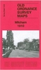
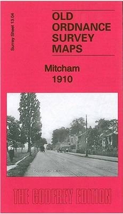
Mitcham 1910
Mitcham in 1910 in a fascinating series of reproductions of old Ordnance Survey plans in the Alan Godfrey Editions, ideal for anyone interested in the history of their neighbourhood or family. Selected towns in Great Britain and Ireland are covered by maps showing the extent of urban development in the last decades of the 19th and early 20th century.In this title: the map covers Lower Mitcham and the southern half of Upper Mitcham. Coverage stretches from the Upper Green and Eastfields southward to Mitcham Junction station (which straddles the southern margin). Features include railways with Mitcham station, St Mark's church, Upper Green, Mitcham House, tramways, Mitcham Hall, Imperial Works, River Wandle, Crown Mill, Wandle Grove, watercress beds, St Peter & St Paul's church,
Cricket Green, Blue Houses etc. On the reverse is a list of private residents from a 1903 directory.About the Alan Godfrey Editions of the 25
Cricket Green, Blue Houses etc. On the reverse is a list of private residents from a 1903 directory.About the Alan Godfrey Editions of the 25
Product Description
Reviews/Comments
Add New
Intelligent Comparison
Archived Product
Mitcham 1910 Stanfords
£3.50
Vouchers
No voucher codes found.
Do you know a voucher code for this product or supplier? Add it to Insights for others to use.
Do you know a voucher code for this product or supplier? Add it to Insights for others to use.
 Denmark