
 United Kingdom
 France
 Germany
 Netherlands
 Sweden
 USA
USA
 Italy
Italy
 Spain
Spain
More From Contributor


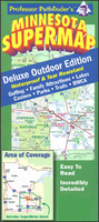
Minnesota SuperMap
Minnesota on an indexed road map at 1:770, 000 approx. from the Minneapolis-based Hedberg Maps, printed on light, waterproof and tear-resistant synthetic paper. Enlargements show selected locations in greater detail and the map includes extensive additional tourist information. On one side is a road map of the state, with colouring prominently highlighting various state or national parks and other protected areas, as well as Native Americans Reservations. Road network indicates limited access highways, border crossings to Canada, etc. Symbols mark various places of interest. The index is next to the map.On the reverse are panels showing in greater detail: the Twin Cities (Minneapolis and St Paul) SuperMetro area, the central Twin Cities Metro map, plus more detailed city maps of
Fargo, ND – Moorhead, Duluth – Superior WI, St Cloud, and Rochester. Additional tourist information includes lists of golf courses and winter sport locations with contact details, lists of fishing lakes, parks and protected areas, hiking trails (also shown on a small map) and casinos, plus a distance table.
Fargo, ND – Moorhead, Duluth – Superior WI, St Cloud, and Rochester. Additional tourist information includes lists of golf courses and winter sport locations with contact details, lists of fishing lakes, parks and protected areas, hiking trails (also shown on a small map) and casinos, plus a distance table.

Product Description
Reviews/Comments
Add New
Vouchers
No voucher codes found.
Do you know a voucher code for this product or supplier? Add it to Insights for others to use.
Do you know a voucher code for this product or supplier? Add it to Insights for others to use.
 Denmark