More From Contributor

£9.99
There`s nothing that can`t be built in Minecraft, but with so many possibilities, where do you start? & how will you ever match the creative flair of the experts? The updated Minecraft Construction Handbook is packed with tips & step-by-step instructions from master building team Fyre UK. You`ll learn how to construct houses, bridges, ships, floating islands & rollercoasters that will amaze other players. Plus, check out some of the most awe-inspiring community builds to fuel your own creative genius. You`ll be a master builder in no time! ...
Archived Product
£9.99
Here`s everything you need to know to get connected to the electrifying possibilities of redstone. From basic mining & logic circuits to more advanced mechanics, the updated Redstone Handbook will give you step by step instructions to get you fully wired to redstone. With builds including redstone traps & arrow firers you never need fear creepers again! &, see some of the most amazing community creations from the very best redstone builders
- they`ll blow your mind!
...
Archived Product
£7.99
In Minecraft, you`re never alone & the threat of attack is constant. How can you survive? The Official Combat Handbook will teach you everything you need to know to defend yourself from hostile monsters & enemy players. You can learn how to build a fort, craft armour & weapons, set mob traps, defeat your enemies in one-to-one combat, & battle your way out of the Nether & the End. With tips from many Minecraft experts, you`ll be a formidable Minecraft warrior in no time! ...
Archived Product
£7.99
There`s nothing that can`t be built in Minecraft, but with so many possibilities, where do you start? & how will you ever match the creative style of the experts? The official Minecraft Construction Handbook is packed with tips & step-by-step instructions from master build team Fyre UK. You`ll learn how to construct houses, bridges, ships, floating islands & rollercoasters of the highest quality. Plus, check out some of the most awe-inspiring community builds to fuel your own creative genius. You`ll be a master builder in no time! ...
Archived Product
£2.99
Minehead
- Dunster
- Selworthy area of the western coast of Somerset on a very detailed, GPS compatible hiking, cycling &

...
Archived Product
£9.99
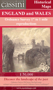
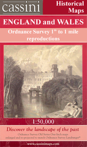
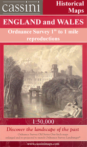
Map No. 181, Minehead & Brendon Hills 1809, in the Cassini Historical Series of old Ordnance Survey mapping of England & Wales at 1:50, 000 in a format designed to offer a convenient comparison with the present day coverage from the OS, & most locations in three different editions. Old historical maps have been combined so that the sheet lines correspond to the current Landranger series & reproduced with the scale changed from one inch to one mile to 1:50, 000. Most locations are covered by three separate maps, showing how the area has changed over the decades, with selected major cities also presented in a fourth edition. * Old Series: the first detailed survey mapping dating for most areas from the first half of the 19th century, in black & white & with relief shown by hachuring.* Revised New Series from 1880s/1900s, with some colouring & a mixture of hachuring & contour lines.* Popular Edition from the inter-war years, with contour lines & colouring to indicate woodlands, parks, etc.* New Popular Edition from the late 1940s, reproduced in the Cassini series for the major cities. Each map

Includes::
notes on the development of Ordnance Survey & the various series produced by them. For those interested in maps & cartography in general, the Cassini series also provides a fascinating insight into how Ordnance Survey cartographic style has developed over a period of over 100 years. Coverage in this title

Includes::
present day Tiverton, Wellington, Watchet, Dulverton, Oare, Culbone, Porlock, Luccombe, Dunster, Williton, Kilve, Nether Stowey, Monksilver, Roadwater, Withycombe, Wheddon, Timberscombe, Exford, Withypool, Winsford, Exton, Hawkridge, Moll&, Upton, Wiveliscombe, Combe Florey, Halse, Norton Fitzwarren, Chipstable, Petton, Bampton, Ashbrittle, Exebridge, Knowstone, Oakford, Rackenford, Witheridge, Washfield, Cove, Huntsham, Westleigh, Uffculme & Culmstock, with the eastern part of the Exmoor National Park including Dunkery Hill & Wimbleball Lake, plus Quantock Hills, Blackdown Hills, Clatworthy Reservoir & the Exe Valley.* PLEASE NOTE: Stanfords can also print on request mapping from all four series *centring the map on a location of your choice.* For more information please click on the link below.


...
Archived Product
£14.99
Map No. 181, Minehead & Brendon Hills 1919, in the Cassini Historical Series of old Ordnance Survey mapping of England & Wales at 1:50, 000 in a format designed to offer a convenient comparison with the present day coverage from the OS, & most locations in three different editions. Old historical maps have been combined so that the sheet lines correspond to the current Landranger series & reproduced with the scale changed from one inch to one mile to 1:50, 000. Most locations are covered by three separate maps, showing how the area has changed over the decades, with selected major cities also presented in a fourth edition. Old Series: the first detailed survey mapping dating for most areas from the first half of the 19th century, in black & white & with relief shown by hachuring. Revised New Series from 1880s/1900s, with some colouring & a mixture of hachuring & contour lines. Popular Edition from the inter-war years, with contour lines & colouring to indicate woodlands, parks, etc. New Popular Edition from the late 1940s, reproduced in the Cassini series for the major cities. Each map

Includes::
notes on the development of Ordnance Survey & the various series produced by them. For those interested in maps & cartography in general, the Cassini series also provides a fascinating insight into how Ordnance Survey cartographic style has developed over a period of over 100 years. Coverage in this title

Includes::
present day Tiverton, Wellington, Watchet, Dulverton, Oare, Culbone, Porlock, Luccombe, Dunster, Williton, Kilve, Nether Stowey, Monksilver, Roadwater, Withycombe, Wheddon, Timberscombe, Exford, Withypool, Winsford, Exton, Hawkridge, Moll&, Upton, Wiveliscombe, Combe Florey, Halse, Norton Fitzwarren, Chipstable, Petton, Bampton, Ashbrittle, Exebridge, Knowstone, Oakford, Rackenford, Witheridge, Washfield, Cove, Huntsham, Westleigh, Uffculme & Culmstock, with the eastern part of the Exmoor National Park including Dunkery Hill & Wimbleball Lake, plus Quantock Hills, Blackdown Hills, Clatworthy Reservoir & the Exe Valley. PLEASE NOTE: Stanfords can also print on request mapping from all four series centring the map on a location of your choice. For more information please click on the link below.


...
Archived Product
£9.99
Map No. 181, Minehead & Brendon Hills 1898-1900, in the Cassini Historical Series of old Ordnance Survey mapping of England & Wales at 1:50, 000 in a format designed to offer a convenient comparison with the present day coverage from the OS, & most locations in three different editions. Old historical maps have been combined so that the sheet lines correspond to the current Landranger series & reproduced with the scale changed from one inch to one mile to 1:50, 000. Most locations are covered by three separate maps, showing how the area has changed over the decades, with selected major cities also presented in a fourth edition. * Old Series: the first detailed survey mapping dating for most areas from the first half of the 19th century, in black & white & with relief shown by hachuring.* Revised New Series from 1880s/1900s, with some colouring & a mixture of hachuring & contour lines.* Popular Edition from the inter-war years, with contour lines & colouring to indicate woodlands, parks, etc.* New Popular Edition from the late 1940s, reproduced in the Cassini series for the major cities. Each map

Includes::
notes on the development of Ordnance Survey & the various series produced by them. For those interested in maps & cartography in general, the Cassini series also provides a fascinating insight into how Ordnance Survey cartographic style has developed over a period of over 100 years. Coverage in this title

Includes::
present day Tiverton, Wellington, Watchet, Dulverton, Oare, Culbone, Porlock, Luccombe, Dunster, Williton, Kilve, Nether Stowey, Monksilver, Roadwater, Withycombe, Wheddon, Timberscombe, Exford, Withypool, Winsford, Exton, Hawkridge, Moll&, Upton, Wiveliscombe, Combe Florey, Halse, Norton Fitzwarren, Chipstable, Petton, Bampton, Ashbrittle, Exebridge, Knowstone, Oakford, Rackenford, Witheridge, Washfield, Cove, Huntsham, Westleigh, Uffculme & Culmstock, with the eastern part of the Exmoor National Park including Dunkery Hill & Wimbleball Lake, plus Quantock Hills, Blackdown Hills, Clatworthy Reservoir & the Exe Valley.* PLEASE NOTE: Stanfords can also print on request mapping from all four series *centring the map on a location of your choice.* For more information please click on the link below.


...
Archived Product
£9.99
Map No. 181, Minehead & Brendon Hills 1919, in the Cassini Historical Series of old Ordnance Survey mapping of England & Wales at 1:50, 000 in a format designed to offer a convenient comparison with the present day coverage from the OS, & most locations in three different editions. Old historical maps have been combined so that the sheet lines correspond to the current Landranger series & reproduced with the scale changed from one inch to one mile to 1:50, 000. Most locations are covered by three separate maps, showing how the area has changed over the decades, with selected major cities also presented in a fourth edition. * Old Series: the first detailed survey mapping dating for most areas from the first half of the 19th century, in black & white & with relief shown by hachuring.* Revised New Series from 1880s/1900s, with some colouring & a mixture of hachuring & contour lines.* Popular Edition from the inter-war years, with contour lines & colouring to indicate woodlands, parks, etc.* New Popular Edition from the late 1940s, reproduced in the Cassini series for the major cities. Each map

Includes::
notes on the development of Ordnance Survey & the various series produced by them. For those interested in maps & cartography in general, the Cassini series also provides a fascinating insight into how Ordnance Survey cartographic style has developed over a period of over 100 years. Coverage in this title

Includes::
present day Tiverton, Wellington, Watchet, Dulverton, Oare, Culbone, Porlock, Luccombe, Dunster, Williton, Kilve, Nether Stowey, Monksilver, Roadwater, Withycombe, Wheddon, Timberscombe, Exford, Withypool, Winsford, Exton, Hawkridge, Moll&, Upton, Wiveliscombe, Combe Florey, Halse, Norton Fitzwarren, Chipstable, Petton, Bampton, Ashbrittle, Exebridge, Knowstone, Oakford, Rackenford, Witheridge, Washfield, Cove, Huntsham, Westleigh, Uffculme & Culmstock, with the eastern part of the Exmoor National Park including Dunkery Hill & Wimbleball Lake, plus Quantock Hills, Blackdown Hills, Clatworthy Reservoir & the Exe Valley.* PLEASE NOTE: Stanfords can also print on request mapping from all four series *centring the map on a location of your choice.* For more information please click on the link below.


...
Archived Product
£9.09
Map No. 181, Minehead & Brendon Hills, in the waterproof & tear-resistant OS Active version of the Ordnance Survey Landranger series at 1:50, 000, including Tiverton, Wellington, Watchet, Dulverton, Oare, Culbone, Porlock, Luccombe, Dunster, Williton, Kilve, Nether Stowey, Monksilver, Roadwater, Withycombe, Wheddon, Timberscombe, Exford, Withypool, Winsford, Exton, Hawkridge, Moll&, Upton, Wiveliscombe, Combe Florey, Halse, Norton Fitzwarren, Chipstable, Petton, Bampton, Ashbrittle, Exebridge, Knowstone, Oakford, Rackenford, Witheridge, Washfield, Cove, Huntsham, Westleigh, Uffculme & Culmstock, with the eastern part of the Exmoor National Park including Dunkery Hill & Wimbleball Lake, plus Quantock Hills, Blackdown Hills, Clatworthy Reservoir, Exe Valley & the north-easternmost section of the South West Coast Path. Edition D1; Publication date April 2012 About Ordnance Survey ...
Archived Product

Minehead And Brendon Hills

Map No. 181, Minehead and Brendon Hills, in the Ordnance Survey Landranger series at 1:50, 000, including Tiverton, Wellington, Watchet, Dulverton, Oare, Culbone, Porlock, Luccombe, Dunster, Williton, Kilve, Nether Stowey, Monksilver, Roadwater, Withycombe, Wheddon, Timberscombe, Exford, Withypool, Winsford, Exton, Hawkridge, Molland, Upton, Wiveliscombe, Combe Florey, Halse, Norton Fitzwarren, Chipstable, Petton, Bampton, Ashbrittle, Exebridge, Knowstone, Oakford, Rackenford, Witheridge, Washfield, Cove, Huntsham, Westleigh, Uffculme and Culmstock, with the eastern part of the Exmoor National Park including Dunkery Hill and Wimbleball Lake, plus Quantock Hills, Blackdown Hills, Clatworthy Reservoir, Exe Valley and the north-easternmost
section of the South West Coast Path. Edition D2; Revised for selected changes 2006, 2009; Copyright date 2009 This title is also available on our website in a waterproof and tear-resistant version.Maps in this series are only published folded. Stanfords can also print flat versions of Ordnance Survey maps through the OS Select system, centring the map on a location of your choice and with a picture provided by you on the cover. For more information please click on the link at the bottom of this description.About Ordnance Survey
RIP - This product is no longer available on our network. It was last seen on 25.09.2019

This page now acts as a permanent archive for this product. Add more information using the comments box below to ensure it can still be found by future generations.

Use our search facility to see if it is available from an alternative contributor.
  • Availability: Out Of Stock
  • Supplier: Stanfords
  • SKU: 9780319231814
Availability: In Stock
£5.59

Product Description

Map No. 181, Minehead & Brendon Hills, in the Ordnance Survey Landranger series at 1:50, 000, including Tiverton, Wellington, Watchet, Dulverton, Oare, Culbone, Porlock, Luccombe, Dunster, Williton, Kilve, Nether Stowey, Monksilver, Roadwater, Withycombe, Wheddon, Timberscombe, Exford, Withypool, Winsford, Exton, Hawkridge, Moll&, Upton, Wiveliscombe, Combe Florey, Halse, Norton Fitzwarren, Chipstable, Petton, Bampton, Ashbrittle, Exebridge, Knowstone, Oakford, Rackenford, Witheridge, Washfield, Cove, Huntsham, Westleigh, Uffculme & Culmstock, with the eastern part of the Exmoor National Park including Dunkery Hill & Wimbleball Lake, plus Quantock Hills, Blackdown Hills, Clatworthy Reservoir, Exe Valley & the north-easternmost section of the South West Coast Path. Edition D2; Revised for selected changes 2006, 2009; Copyright date 2009 This title is also available on our website in a waterproof & tear-resistant version. Maps in this series are only published folded. Stanfords can also print flat versions of Ordnance Survey maps through the OS Select system, centring the map on a location of your choice & with a picture provided by you on the cover. For more information please click on the link at the bottom of this description. About Ordnance Survey

Reviews/Comments

Add New

Price History

Vouchers

No voucher codes found.
Do you know a voucher code for this product or supplier? Add it to Insights for others to use.

Facebook

Jargon Buster

Date - A day on a calendar
Date - A social activity whith a current or potential partner
Waterproof - Resistant to water, usualy specified by depth in metres
Resistant - Something that can repel against something.
Print - A mechanical process of putting text onto paper. It can also relate to a pattern on an item.

Supplier Information

Stanfords
Stanfords was established in 1853 and opened their iconic Covent Garden flagship store in 1901. They have become the top retailer of maps, travel books and accessories in the UK and arguably offer the largest selection of maps and travel books worldwide. Famous names such as Captain Robert Falcon Scott, Ranulph Fiennes and Michael Palin have purchased from Stanfords. They now have a shop in Bristol and both stores together with other venues operate a calendar of events including talks, book signings and exhibitions. As a specialist map retailer, the map selection is comprehensive and includes road maps, street maps and walking maps from worldwide destinations, as well as a selection of world atlases and wall maps. Books include travel guides and travel literature. Stanfords also stock globes, from miniatures made of blue marble to magnificent floor-standing globes. The website features a selection of interesting articles on travel topics.
Page Updated: 2023-11-12 20:15:36

Community Generated Product Tags

Oh No! The productWIKI community hasn't generated any tags for this product yet!
Menu