
 United Kingdom
 France
 Germany
 Netherlands
 Sweden
 USA
USA
 Italy
Italy
 Spain
Spain
More From Contributor

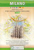


Milan
Waterproof and tear-resistant street plan of Milan at 1:15, 000 from Marco Polo Travel Publishing with an enlargement of the city centre, tram routes with line numbers, a diagram of the metro and rail network, a road map of the environs, and an index which also lists various facilities and places of interest.Coverage extends west to include San Siro, and east to the Linate airport. Metro lines and stations are clearly marked and tram routes are shown with line numbers. For drivers the plan indicates principal traffic arteries, the restricted entry zone, pedestrianized and one way streets, and selected car parks. Important buildings are highlighted and named. Street index on the reverse side includes separate lists and where appropriate contact details of various places of interest
and facilities, such as public transport offices, accommodation agencies, museums, etc.The map includes a diagram of the city
and facilities, such as public transport offices, accommodation agencies, museums, etc.The map includes a diagram of the city

Product Description
Reviews/Comments
Add New
Vouchers
No voucher codes found.
Do you know a voucher code for this product or supplier? Add it to Insights for others to use.
Do you know a voucher code for this product or supplier? Add it to Insights for others to use.
 Denmark