More From Contributor
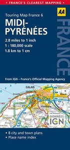
£2.95
Middleton North in 1915 in a fascinating series of reproductions of old Ordnance Survey plans in the Alan Godfrey Editions, ideal for anyone interested in the history of their neighbourhood or family. Selected towns in Great Britain & Ireland are covered by maps showing the extent of urban development in the last decades of the 19th & early 20th century. In this title: the map covers the north of Middleton, stretching from the Cricket Ground eastward to the railway & from the Old Rectory northward to Stanycliffe. Features include Middleton Cricket Ground, Rochdale Road, Rochdale Canal, railway, old Grammar School, Acres, Stanycliffe, tramway, Boarshaw Mill, Irk Vale Chemical Works, Lower Touchethall, Little Green area, Boarshaw area, etc. Part of rural Chadderton is also included around Acres. A section of the commercial directory, entries A-O, is on the reverse. About the Alan Godfrey Editions of the 25 ...
Archived Product
£3.50
Middleton North in 1915 in a fascinating series of reproductions of old Ordnance Survey plans in the Alan Godfrey Editions, ideal for anyone interested in the history of their neighbourhood or family. The map covers the north of Middleton, stretching from the Cricket Ground eastward to the railway & from the Old Rectory northward to Stanycliffe. Features include Middleton Cricket Ground, Rochdale Road, Rochdale Canal, railway, old Grammar School, Acres, Stanycliffe, tramway, Boarshaw Mill, Irk Vale Chemical Works, Lower Touchethall, Little Green area, Boarshaw area, etc. Part of rural Chadderton is also included around Acres. A section of the commercial directory, entries A to O, is on the reverse. About the Alan Godfrey Editions of the 25” OS Series: Selected towns in Great Britain & Ireland are covered by maps showing the extent of urban development in the last decades of the 19th & early 20th century. The plans have been taken from the Ordnance Survey mapping & reprinted at about 15 inches to one mile (1:4, 340). On the reverse most maps have historical notes & many also include extracts from contemporary directories. Most maps cover about one mile (1.6kms) north/south, one & a half miles (2.4kms) across; adjoining sheets can be combined to provide wider coverage.FOR MORE INFORMATION & A COMPLETE LIST OF ALL AVAILABLE TITLES PLEASE CLICK ON THE SERIES LINK. ...
Archived Product
£2.95
Middlewich in 1908 in a fascinating series of reproductions of old Ordnance Survey plans in the Alan Godfrey Editions, ideal for anyone interested in the history of their neighbourhood or family. Selected towns in Great Britain & Ireland are covered by maps showing the extent of urban development in the last decades of the 19th & early 20th century. In this title: the map covers most of the town of Middlewich, from the Shropshire Union Canal northward to Ravenscroft Bridge, & from Bankquay Farm, westward to Stanthorne Lodge. Small portions of Stanthorne & Kinderton parishes are included. Features include Trent & Mersey Canal, Shropshire Union Canal (Middlewich Branch), LNWR railway with station, Murgatroyd's Salt Works (lower right corner), Mid Cheshire Alkali Works (split by lower margin), Brooks Lane Salt Works, other salt works, Poolhead Farm, Town Hall, Milk Condensing Factory, town centre with all buildings neatly delineated, Sea Bank, Mount Pleasant, Newton Bank area, Newton Heath area, Newton Hall, Harbutt's Field (supposed site of Condate), Kinderton Hall, Stanthorne Mills, Stanthornemill Farm, Stanthorne Bridge etc. On the reverse is an 1898 directory of Middlewich. About the Alan Godfrey Editions of the 25 ...
Archived Product
£3.50
Middlewich in 1908 in a fascinating series of reproductions of old Ordnance Survey plans in the Alan Godfrey Editions, ideal for anyone interested in the history of their neighbourhood or family. The map covers most of the town of Middlewich, from the Shropshire Union Canal northward to Ravenscroft Bridge, & from Bankquay Farm, westward to Stanthorne Lodge. Small portions of Stanthorne & Kinderton parishes are included. Features include Trent & Mersey Canal, Shropshire Union Canal (Middlewich Branch), LNWR railway with station, Murgatroyd`s Salt Works (lower right corner), Mid Cheshire Alkali Works (split by lower margin), Brooks Lane Salt Works, other salt works, Poolhead Farm, Town Hall, Milk Condensing Factory, Sea Bank, Mount Pleasant, Newton Bank area, Newton Heath area, Harbutt`s Field (supposed site of Condate), Kinderton Hall, Stanthorne Mills, Stanthornemill Farm, Stanthorne Bridge, etc. On the reverse is an 1898 directory of Middlewich. About the Alan Godfrey Editions of the 25” OS Series: Selected towns in Great Britain & Ireland are covered by maps showing the extent of urban development in the last decades of the 19th & early 20th century. The plans have been taken from the Ordnance Survey mapping & reprinted at about 15 inches to one mile (1:4, 340). On the reverse most maps have historical notes & many also include extracts from contemporary directories. Most maps cover about one mile (1.6kms) north/south, one & a half miles (2.4kms) across; adjoining sheets can be combined to provide wider coverage.FOR MORE INFORMATION & A COMPLETE LIST OF ALL AVAILABLE TITLES PLEASE CLICK ON THE SERIES LINK. ...
Archived Product
£20.00
Middy Instructional
- Bar Parallel Rule 400mm Budget version of the Captain Fields` Pattern Parallel Rule. Excellent buy for use
...
Archived Product
£5.99
French region of Midi-Pyrénées, covering a wide area extending from Cahors & Rodez to the highest part of the Pyrenees, at 1:200, 000 in a series of double-sided touring maps from Michelin. The map

Includes::
a city centre street plan of Toulouse indicating principal traffic arteries, one way streets & places of interest, with selected streets named & listed in the accompanying index. Maps in the Michelin’s REGIONAL series are designed to cover a large area in each title & offer a more convenient touring alternative to the publishers’ LOCAL coverage of France at 1:150, 000. The maps present the road network in great detail, indicating width & the number of lanes, motorway services & rest areas, dangerous or restricted entry roads, steep gradients, height & weight restrictions, etc. Scenic sections are highlighted. The maps also show selected cycle paths & nature trails. Railway lines are shown with stations & local airports are marked. Satellite-derived base with colouring for the forested areas & boundaries of national or regional parks shows the topography. In the mountainous regions the maps have bold, very effective relief shading, with a large number of names of peaks, passes, & other topographic features. The maps have latitude & longitude lines at 10’ intervals & are indexed. Map legend

Includes::
English. To see the list of all the regional titles in this series please click on the series link.


...
Archived Product
£4.99
Britain`s clearest mapping from the experts at the AA, in a handy foldable road map covering the Midlands & Central Engl&. Fully updated, the map combines clear design & an easy-to-read scale of 3 miles to 1 inch, with more road detail to ensure you never lose your way while navigating Britain`s roads. The map

Includes::
information on toll points, service areas, road numbers, motorways, dual carriageways & wide & narrow local roads. National parks & places of interest are also highlighted.

...
Archived Product
£3.00
Folded cycling map of the Midlands from the National Byway Trust, forming part of their heritage cycling route of Great Britain. One side of the map has AA mapping at 1:187, 500, whilst the reverse has detailed descriptions of this section of the National Byway, including Chester to Whitchurch & Tewkesbury to Cirencester. The map shows the National Byway route & additional loop sections off of the cycleway, with small boxes describing the individual loop rides. Cartography shows motorways, A & B & minor roads, with the routes highlighted prominently. Areas of ...
Archived Product
£4.99
Midlands & Central England at 1:200, 000 in a series of nine road maps from the AA, with particularly clear presentation of the road network, including speed cameras, & places of interest shown on a plain, unobtrusive base. Street plans of main towns highlight parking facilities.AA's regional road maps are characterised by their plain white base designed to provide an unobtrusive background for the road network & the names of towns & villages. Colouring is used only to show national parks & forest parks. Rivers & lakes are included, but other topographic information is limited to names of selected mountain ranges, peaks & valleys, plus spot heights. Steep roads have gradient signs. As expected from the AA, the road network is shown with considerable attention given to different types of junctions & interchanges. Primary route destinations are highlighted & detailed information is provided on locations of speed cameras indicating speed limits. Services areas, tolls, etc., are marked & driving distance are given on A & selected B roads. Railway lines are shown with stations & ferry routes are included. The plain base also provides a clear background for a very wide range of symbols highlighting and/or naming numerous places of interest, including National Trust or English Heritage sites & their equivalents in Scotland & Wales, sport & recreational facilities, caravan & campsites, etc. The maps have the British national grid lines. The index is on the reverse & each title also

Includes::
indexed street plans of city centres, indicating main traffic arteries, one way streets & parking facilities. In this title: street plans show the city centres in Birmingham, Cheltenham, Coventry, Derby, Leicester, Milton Keynes, Nottingham & Wolverhampton. The current edition of this map was published in 2011.

...
Archived Product
£4.99
Fully updated, this map combines clear design & an easy-to-read scale with more road detail to ensure that you never lose your way. Including information on toll points, service areas, road numbers, motorways, dual carriageways & wide & narrow local roads. National Parks & places of interest are also highlighted including National Trust, English Heritage & Scottish & Welsh heritage sites. The map is presented in a practical slimline format, with a durable weatherproof cover for protection from the elements. ...
Archived Product

Midi-Pyrénées

Midi-Pyrénées region at 1:180, 000 in a series of double-sided, indexed road maps of French regions from the AA with cartography from the Insitut Géographique National (IGN). Small plans show main streets and principal routes across Parniers, Carcassonne, Toulouse, Castres and Perpignan.Cartography is identical to IGN’s own regional series at 1:250, 000, simply enlarged without additional information. Detailed mapping of regional and minor local roads is combined with very clear presentation of motorways and main national routes, showing junction numbers, locations of toll gates or fixed speed cameras, and service or rest areas. The maps indicate access restrictions, unmaintained sections of minor local roads, etc. Intermediate driving distances are marked on main and
secondary routes. The maps also show the country’s railway network with stations and local stops. Towns of particular tourist interest are highlighted and a wide range of symbols mark locations of various places of interest, including the country’s cultural heritage, notable natural sights, etc. National and regional parks are prominently marked. Topography is shown by relief shading with colouring and graphics to indicate wooded areas, marshes, salt marshes, dry or wet sand shoreline, etc. Unlike the IGN regional series, the AA maps do not show geographical coordinates. Current edition of this map was published in January 2014.PLEASE READ BEFORE ORDERING - COVERAGE BY EACH MAP: the publishers’ series grid shown on our website provides only a very approximate picture how the
various titles overlap, since it does not take into account which parts of each sheet are used for street plans and the index. For the exact area please see the coverage image provided with this title.To see the list of all the titles in this series please click on the series link.
RIP - This product is no longer available on our network. It was last seen on 25.09.2019

This page now acts as a permanent archive for this product. Add more information using the comments box below to ensure it can still be found by future generations.

Use our search facility to see if it is available from an alternative contributor.
  • Availability: Out Of Stock
  • Supplier: Stanfords
  • SKU: 9780749575502
Availability: In Stock
£5.49

Product Description

Midi-Pyrénées region at 1:180, 000 in a series of double-sided, indexed road maps of French regions from the AA with cartography from the Insitut Géographique National (IGN). Small plans show main streets & principal routes across Parniers, Carcassonne, Toulouse, Castres & Perpignan. Cartography is identical to IGN’s own regional series at 1:250, 000, simply enlarged without additional information. Detailed mapping of regional & minor local roads is combined with very clear presentation of motorways & main national routes, showing junction numbers, locations of toll gates or fixed speed cameras, & service or rest areas. The maps indicate access restrictions, unmaintained sections of minor local roads, etc. Intermediate driving distances are marked on main & secondary routes. The maps also show the country’s railway network with stations & local stops. Towns of particular tourist interest are highlighted & a wide range of symbols mark locations of various places of interest, including the country’s cultural heritage, notable natural sights, etc. National & regional parks are prominently marked. Topography is shown by relief shading with colouring & graphics to indicate wooded areas, marshes, salt marshes, dry or wet sand shoreline, etc. Unlike the IGN regional series, the AA maps do not show geographical coordinates. Current edition of this map was published in January 2014.PLEASE READ BEFORE ORDERING
- COVERAGE BY EACH MAP: the publishers’ series grid shown on our website provides only a very approximate picture how the various titles overlap, since it does not take into account which parts of each sheet are used for street plans & the index. For the exact area please see the coverage image provided with this title. To see the list of all the titles in this series please click on the series link.

Reviews/Comments

Add New

Intelligent Comparison

Oooops!
We couldn't find anything!
Perhaps this product's unique.... Or perhaps we are still looking for comparisons!
Click to bump this page and we'll hurry up.

Price History

Vouchers

No voucher codes found.
Do you know a voucher code for this product or supplier? Add it to Insights for others to use.

Facebook

Jargon Buster

Dry - A term used to describe an item with has little or no water present
Dry - A term used in wine making to describe the lack of sugar (sweetness)
Graphics - A general term for visual aspects of an item/display
MIDI - Musical Instrument Digital Interface - an industry standard to allow devices and musical instrument to interact.
speed - A measurement of how fast an object travels between two points
Natural - not manmade
Network - A link and communication between things. Often computers or people.
Small - something that takes up less space than normal.
Road - a manmade lane or a path that is used to speed up travel.
Wide - Something with a large width.
Junction - A point where two or more things come together, typically used to describe roads
Regional - An adjective to describe a set geographic area.
Toulouse - A city on the south of France.

Supplier Information

Stanfords
Stanfords was established in 1853 and opened their iconic Covent Garden flagship store in 1901. They have become the top retailer of maps, travel books and accessories in the UK and arguably offer the largest selection of maps and travel books worldwide. Famous names such as Captain Robert Falcon Scott, Ranulph Fiennes and Michael Palin have purchased from Stanfords. They now have a shop in Bristol and both stores together with other venues operate a calendar of events including talks, book signings and exhibitions. As a specialist map retailer, the map selection is comprehensive and includes road maps, street maps and walking maps from worldwide destinations, as well as a selection of world atlases and wall maps. Books include travel guides and travel literature. Stanfords also stock globes, from miniatures made of blue marble to magnificent floor-standing globes. The website features a selection of interesting articles on travel topics.
Page Updated: 2023-11-12 20:15:36

Community Generated Product Tags

Oh No! The productWIKI community hasn't generated any tags for this product yet!
Menu