More From Contributor
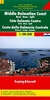
£9.50
Topographical survey of Belgium at 1:20, 000 from Nationaal Geografisch Instituut / Institut Géographique National, the country’s national survey organization. Each 20K map covers one quarter of the corresponding 1:50, 000 map (with adjustments in the border & coastal areas). The maps provide all the information expected of topographic mapping at this scale & in addition have an unusually large amount of vegetation and/or land use information (different types of woodlands, gardens, orchards, heath, etc). The maps have a 1-km UTM grid, with margin ticks for latitude & longitude at intervals of 1`. Map legend & a glossary of terms used on the maps include English. Stanfords keeps as regular stock 20K maps for the World War I battlefields around the Ypres, Messines & Passchendaele, & for the area of the Battle of Waterloo. The 1:20, 000 survey covers the whole of Belgium & maps for other regions can be supplied as special orders. To see the list of titles in this series please click on the series link.PLEASE NOTE: the Long-Distance Footpaths Map of Belgium at 1:300, 000 which shows the division of Belgium into the 50K survey sheets can also be used to see in more detail coverage by the 20K maps. ...
Archived Product
£9.99
Black Forest Middle – Strasbourg on a waterproof, tear-resistant, GPS compatible cycling map at 1:75, 000 from the ADFC (Allgemeiner Deutscher Fahrrad-Club
- the official German cycling federation), in a series of maps with extensive overprint for long-distance & local cycling routes. GPS waypoints, route profiles, details of online links for information about accommodation etc. are also provided. Maps included in this series are contoured & the interval varies according to the type of the terrain. Steep sections are annotated with gradient markings. Colouring and/or graphics show various types of landscape: woods, vineyards, etc. An overprint highlights both the national long-distance cycling routes & the shorter local cycling trails, each clearly identified by a symbol and/or an abbreviation of its name. Sections with heavy traffic and/or poor road surface are clearly marked. Symbols indicate various facilities, such as railway stations with cycle hire, cycle repair shops, campsites, youth hostels, shelters, country restaurants/bars, sport & leisure facilities. Maps have a UTM grid for measuring distances & for determining location using GPS device & they are printed on weather resistant & tear-resistant paper. Each map covers an area of Approx. 87 x 130 km & the map legend is in German only. To see all the titles in this series please click on the series link.
...
Archived Product
£9.99
This is a collection of real-life inconveniences faced by the iPhone-losing, polenta-burning, Eurostar-missing middle classes. While 870 million people in the world suffer from starvation, it`s worth sparing a thought for the beleaguered & misunderstood middle classes who face similarly harrowing issues every day. ` My horse just ate my favourite boots`, ` Feel like I`ve forgotten how to ski`, ` Put too much balsamic vinegar on my salad & now I`m dying`... From overcooking the quinoa to downloading the wrong book to the wrong kindle, things can get pretty rough in the recently renovated homes of our harangued elite. Fortunately, they can now turn to Twitter in their distress, finding a haven & a natural outlet in @ Middle Class Prob, where Benjamin Lee has been collecting our most hilarious cris de coeur since 2010. ...
Archived Product
£10.99
The Dalmatian Coast of Croatia from Split southwards to Gradec on a detailed map at 1:100, 000 from Freytag & Berndt with large icons indicating various facilities including campsites & beaches, ferry connections, etc. Coverage

Includes::
the islands of Brac, Hvar, Vis, Korcula & Lastovo, plus the northern part of the Peljesac peninsula. The map shows local roads & indicates ferry connections. Icons mark various facilities such as campsites, beaches & marinas, as well as places of interest. The map has latitude & longitude lines but without providing the coordinates. Map legend

Includes::
English. Street plans show Split, Hvar, Korcula & Makarska. On the reverse there is a guide to the area, in English, with plans of local marinas, etc. Please note: this title is not a nautical chart for sailing.


...
Archived Product
£10.99
The southernmost part of the Dalmatian Coast of Croatia including Dubrovnik on a detailed map at 1:100, 000 from Freytag & Berndt with large icons indicating various facilities including campsites & beaches, ferry connections, etc. Coverage

Includes::
the islands of Mljet & Sipan, & the southern part of the Peljesac peninsula. The map shows local roads & indicates ferry connections. Icons mark various facilities such as campsites, beaches & marinas, as well as places of interest. No geographical coordinates or an index of place names are provided. Map legend

Includes::
English.A large inset shows a street plan of Dubrovnik with Lapad, with an enlargement for Dubrovnik’s Old Town. On the reverse there is a guide to the area, in English, with a plan of Dubrovnik’s marina. Please note: this title is not a nautical chart for sailing.


...
Archived Product
£5.99
Middle East at 1:4, 000, 000 on a large map from Insight Guides, with coverage extending from the whole of Turkey & the Nile Valley to Almaty & north-western India with Delhi. Extensive index is placed next to the map. Topography is shown by bold relief shading with plenty of names of geographical features & country borders are clearly marked. All place names are in Latin alphabet only. The map presents the region ...
Archived Product
£15.19
Middle East in the Countries & Regions series from Lonely Planet, market-leading comprehensive guides aimed at independent travellers & serving a large range of international destinations. Frank & informal in style, the guides explore an extensive range of sights, activities, accommodation, restaurants & nightlife & are designed for practical use while travelling on the road. Written & researched by a team of experts, each book is independent in its recommendations & suggestions, often offering individual takes on individual destinations. Widely recognised for their reliability, each Lonely Planet country & region guide has the same layout. Introductory sections profile the destination with individual chapters on particular highlights, getting started, (including when to go) itineraries, history, culture, arts, food & drink & the environment. Each guide is organised geographically by region, with individual sections detailing an extensive range of sights, places of interest, attractions, restaurants, nightlife, accommodation & any local activities. The guides have detailed explanations of historical context where relevant. There is also practical guidance on ...
Archived Product
£19.99
Middle East in the Countries & Regions series from Lonely Planet, market-leading comprehensive guides aimed at independent travellers & serving a large range of international destinations. Frank & informal in style, the guides explore an extensive range of sights, activities, accommodation, restaurants & nightlife & are designed for practical use while travelling on the road. Written & researched by a team of experts, each book is independent in its recommendations & suggestions, often offering individual takes on individual destinations. Widely recognised for their reliability, each Lonely Planet country & region guide has the same layout. Introductory sections profile the destination with individual chapters on particular highlights, getting started, (including when to go) itineraries, history, culture, arts, food & drink & the environment. Each guide is organised geographically by region, with individual sections detailing an extensive range of sights, places of interest, attractions, restaurants, nightlife, accommodation & any local activities. The guides have detailed explanations of historical context where relevant. There is also practical guidance on ...
Archived Product
£4.99
The highly successful Globetrotter Travel Series, which

Includes::
Travel Guides, Travel Maps, Road Atlases,

...
Archived Product
£9.99
The Middle East is notoriously complex & difficult. This compact book on the topic by the University of Oxford`s leading expert does not shirk the challenge. Organised thematically, & dealing with all the pivotal issues in the region, from oil & religion, to gender & conflict, this comprehensive primer is both easy-to-read & full of insight. Stuffed with historical background, real-life examples, profiles of key figures from Nasser to Gadaffi, & even popular jokes from the area, ” The Middle East: A Beginner`s Guide” will captivate tourists, students, & the interested general reader alike. ...
Archived Product

Middle East

Political road map of the Middle East from Cartographia at 1:4, 000, 000, providing an overview of countries with coverage extending east to include the whole of Pakistan and Afghanistan. Major road networks are shown (including desert highways), as are railway lines, local airports and shipping routes. International boundaries are indicated, likewise disputed boundaries and ceasefire lines; federal boundaries are marked where necessary. All place names are given in Latin alphabet only; names of countries or major cities are usually transliterated according to local use, e.g. Misr and Al Qahira or Al Iskandariyah, with internationally recognized names provided as necessary. Oil pipelines, antique sites, wadis, salt lakes and salt marshes are clearly marked. Longitude and latitude
lines are drawn at 5
RIP - This product is no longer available on our network. It was last seen on 25.09.2019

This page now acts as a permanent archive for this product. Add more information using the comments box below to ensure it can still be found by future generations.

Use our search facility to see if it is available from an alternative contributor.
  • External links may include paid for promotion
  • Availability: Out Of Stock
  • Supplier: Stanfords
  • SKU: 9789633529768
Availability: In Stock
£8.50

Product Description

Political road map of the Middle East from Cartographia at 1:4, 000, 000, providing an overview of countries with coverage extending east to include the whole of Pakistan & Afghanistan. Major road networks are shown (including desert highways), as are railway lines, local airports & shipping routes. International boundaries are indicated, likewise disputed boundaries & ceasefire lines; federal boundaries are marked where necessary. All place names are given in Latin alphabet only; names of countries or major cities are usually transliterated according to local use, e.g. Misr & Al Qahira or Al Iskandariyah, with internationally recognized names provided as necessary. Oil pipelines, antique sites, wadis, salt lakes & salt marshes are clearly marked. Longitude & latitude lines are drawn at 5

Reviews/Comments

Add New

Price History

Vouchers

No voucher codes found.
Do you know a voucher code for this product or supplier? Add it to Insights for others to use.

Facebook

Jargon Buster

Oil - A hydrophobic liquid with high carbon and hydrogen content. Has many variations including; cooking oils, petrochemical oils, essential oils.
antique - An old collectible item with desirable qualities.
Road - a manmade lane or a path that is used to speed up travel.

Supplier Information

Stanfords
Stanfords was established in 1853 and opened their iconic Covent Garden flagship store in 1901. They have become the top retailer of maps, travel books and accessories in the UK and arguably offer the largest selection of maps and travel books worldwide. Famous names such as Captain Robert Falcon Scott, Ranulph Fiennes and Michael Palin have purchased from Stanfords. They now have a shop in Bristol and both stores together with other venues operate a calendar of events including talks, book signings and exhibitions. As a specialist map retailer, the map selection is comprehensive and includes road maps, street maps and walking maps from worldwide destinations, as well as a selection of world atlases and wall maps. Books include travel guides and travel literature. Stanfords also stock globes, from miniatures made of blue marble to magnificent floor-standing globes. The website features a selection of interesting articles on travel topics.
Page Updated: 2023-11-12 20:15:36

Community Generated Product Tags

Oh No! The productWIKI community hasn't generated any tags for this product yet!
Menu