More From Contributor

£19.99
Middle East in the Countries & Regions series from Lonely Planet, market-leading comprehensive guides aimed at independent travellers & serving a large range of international destinations. Frank & informal in style, the guides explore an extensive range of sights, activities, accommodation, restaurants & nightlife & are designed for practical use while travelling on the road. Written & researched by a team of experts, each book is independent in its recommendations & suggestions, often offering individual takes on individual destinations. Widely recognised for their reliability, each Lonely Planet country & region guide has the same layout. Introductory sections profile the destination with individual chapters on particular highlights, getting started, (including when to go) itineraries, history, culture, arts, food & drink & the environment. Each guide is organised geographically by region, with individual sections detailing an extensive range of sights, places of interest, attractions, restaurants, nightlife, accommodation & any local activities. The guides have detailed explanations of historical context where relevant. There is also practical guidance on ...
Archived Product
£4.99
The highly successful Globetrotter Travel Series, which

Includes::
Travel Guides, Travel Maps, Road Atlases,

...
Archived Product
£9.99
The Middle East is notoriously complex & difficult. This compact book on the topic by the University of Oxford`s leading expert does not shirk the challenge. Organised thematically, & dealing with all the pivotal issues in the region, from oil & religion, to gender & conflict, this comprehensive primer is both easy-to-read & full of insight. Stuffed with historical background, real-life examples, profiles of key figures from Nasser to Gadaffi, & even popular jokes from the area, ” The Middle East: A Beginner`s Guide” will captivate tourists, students, & the interested general reader alike. ...
Archived Product
£12.99
All Arto der Haroutunian`s twelve cookbooks written in the 1980s became classics; it was his belief that the rich culinary tradition of the Middle East is the main source of many of our Western cuisines & his books were intended as an introduction to that tradition. His ” Middle Eastern Cookery” is regarded as the seminal work on the subject but it had been out of print for twenty years with second hand copies on offer for over four hundred pounds, such was its scarcity & popularity. At last here in a new redesigned paperback edition is ” The Middle Eastern Cookbook” that everyone wants. It is a book containing every possible recipe from the Middle East
- there are dishes from the plains of Georgia, from Afganistan, Egypt, Syria, Lebanon, Israel, Persia & Armenia. It is written in the same wonderful style as his other classic cookbooks; peppered with anecdotes on life, food & culture. He guides us first round the mezze table & then leads us on to recipes for soups, salads, savouries, pilaffs, kebabs, casseroles & grills that make the best use of meat, fish & poultry. He teaches the cook about the different spices that are favoured by different countries
- mint for Armenia, cumin for Iran & with each recipe comes a piece of history or a fable which makes this a book to read as well as an unequalled collection of recipes.

...
Archived Product
£10.99
Middle East at 1:2, 000, 000 from Freytag & Berndt, with a separate index booklet also providing street plans of central districts of Amman, Cairo, Damascus, Nicosia & Tehran. City names are in their local versions, with English equivalents shows where necessary (Dimashs/ Damascus, Bur Said/ Port Said, Halab/ Aleppo, Al Mawsul/ Mosul, etc.). Topography is shown by relief shading with additional colouring/graphics for salt flats, rock or sand deserts, etc. National boundaries are prominently marked & within most countries internal administrative borders are also shown (without names of the provinces). Road network

Includes::
selected local & desert tracks, Driving distances are shown on main routes & border crossings are clearly marked. The map also shows principal railway lines, ferry routes & local airports. Also marked are oil fields & pipelines. Latitude & longitude lines are drawn at 1° intervals. The index, in a separate booklet attached to the map cover, lists all locations by country. Map legend

Includes::
English. The booklet also provides street plans of central districts of Amman, Cairo, Damascus, Nicosia & Tehran.


...
Archived Product
£13.99
Mapping by ITMB of Middle East countries presented in a handy size, A5 paperback atlas, with each country accompanied by one or more pages with street plans. The country maps have altitude colouring & spot heights (both given in feet) to show the topography. Additional graphics indicate deserts, swamps, salt pans, etc. Road network

Includes::
selected local/desert tracks, gives distances on most main routes, & indicates locations of border crossings. Symbols indicate various places of interest. In most countries the maps show internal administrative boundaries with names of the provinces. Latitude & longitude lines are drawn on the maps. All place names are given in the Latin alphabet only. One combined index covers all the countries. Accompanying street plans highlight various places of interest & facilities, including selected accommodation. The atlas covers:- Bahrain at 1:145, 000 with a street plan of central Manama- Iraq at 1:1, 500, 000 with a street plan of central Bagdad, an enlargement of the city’s environs, plus a small map of the showing ancient cities of Mesopotamia- Israel at 1:280, 000 with a street plan of central Jerusalem- Jordan at 1:760, 000 with a street plan of central Amman- Kuwait at 1:390, 000 with a street plan of central Kuwait City- Lebanon at 1:190, 000 with a street plan of central Beirut- Qatar at 1:375, 000 with a street plan of central Doha- Saudi Arabia at 1:2, 200, 000 with a street plan of central Riyadh- Syria at 1:925, 000 with a street plan of central Damascus- United Arab Emirates & Oman at 1:1, 750, 000 with street plans of central Dubai, Muscat & Salalah- Yemen at 1:1, 875, 000 with street plans of central Sana’a & of Taizz

...
Archived Product
£16.99
Middle East wall map, 77 x 60cm (2ft 6” x 2ft approx) – encapsulated version, presenting the region at 1:6, 087, 000 in the NGS classic style on a light base with country boundaries outlined in contrasting colours. Coverage extends from the Nile Valley in Egypt & Sudan to Pakistan & Tajikistan. Topography of the region is shown by relief shading, with additional colouring/graphics indicating deserts, swamps, salt flats, glaciers, etc. The map provides plenty of names of geographic features such a mountain ranges, deserts, peaks, etc. Heights are given in metres. All place names are shown transliterated into Latin alphabet, with alternative spellings provided where appropriate (Kabul/ Kabol, Makkah/ Mecca etc). The map shows the network of main road & railway connections, local airports, as well as oil fields & pipelines. Latitude & longitude lines are drawn at 4° intervals. Also provided is a glossary of geographical term & abbreviations used on the map.* This map is also available on paper without the encapsulation.*LAMINATED & ENCAPSULATED WALL MAPS:*- *laminated* wall maps have a thin layer of plastic usually applied to the printed side only. They can be written on with suitable marker pens without any damage to the map but, unless laminated on both sides, they are not damp-proof.- *encapsulated* wall maps are sealed between two sheets of plastic. They are more rigid & heavier than laminated maps of the same size. They are damp-proof & do not crinkle in humid conditions. Encapsulation gives the map a shiny surface, similar to being displayed behind glass.- *please note:* many publishers & retailers often use these two terms interchangeably. Our map titles & descriptions follow the definitions provided above. ...
Archived Product
£12.99
Middle East wall map, 77 x 60cm (2ft 6” x 2ft approx) – paper version, presenting the region at 1:6, 087, 000 in the NGS classic style on a light base with country boundaries outlined in contrasting colours. Coverage extends from the Nile Valley in Egypt & Sudan to Pakistan & Tajikistan. Topography of the region is shown by relief shading, with additional colouring/graphics indicating deserts, swamps, salt flats, glaciers, etc. The map provides plenty of names of geographic features such a mountain ranges, deserts, peaks, etc. Heights are given in metres. All place names are shown transliterated into Latin alphabet, with alternative spellings provided where appropriate (Kabul/ Kabol, Makkah/ Mecca etc). The map shows the network of main road & railway connections, local airports, as well as oil fields & pipelines. Latitude & longitude lines are drawn at 4° intervals. Also provided is a glossary of geographical term & abbreviations used on the map.* This map is also available encapsulated. ...
Archived Product
£4.79
The Lonely Planet Middle East Phrasebook is not only an extensive list of useful phrases, but also an ideal tool to start getting to grips with a language & beginning two-way communication. Containing excellent sections on language basics such as numbers, question phrases, dates, phrase construction, grammar & pronunciation, as well as containing concise but well-rounded two-way dictionaries, Lonely Planet phrasebooks enable you to quickly & confidently construct your own phrases in addition to those given. The given phrases cover all the essential travel & tourism categories such as transport, communications, business meetings & accommodation, as well as in-depth categories such as health, food & social interaction. The phrasebooks are designed to enable more than just simple question-answer communication, allowing the start of two-way conversations
- putting you comfortably on your way to learning the language & understanding its speakers. True to Lonely Planet
...
Archived Product
£10.50
The northern part of the Middle East at 1:1, 200, 000 on a double-sided, indexed, waterproof & tear-resistant road map published by Reise Know-How as part of their highly acclaimed World Mapping Project. The map is double-sided to provide the best balance between a good scale & a convenient size sheet. Coverage on one side extends from Cairo & the Sinai Peninsula to include all of Israel, Lebanon & Jordan, most of Syria as well as Cyprus & the south-western coastline of Turkey. On the reverse is the easternmost part of Syria plus Iraq & Kuwait. Place names are in Latin alphabet, with names of larger towns are given in Arabic. Roads (from motorways to selected seasonal tracks) & railways are easy to see on a clear base which shows the area’s topography by altitude colouring with contours, spot heights, mountain passes & names of its numerous mountain ranges, deserts, etc. National parks & protected areas highlighted. Presentation of international boundaries

Includes::
the pre-1967 borders of the West Bank & the Golan Heights as well are the current position. Border crossings are marked. Also shown are internal administrative boundaries with names of the provinces.A range of symbols highlights various places of interest, including UNESCO heritage sites, archaeological remains, beaches & diving sites, etc. The map has a latitude & longitude grid at intervals of 1° & an index of place names with a separate list of national parks. Map legend

Includes::
English.*” World Mapping Project”* is an extensive series of maps at varying scales, aiming to provide coverage of countries & regions worldwide using clear, well presented cartography with both topographic & tourist information.


...
Archived Product

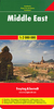
Middle East Gizi Map

Political road map of the Middle East from Gizi Maps with administrative subdivisions of the countries and large amount of topographic information. Coverage extends from Turkey and Egypt to Pakistan and parts of Central Asia. An enlargement covers Israel and the adjoining areas of the neighbouring countries at 1:2, 000, 000.All place names, are in Latin alphabet, with names of selected larger towns also shown in Arabic or Hebrew scripts. Countries are presented in pleasant pastel colours and most include boundaries and names of their administrative provinces.The map shows region’s road and rail networks as well as sea routes and includes a large amount of topographic information with plenty of names of deserts, mountain chains, water wells, coral reefs, etc. Numerous places of
interest are highlighted, including UNESCO World Heritage sites, archaeological remains and national parks. Latitude and longitude lines are drawn at intervals of 2°. Multilingual map legend includes English and Arabic. Extensive index, placed on the reverse side, lists all locations by country.
RIP - This product is no longer available on our network. It was last seen on 25.09.2019

This page now acts as a permanent archive for this product. Add more information using the comments box below to ensure it can still be found by future generations.

Use our search facility to see if it is available from an alternative contributor.
  • Availability: Out Of Stock
  • Supplier: Stanfords
  • SKU: 9789638746573
Availability: In Stock
£9.99

Product Description

Political road map of the Middle East from Gizi Maps with administrative subdivisions of the countries & large amount of topographic information. Coverage extends from Turkey & Egypt to Pakistan & parts of Central Asia. An enlargement covers Israel & the adjoining areas of the neighbouring countries at 1:2, 000, 000. All place names, are in Latin alphabet, with names of selected larger towns also shown in Arabic or Hebrew scripts. Countries are presented in pleasant pastel colours & most include boundaries & names of their administrative provinces. The map shows region’s road & rail networks as well as sea routes &

Includes::
a large amount of topographic information with plenty of names of deserts, mountain chains, water wells, coral reefs, etc. Numerous places of interest are highlighted, including UNESCO World Heritage sites, archaeological remains & national parks. Latitude & longitude lines are drawn at intervals of 2°. Multilingual map legend

Includes::
English & Arabic. Extensive index, placed on the reverse side, lists all locations by country.

Reviews/Comments

Add New

Price History

Vouchers

No voucher codes found.
Do you know a voucher code for this product or supplier? Add it to Insights for others to use.

Facebook

Jargon Buster

water - A chemical substance. Chemical formula H2O.
World - A physical grouping, commonly used to describe earth and everything associated with ti
Large - something that takes up more space than normal.
Road - a manmade lane or a path that is used to speed up travel.

Supplier Information

Stanfords
Stanfords was established in 1853 and opened their iconic Covent Garden flagship store in 1901. They have become the top retailer of maps, travel books and accessories in the UK and arguably offer the largest selection of maps and travel books worldwide. Famous names such as Captain Robert Falcon Scott, Ranulph Fiennes and Michael Palin have purchased from Stanfords. They now have a shop in Bristol and both stores together with other venues operate a calendar of events including talks, book signings and exhibitions. As a specialist map retailer, the map selection is comprehensive and includes road maps, street maps and walking maps from worldwide destinations, as well as a selection of world atlases and wall maps. Books include travel guides and travel literature. Stanfords also stock globes, from miniatures made of blue marble to magnificent floor-standing globes. The website features a selection of interesting articles on travel topics.
Page Updated: 2023-11-12 20:15:36

Community Generated Product Tags

Oh No! The productWIKI community hasn't generated any tags for this product yet!
Menu