
 United Kingdom
 France
 Germany
 Netherlands
 Sweden
 USA
USA
 Italy
Italy
 Spain
Spain
More From Contributor

Mexico Road Guide
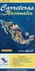
Mexico on an A4, paperback atlas from Quimera Editores with 31 street maps, ground plans of the archaeological sites at Chichen Itza, Palenque and Teotihuacan. plus bilingual tourist notes and thematic maps.The road atlas section at 1;1, 750, 000 on 28 pages, shows major highways, main roads and selected rural roads and local tracks, indicating toll roads, scenic routes, and locations of petrol stations. Main railways and car ferries are also marked. Other detail includes state boundaries, time zone lines, airports, archeological sites and UNESCO World Heritage sites, other places of interest, etc. Topography is indicated by hill shading with spot heights, and further graphics show deserts, seasonal water features, swamps, reefs, and national parks.The area around Mexico
City is presented at 1:750, 000 in greater detail, with the inclusion of symbols for motorway exits and toll booths. Plans of 31 town and city centres show main streets and places of interest. Also included are ground plans of the archaeological sites at Chichen Itza, Palenque and Teotihuacan. The atlas is indexed and has a bilingual introductory section on main places of interest, supported by maps highlighting archaeological sites, colonial towns, and national parks and protected areas.Map legend and the text include English.
City is presented at 1:750, 000 in greater detail, with the inclusion of symbols for motorway exits and toll booths. Plans of 31 town and city centres show main streets and places of interest. Also included are ground plans of the archaeological sites at Chichen Itza, Palenque and Teotihuacan. The atlas is indexed and has a bilingual introductory section on main places of interest, supported by maps highlighting archaeological sites, colonial towns, and national parks and protected areas.Map legend and the text include English.
Product Description
Reviews/Comments
Add New
Vouchers
No voucher codes found.
Do you know a voucher code for this product or supplier? Add it to Insights for others to use.
Do you know a voucher code for this product or supplier? Add it to Insights for others to use.
 Denmark