More From Contributor

£17.95
Trekking route to the Mera peaks at 1:40, 000 in the Nepa Maps series which provides extensive coverage of trekking areas of Nepal on detailed contoured maps with trekking routes & hiking trails, huts & camp sites, local places of interest & other tourist information. The map shows a section of the main Everest trek between Taksindu & Lukla, plus northwards towards Namche Bazar, with a spur leading east to the Mera peaks in the Makalu Barun National Park. Also marked is the spur to Kusumkhang Base Camp & onto the peak, plus a trek westwards to the Kongde Base Camp. Sections requiring climbing are clearly marked. Contours are at 20m intervals, with relief shading & vegetation colouring. Index lists places, peaks, passes, lakes & base camps. Margin ticks show latitude & longitude at intervals of 2'30 ...
Archived Product
£17.99
Trekking route to the Mera peaks at 1:40, 000 in the Nepa Maps series which provides extensive coverage of trekking areas of Nepal on detailed contoured maps with trekking routes & hiking trails, huts & camp sites, local places of interest & other tourist information. The map shows a section of the main Everest trek between Taksindu & Lukla, plus northwards towards Namche Bazar, with a spur leading east to the Mera peaks in the Makalu Barun National Park. Also marked is the spur to Kusumkhang Base Camp & onto the peak, plus a trek westwards to the Kongde Base Camp. Sections requiring climbing are clearly marked. Contours are at 20m intervals, with relief shading & vegetation colouring. Index lists places, peaks, passes, lakes & base camps. Margin ticks show latitude & longitude at intervals of 2`30’’. Additional information

Includes::
a route profile of the Mera Peak trek, plus tables showing the route & the Kongde trek in stages with altitudes in metres & feet & trekking times. Titles in this series have cartography is based on the country’s topographic survey, with contours usually at 40m or 50m intervals, enhanced by relief shading, colouring & graphics to show various features of the terrain, including glaciers, forested or cultivated areas, etc. Numerous peaks, with additional spot heights, plus names of glaciers & mountain ranges are prominently shown. The network of rivers, streams & lakes is shown in great detail, with many smaller rivers & lakes named. Overprint highlights main trekking routes & numerous local trails, with symbols indicating various places of interest & tourist facilities. Most maps are indexed & include additional information such as route profiles, glossaries, etc. All the information is in English & heights are given in metres.

...
Archived Product
£19.99
The new Supertrail Maps show the best singletrails in Europe’s hottest mountain bike spots. These unique topographic maps make the knowledge of locals available to other mountain bikers. Consistent difficulty rating & useful additional information prevent the user from critical situations on the trails. The best singletrails in the best mountain bike spots throughout Europe
- this is the convincing formula of the brand new Supertrail Maps. For the first time ever, these unique topographic maps make the knowledge of locals available to others. All the trails on a map have been biked & rated in five difficulty levels for up- & downhill separately by specially trained authors. This consistent rating facilitates tour planning & spares a user from getting into sketchy situations on the trails. In addition to the difficulty rating, extraordinary nice trails are marked with a «highlight»-pictogram. The maps in a scale of 1:50 000 show all information required for tour planning & orienting oneself on the trails, such as: difficulty, highlight-trails, mountain railways with mountain bike transport, mountain bike shuttles, dangerous falls, restaurants, bike shops, emergency numbers & touristic infopoints. Thanks to the especially chosen map section, one map covers the whole area. The Supertrail Maps are printed on tear- & waterproof foil which makes them very sturdy. On the back of any map, additional information about the area & the use of a Supertrail Map are presented in two languages. Folded

Dimensions of 10x 15cm allow the map to fit into any pocket without squeezing.


...
Archived Product
£7.95
Map No. 053, Merano
- with a panorama map on the reverse, from Kompass printed on waterproof & tear-resistant synthetic paper
...
Archived Product
£12.99
Merano
- Bolzano & Environs in the Dolomites at 1:35, 000 in a series of waterproof & tear-resistant, GPS compatible & contoured
...
Archived Product
£13.99
Merano & the Surrounding area on a GPS compatible hiking & recreational map at 1:50, 000 from Kompass, printed on durable, waterproof & tear-resistant synthetic paper. Coverage extends from Bolzano in the south to the Tessa / Texel Natural Park & across the border to Obergurlg in the Ã-tztaler Alps in Austria. On the reverse is a panorama map of that section of the Alps, looking north from Trento & the Adamello group to Bregenz (in the north-west), Munich, & Salzburg (in the north-east), plus several colour photos of the local fauna & flora. KOMPASS HIKING MAPS OF ITALY: This title is part of an extensive series of walking maps from Kompass covering selected areas of Italy at mainly 1:50, 000, with a GPS compatible, contoured topographic base, extensive overprint for hiking routes, various types of accommodation, numerous recreational facilities, places of interest, etc. COVERAGE: The series covers the northern part of the Italian Alps, the lake region of Lombardy, the Dolomites, Italian Riviera, selected parts of Tuscany & Umbria, the Sorrento Peninsula, & the islands of the Tyrrhenian Sea. Coverage of the Dolomites by Kompass at more detailed scales (mainly 1:25, 000) is listed on our website in a separate series.CARTOGRAPHY: Contour interval varies according to the terrain from 100m to 25m. All the maps highlight local hiking paths &, where appropriate, long-distance routes or via ferrata trails. Symbols indicate various types of accommodation such as selected inns & hotels, campsites, mountain huts & refuges, etc. Most titles also show cycle or mountain bike trails and/or ski routes. Selected titles include on the reverse panorama drawings of the area, as indicated in the individual descriptions.GPS COMPATIBILITY: Unless indicated to the contrary in the individual description, all the titles are GPS compatible, with latest editions providing a 2-km UTM grid.MAP LEGEND: Map legend

Includes::
English.DURABILITY: New editions are now published on waterproof & tear-resistant synthetic paper, as indicated in the individual description.BOOKLETS: PLEASE NOTE BEFORE ORDERING! Many titles come with a booklet describing the area and/or various hiking routes. Unless indicated in the individual description that the booklet

Includes::
English, these booklets are in Italian & German only. The booklets are not necessary to use the maps since, as stated above, full English language map legend is provided. Kompass are Europe’s largest publishers of walking maps, with extensive coverage of hiking areas in other countries, all listed on our website.


...
Archived Product
£8.95
Map No. 53, Merano & the Surrounding Area, from Kompass in a series of walking maps of selected areas of Italy at 1:50, 000, with hiking routes on a topographic base, various types of accommodation, recreational facilities, places of interest, etc. Kompass are Europe ...
Archived Product
£10.95
Merano & the Surrounding area on a GPS compatible hiking & recreational map at 1:50, 000 from Kompass, printed on durable, waterproof & tear-resistant synthetic paper. Coverage extends from Bolzano in the south to the Tessa / Texel Natural Park & across the border to Obergurlg in the ...
Archived Product
£10.99
Merano & the Surrounding Area in a series of Tabacco maps at 1:25, 000 covering the Dolomites & the mountains of north-eastern Italy
-
...
Archived Product
£11.99
Map No. 053, Merano
- with a panorama map on the reverse, from Kompass printed on waterproof & tear-resistant synthetic paper
...
Archived Product

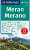
Merano And Surroundings Freytag & Berndt Map

One of the titles in Freytag & Berndt’s series of hiking maps of Dolomites. The maps have contours at 100-metre intervals. An overprint highlights footpaths, including all nine Alte Vie - the Dolomites High Level Routes, with cycling, mountain bike, and ski routes also shown on some of the titles. The maps show mountain refuges, campsites, youth hostels, etc. Geographical coordinates vary from margin ticks showing latitude and longitude in steps of 5` to a UTM grid - please see individual descriptions. Map legend includes English.This title includes: UTM grid, GPS waypoints, index, cycle and mountain bike routes, ski routes, a booklet with description of the area in German and Italian only plus a street plan of Merano.
RIP - This product is no longer available on our network. It was last seen on 25.09.2019

This page now acts as a permanent archive for this product. Add more information using the comments box below to ensure it can still be found by future generations.

Use our search facility to see if it is available from an alternative contributor.
  • Availability: Out Of Stock
  • Supplier: Stanfords
  • SKU: 9783707903478
Availability: In Stock
£9.99

Product Description

One of the titles in Freytag & Berndt’s series of hiking maps of Dolomites. The maps have contours at 100-metre intervals. An overprint highlights footpaths, including all nine Alte Vie
- the Dolomites High Level Routes, with cycling, mountain bike, & ski routes also shown on some of the titles. The maps show mountain refuges, campsites, youth hostels, etc. Geographical coordinates vary from margin ticks showing latitude & longitude in steps of 5` to a UTM grid
- please see individual descriptions. Map legend

Includes::
English. This title
Includes:: UTM grid, GPS waypoints, index, cycle & mountain bike routes, ski routes, a booklet with description of the area in German & Italian only plus a street plan of Merano.

Reviews/Comments

Add New

Intelligent Comparison

Oooops!
We couldn't find anything!
Perhaps this product's unique.... Or perhaps we are still looking for comparisons!
Click to bump this page and we'll hurry up.

Price History

Vouchers

No voucher codes found.
Do you know a voucher code for this product or supplier? Add it to Insights for others to use.

Facebook

Jargon Buster

GPS - Global Positioning System - Global position using satellites
Hiking - An outdoor activity envolving walking in nature
Italian - A word used ot descibe something from Italy
Metre - 100cm. A unit of length.
Individual - A single separate item or person.

Supplier Information

Stanfords
Stanfords was established in 1853 and opened their iconic Covent Garden flagship store in 1901. They have become the top retailer of maps, travel books and accessories in the UK and arguably offer the largest selection of maps and travel books worldwide. Famous names such as Captain Robert Falcon Scott, Ranulph Fiennes and Michael Palin have purchased from Stanfords. They now have a shop in Bristol and both stores together with other venues operate a calendar of events including talks, book signings and exhibitions. As a specialist map retailer, the map selection is comprehensive and includes road maps, street maps and walking maps from worldwide destinations, as well as a selection of world atlases and wall maps. Books include travel guides and travel literature. Stanfords also stock globes, from miniatures made of blue marble to magnificent floor-standing globes. The website features a selection of interesting articles on travel topics.
Page Updated: 2023-11-12 20:15:36

Community Generated Product Tags

Oh No! The productWIKI community hasn't generated any tags for this product yet!
Menu