
 United Kingdom
 France
 Germany
 Netherlands
 Sweden
 USA
USA
 Italy
Italy
 Spain
Spain
More From Contributor


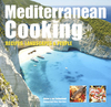


Mediterranean Cookbook
This title features fresh, fast and easy Mediterranean recipes. If you are looking to recapture an amazing meal enjoyed on a Mediterranean holiday or just to enjoy the fresh flavoursome food that the Mediterranean has to offer, The Mediterranean Cookbook is perfect for you. This cookbook celebrates the healthy recipes and fantastic tastes that characterise the wonderful diversity of Mediterranean food, such as tapas, paellas and honey and spices. Over 300 local recipes from regions like Andalucia, Tuscany, Provence and the Greek Islands mingle with Middle Eastern recipes from areas including Morocco, Eygpt and Lebanon. Fancy recreating a sultry taverna, bustling bazaar or lively tapas bar in the comfort of your own home? You can uncover lots of easy recipes from different regions,
alongside all the ingredients and step-by-step techniques you need to create healthy food from the Mediterranean. You`ll also get to delve into the cuisines of key regions, such as Provence and Tuscany, with menus showing typical family meals. The Mediterranean Cookbook is a fantastic way for the whole family to enjoy easy, healthy Mediterranean food.
alongside all the ingredients and step-by-step techniques you need to create healthy food from the Mediterranean. You`ll also get to delve into the cuisines of key regions, such as Provence and Tuscany, with menus showing typical family meals. The Mediterranean Cookbook is a fantastic way for the whole family to enjoy easy, healthy Mediterranean food.

Product Description
Reviews/Comments
Add New
Vouchers
No voucher codes found.
Do you know a voucher code for this product or supplier? Add it to Insights for others to use.
Do you know a voucher code for this product or supplier? Add it to Insights for others to use.
 Denmark