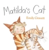
More From Contributor
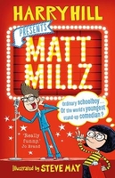
£5.99
Climbing trees, playing with wool.. . Matilda is sure her cat will love these things, but he doesn`t seem very enthusiastic. Undaunted, she thinks up new ways to amuse her reluctant playmate. Tea parties? Dressing up? Or what about a nice bike ride? As the beleagured cat goes from nonplussed to terrified, Matilda gets more & more frustrated. After all, what use is a pet if it doesn`t want to play? An insightful, fond & funny look at the relationship between a little girl & her cat, this is sure to strike a chord with anyone who`s ever been a devoted pet owner. ...
Archived Product
£11.99
Detailed topographic map of the region immediately south of Cayenne, between the Mahury & Cayenne rivers, with street plans of Balata & Matoury. The main map extends from southern outskirts of Cayenne to the town of Roura in the south, &

Includes::
the towns Matoury & Balata, & the Cayenne-Rochambeau airport. Height contours are at 5m intervals, spot heights are applied & additional graphic shading distinguishes vegetation variations eg. mangrove, plantation, flooded areas, scrub. Road detail

Includes::
minor tracks, other detail

Includes::
built-up areas, isolated buildings, churches, pylons, wrecks, electricity lines, canton boundaries, seasonal water features etc. The map is indexed & the legend is in French only. The two street plans are at 1;15, 000 & clearly show built-up areas, green spaces & notable buildings. The plans are indexed for streets & selected sites.


...
Archived Product
£13.50
Matra Mountains Atlas from the Budapest-based Cartographia with detailed, contoured & GPS compatible mapping at 1:40, 000, plus an extensive, Hungarian language guide section providing descriptions of numerous places of interest. The guide has detailed topographic maps at 1:40, 000 with contours at 10m intervals enhanced by relief shading, plus colouring & graphics for different types of vegetation & land use, e.g. vineyards, orchards, meadows, woodlands, etc. An overprint highlights local and/or long-distance hiking trails, indicating their waymarking signage. Also marked are recommended cycling routes. Local roads indicate bus routes & stops, & railway lines are shown with stations. Symbols mark various facilities & places of interests including campsites, hostels & other tourist accommodation, restaurants & cafes, etc. The maps have margin ticks with latitude & longitude at 1’ intervals. Map legend

Includes::
English. Extensive text, illustrated with colour photos, is in Hungarian only – a challenge indeed! – but a lot of useful information, including telephone numbers for tourist offices, can be deciphered with help from a pocket dictionary. To see other titles in this series please click on the series link.

...
Archived Product
£9.99
Matrei
- Deferggen
- Virgental area of the Austrian Alps presented at 1:50, 000 in a series of contoured & GPS compatible outdoor

...
Archived Product
£13.99
Matrei in Osttirol
- Kals am Großglockner (No.46) a detailed, GPS compatible map at 1:50, 000 from Kompass with local & long-distance
...
Archived Product
£8.99
Fire Support Base Matterhorn: a fortress carved out of the grey-green mountain jungle. Cold monsoon clouds wreath its mile-high summit, concealing a battery of 105-mm howitzers surrounded by deep bunkers, carefully constructed fields of fire & the 180 marines of Bravo Company. Just three kilometres from Laos & two from North Vietnam, there is no more isolated outpost of America`s increasingly desperate war in Vietnam. Second Lieutenant Waino Mellas, 21 years old & just a few days into his 13-month tour, has barely arrived at Matterhorn before Bravo Company is ordered to abandon their mountain & sent deep in-country in pursuit of a North Vietnamese Army unit of unknown size. Beyond the relative safety of the perimeter wire, Mellas will face disease, starvation, leeches, tigers & an almost invisible enemy. Beneath the endless jungle canopy, Bravo Company will confront competing ambitions, duplicitous officers & simmering racial tensions. Behind them, always, Matterhorn. The impregnable mountain fortress they built & then abandoned, without a shot, to the North Vietnamese Army - ...
Archived Product
£20.99
Matterhorn
- Mischabel area, map No. 5006, in the standard topographic survey of Switzerland at 1:50, 000 from Swisstopo, i.e.
...
Archived Product
£13.99
The Italian side of the Matterhorn & Monte Rosa, with coverage extending from Zermatt to Aosta, in a series contoured hiking maps at 1:50, 000 with local trails, long-distance footpaths, mountain accommodation, etc. from the Turin based Istituto Geografico Centrale. Maps in this series have contours at 50m intervals, enhanced by shading & graphic relief. An overprint highlights local footpaths & long-distance routes, including the GTA (Grande Traversata delle Alpi), Via Alpina, Tour Monte Rosa, & Alta Via del Monti Liguri
- the high level route along the Ligurian Alps. Difficult sections of the routes & the Via Ferrata passages are indicated. New editions now also include an overprint highlighting cycling routes, where indicated in the map’s individual description. The maps also show various types of alpine accommodation: refuges, shelters, hostels, campsites, etc. Cable car lines, chair lifts, & mountain railways are marked, as well as, for road users, entry restrictions on local tracks. Each map covers Approx. 50 x 40 km / 30 x 25 miles. The maps have no geographical coordinates. Map legend

Includes::
English. To see the other titles in this series please click on the series grid.


...
Archived Product
£12.99
Map No. 1347, Matterhorn, in the topographic survey of Switzerland at 1:25, 000 from Bundesamt für Landestopographie (swisstopo), covering the whole country on 247 small format sheets, with special larger maps published for popular regions including some titles now available in hiking versions. Highly regarded for their superb use of graphic relief & hill shading, the maps give an almost 3-D picture of Switzerland`s mountainous terrain. Contours are at 10 m intervals, with 20m intervals in the mountainous areas. All the maps have a 1-km grid for Swiss national coordinates (datum CH 1903). * Small format sheets (Nos. 1011
- 1374)* Map legend in the language of the area covered by the map. Additional margin ticks show latitude & longitude in steps of 2`. The area covered by each map is 17 x 12 km (11 x 7 miles approx). * Special larger sheets (Nos. from 2501 onwards) – STANDARD editions:* No map legend is included but a separate leaflet can be provided instead. The area covered by each map is 25 x 17 km (15 x 11 miles approx).* Special larger sheets (Nos. from 2501 onwards) – HIKING editions:* An overprint highlights hiking, mountain & alpine paths, including regional & national long-distance trails. The maps also show bus routes with bus stops, plus inns in remote locations. The area covered by each map is 25 x 17 km (15 x 11 miles approx).
...
Archived Product
£12.95
Tour of the Matterhorn is experienced walker Hilary Sharp’s Cicerone guide to the route around one of the classic peaks of the Alps. The guide covers the entire 145km route anticlockwise from Zermatt, describing the path as it crosses six valleys, taking the walker past more than 25 peaks surpassing 4000m & visiting both the Swiss region of Valais/ Wallis & the Italian Valle d’ Aosta. The peak of the Matterhorn has inspired adventurers for generations & in this book the author brings alive the magic of the tour around the mountain. The guide is organised into seven stages taking 10 days in total & offers suggestions for alternative routes & idea for shorter walks at various points throughout the tour. Each stage has an information box providing details on accessing the starting points, altitude, total distance & time, transport options, the relevant map, facilities & ‘escape routes’. There is also a gradient profile of the day’s walking. A detailed introduction gives practical advice on when to go, accommodation, language, currencies, difficulties of the trails & lifts & buses. There is also a safety section including information on glacier travel & alpine weather. Detailed route descriptions are accompanied by colour sketch diagrams mapping he route in addition to colour photographs illustrating some of the beautiful scenery of the Matterhorn. ...
Archived Product

Matt Millz

Meet Matt Millz - Britain`s Youngest (and funniest!) Comedian! Matt may be small but he is truly mighty on the comedy circuit. Well, he is in his head anyway. When the school holds a talent show, Matt has the opportunity to demonstrate that he`s got the magical chutzpah quip to take him all the way to the Apollo. With the help of his diminutive manager, Kitty Hope, and his hapless form teacher, as well as the school brute, his heartthrob and Rob his best friend, Matt learns what it takes to be really funny... A hilarious new book from National TreasureT and real-life (very) funny man Harry Hill.
RIP - This product is no longer available on our network. It was last seen on 25.09.2019

This page now acts as a permanent archive for this product. Add more information using the comments box below to ensure it can still be found by future generations.

Use our search facility to see if it is available from an alternative contributor.
  • External links may include paid for promotion
  • Availability: Out Of Stock
  • Supplier: Stanfords
  • SKU: 9780571332496
Availability: In Stock
£6.99

Product Description

Meet Matt Millz
- Britain`s Youngest (and funniest!) Comedian! Matt may be small but he is truly mighty on the comedy circuit. Well, he is in his head anyway. When the school holds a talent show, Matt has the opportunity to demonstrate that he`s got the magical chutzpah quip to take him all the way to the Apollo. With the help of his diminutive manager, Kitty Hope, & his hapless form teacher, as well as the school brute, his heartthrob & Rob his best friend, Matt learns what it takes to be really funny... A hilarious new book from National Treasure T & real-life (very) funny man Harry Hill.

Reviews/Comments

Add New

Intelligent Comparison

Oooops!
We couldn't find anything!
Perhaps this product's unique.... Or perhaps we are still looking for comparisons!
Click to bump this page and we'll hurry up.

Price History

Vouchers

No voucher codes found.
Do you know a voucher code for this product or supplier? Add it to Insights for others to use.

Facebook

Jargon Buster

Small - something that takes up less space than normal.
Matt - A non glossy colour that light wont reflect off.
Head - The upper part of a body typically separated by the neck.

Supplier Information

Stanfords
Stanfords was established in 1853 and opened their iconic Covent Garden flagship store in 1901. They have become the top retailer of maps, travel books and accessories in the UK and arguably offer the largest selection of maps and travel books worldwide. Famous names such as Captain Robert Falcon Scott, Ranulph Fiennes and Michael Palin have purchased from Stanfords. They now have a shop in Bristol and both stores together with other venues operate a calendar of events including talks, book signings and exhibitions. As a specialist map retailer, the map selection is comprehensive and includes road maps, street maps and walking maps from worldwide destinations, as well as a selection of world atlases and wall maps. Books include travel guides and travel literature. Stanfords also stock globes, from miniatures made of blue marble to magnificent floor-standing globes. The website features a selection of interesting articles on travel topics.
Page Updated: 2023-11-12 20:15:36

Community Generated Product Tags

Oh No! The productWIKI community hasn't generated any tags for this product yet!
Menu