More From Contributor
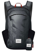
£16.99
” Vivid, detailed, colourful.. .a first-class history.. .all sorts of delights leap out of these pages”. (” Daily Telegraph”). From the very first master of the post in 1512 to the vast network of today, the Royal Mail is an intrinsic part of everyday life in Britain. This book tells its extraordinary story in full. Whether describing the sensation caused by the penny post in 1840, the Post Office boffins who helped the wartime code-breakers of Bletchley Park, the Great Train Robbery of 1963, the growth of telegrams & telephones, or the many visionaries, philanthropists & firebrands who made the service what it is today, ” Masters of the Post” shows how the history of the Royal Mail is our history. ...
Archived Product
£6.99
Masterton & Wairarapa towns in a series of maps covering various districts of New Zeal&, with each title combining a detailed road map with street plans of local towns, all with road & street indexes. The maps are published in two formats: handy Pocket Maps or Pathfinders with, as the publishers put it “ Larger print so you don’t squint”. The road maps, typically around 1:175, 000
- 1:275, 000, show local roads & 4WD tracks. Main sightseeing routes across the country, such as the Pacific Road Highway or Thermal Explorer Highway, are identified by small icons. Railways, local airports & where appropriate, ferry routes are shown. The maps also include selected local hiking tracks. A range of symbols highlight various places of interest & sport or recreational facilities. Topography is indicated by names of mountain ranges & selected peaks. Colouring shows forested areas, with national parks & reserves highlighted. The maps have no geographical coordinates but each one has an index listing names of local roads. Each title also

Includes::
numerous street plans of the main centres of population in the area covered by the road map. The plans are usually at 1:25, 000 to 1:35, 000, & for larger towns an enlargement of the town centre is also provided. The plans shows one way streets, public buildings & various facilities, including sport & recreational centres &, almost invariably, public toilets. Each plan has a separate street index.* In this title:* street plan of Masterton, with an enlargement for the town centre, plus Dannevirke, Martinborough, Carterton, Featherston, Pahiatua, Greytown, Woodville, Ormondville, Norsewood, Pongaroa, Eketahuna & Riversdale Beach, all at 1:30, 000. The road map is at 1:275, 000.


...
Archived Product
£30.00
This Code of Conduct for the Merchant Navy sets out principles aimed at ensuring high standards of discipline on board merchant ships & promotes the well-being of the seafarers working on them. The code is widely used across the shipping industry – it has been adopted by many employers of seafarers for use on ships registered in the United Kingdom & elsewhere, & it may be referred to in Seafarer Employment Agreements. Disciplinary procedures form a key element of following the code & can raise major issues, especially when a seafarer has committed a breach serious enough to warrant dismissal from the ship. The Code of Conduct has recently undergone a comprehensive revision to ensure that it remained up-to-date & relevant, which in turn led the UK Chamber of Shipping to review & revise its Guide. The recommendations set out are not designed to be definitive but give advice on good practice on how investigations & hearings should be conducted on board. ...
Archived Product
£25.00
This book was inspired by a centenary marking the first aerial photographs of an archaeological monument in Britain. Those photographs are inevitably of Stonehenge. How a single balloon flight & the resulting photographs fit into the context of the history of aerial photography is revealed in this fascinating new book. The main emphasis is on how aerial photography came to be such an important tool for archaeologists over the last 100 years. However, the beginnings & development of aerial photography within military & civilian contexts are explored in depth, especially the contribution of pioneering aeronauts & aviators such as Samuel Cody who designed man-lifting kites & J L B Templer who was crucial to the development of military ballooning. During the First World War the true potential of aerial photography as a reconnaissance technique was realised. The Second World War saw even greater resources invested in aerial photography & the training of skilled specialist staff to interpret the millions of photographs taken from aircraft. Nevertheless, after the First World War it was realised how something that had developed within the context of warfare could serve non-military uses, including archaeology. Between the wars, aerial photography had a considerable impact on our understanding of the past, particularly once the significance & extent of cropmarks became apparent
- the airborne camera could record sites & landscapes that were often invisible from the ground. As examples of recent & current archaeological work are explored, it becomes apparent just how far we have progressed in the use of aerial photography to record & interpret past landscapes. The book

Includes::
nearly 200 colour & black & white photographs, ranging from images of early balloon exploits & intriguing photographs from the Boer War to reconnaissance views from the World Wars & modern aerial shots of archaeological sites


...
Archived Product
£52.99
Matador Day Lite 16 Packable Backpack. Lightweight & packable, built for travel. Matador Day Lite 16 uses the finest materials, hardware, & construction methods available: 30D waterproof Cordura® fabric, Duraflex® hardware, SBS® water resistant sealing zippers. Breathable shoulder straps with Cordura® reinforced gussets provide comfort & superior strength. Stretchable side pockets & front zipper pocket increase storage capacity & improve organization. Water resistant zippers & construction protect your gear from the elements. When packed into the tethered storage bag the Day Lite 16 fits in the palm of your h&. The quality & feature set of the Day Lite 16 makes it the ideal bag for world travelers & day-trippers alike. 16 Liter capacity, does not protect against submersion. ...
Archived Product
£6.95
Topographic coverage of mainland Spain at 1:50, 000 in the MTN50 (Mapa Topográfico Nacional) series from the Centro Nacional de Información Geografica, the country’s civilian survey organization. The maps have contours at 20m intervals, enhanced by relief shading, plus colouring and/or graphics to show different types of terrain, vegetation or land use. Boundaries of national parks & other protected areas are marked. In addition to all the usual information featured on topographic mapping at this scale, detailed presentation of the road & rail networks, rural tracks & paths, etc, the maps also show campsites & mountain refuges. On more recent editions some GRs, the official long-distance hiking routes, are also marked (although not as clearly as on hiking maps from other publishers). Each map covers 29.5x 18.5 km (with adjustments in the border or coastal areas). The maps have a 1-km UTM grid, plus margin ticks for latitude & longitude at 1` intervals. Map legend is in Spanish only.HOW TO CHOOSE THE RIGHT 50K MAP: all the titles in CNIG’s 200K Provincial Road Maps series at 1:200, 000 are overprinted with the grid for the 1:50, 000 maps & can be used to see the area covered by each 50K title. TO SEE THE LIST OF TITLES IN THIS SERIES PLEASE CLICK ON THE SERIES LINK.PLEASE NOTE
- MAP TITLES: the grids shown on our website serve both the civilian & the military 1:50, 000 topographic series. Although the areas covered by maps in both series are identical (apart from some border or coastal sheets), occasionally map titles differ – only one title is shown on the grid, usually the military one. In Galicia, the Basque country & in the Catalan speaking areas the tendency now is to use local place names rather than the often better known Castilian ones. Where possible, both versions are included in our titles. Map titles listed on our website are based on information received by us at the time of publication, but sometimes maps arrive showing a completely different title! As long as the map number is as ordered, the correct map has been supplied.
...
Archived Product
£6.50
Topographic coverage of mainland Spain at 1:25, 000 published by the Centro Nacional de Información Geograficá, the country’s civilian survey organization. The maps have contours at 10m intervals & colouring and/or graphics to show different types of vegetation or land use. Boundaries of national parks & other protected areas are marked. In addition to all the usual information shown on topographic maps at this scale, detailed presentation of the road & rail networks, rural tracks & paths, etc, the maps also show campsites. The maps have a 1-km UTM grid, with margin ticks for latitude & longitude at 1` intervals. Map legend is in Spanish only.PLEASE NOTE: our grid for the whole of Spain is in preparation
- in the meantime, for areas other than those shown on the attached grid please use CNIG’s topographic survey at 1:50, 000 by searching for ‘SI00000832’. Each 25K map covers one quarter of the corresponding 50K map, with the numbering system: I = NW quarter, II = NE quarter, III = SW quarter & IV = SE quarter. CNIG maps in the Provincial Road Maps series at 1:200, 000 are overprinted with the grid for the 1:50, 000 survey & can be used to see the area covered by each 50K or 25K title in more detail. To see the list of titles in this series please click on the series grid
- for map numbers not yet listed on our website please contact us by email.

...
Archived Product
£17.99
Topographic mapping from Mexico’s national survey agency, Instituto Nacional de Estadística, Geografía e Informática. The maps have contours at 20m intervals with relief shading & indicate various types of terrain & vegetation, e.g. dense vegetation, cultivated areas, swamps, sand dunes, salt pans, etc. UTM grid is at 10km intervals, with latitude & longitude shown by margin ticks at intervals of 5`. Map legend is in Spanish only. To see the other titles in this series please click on the series link. ...
Archived Product

Matador Droplet

The Droplet is compact enough to fit on a keychain and large enough to fit a whole outfit in. It also works as a dry bag, keeping water away from things thatprefer to stay dry.Use it to secure items that might leak in your luggage and organize small items.Keep a Droplet in your keychain, pack one in yourgym bag or stash one in your luggage. Droplets protect your stuff, and so much more.
RIP - This product is no longer available on our network. It was last seen on 25.09.2019

This page now acts as a permanent archive for this product. Add more information using the comments box below to ensure it can still be found by future generations.

Use our search facility to see if it is available from an alternative contributor.
  • External links may include paid for promotion
  • Availability: Out Of Stock
  • Supplier: Stanfords
  • SKU: 0867702000024
Availability: In Stock
£12.99

Product Description

The Droplet is compact enough to fit on a keychain & large enough to fit a whole outfit in. It also works as a dry bag, keeping water away from things thatprefer to stay dry. Use it to secure items that might leak in your luggage & organize small items. Keep a Droplet in your keychain, pack one in yourgym bag or stash one in your luggage. Droplets protect your stuff, & so much more.

Reviews/Comments

Add New

Intelligent Comparison

Oooops!
We couldn't find anything!
Perhaps this product's unique.... Or perhaps we are still looking for comparisons!
Click to bump this page and we'll hurry up.

Price History

Vouchers

No voucher codes found.
Do you know a voucher code for this product or supplier? Add it to Insights for others to use.

Facebook

Jargon Buster

Dry - A term used to describe an item with has little or no water present
Dry - A term used in wine making to describe the lack of sugar (sweetness)
water - A chemical substance. Chemical formula H2O.
compact - Carefuly designed to ensure an item has a minimal physical size
Large - something that takes up more space than normal.
Small - something that takes up less space than normal.
Compact - something that has a lot combined within a small space.

Supplier Information

Stanfords
Stanfords was established in 1853 and opened their iconic Covent Garden flagship store in 1901. They have become the top retailer of maps, travel books and accessories in the UK and arguably offer the largest selection of maps and travel books worldwide. Famous names such as Captain Robert Falcon Scott, Ranulph Fiennes and Michael Palin have purchased from Stanfords. They now have a shop in Bristol and both stores together with other venues operate a calendar of events including talks, book signings and exhibitions. As a specialist map retailer, the map selection is comprehensive and includes road maps, street maps and walking maps from worldwide destinations, as well as a selection of world atlases and wall maps. Books include travel guides and travel literature. Stanfords also stock globes, from miniatures made of blue marble to magnificent floor-standing globes. The website features a selection of interesting articles on travel topics.
Page Updated: 2023-11-12 20:15:36

Community Generated Product Tags

Oh No! The productWIKI community hasn't generated any tags for this product yet!
Menu