More From Contributor
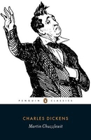
£19.99
The new Supertrail Maps show the best singletrails in Europe’s hottest mountain bike spots. These unique topographic maps make the knowledge of locals available to other mountain bikers. Consistent difficulty rating & useful additional information prevent the user from critical situations on the trails. The best singletrails in the best mountain bike spots throughout Europe
- this is the convincing formula of the brand new Supertrail Maps. For the first time ever, these unique topographic maps make the knowledge of locals available to others. All the trails on a map have been biked & rated in five difficulty levels for up- & downhill separately by specially trained authors. This consistent rating facilitates tour planning & spares a user from getting into sketchy situations on the trails. In addition to the difficulty rating, extraordinary nice trails are marked with a «highlight»-pictogram. The maps in a scale of 1:50 000 show all information required for tour planning & orienting oneself on the trails, such as: difficulty, highlight-trails, mountain railways with mountain bike transport, mountain bike shuttles, dangerous falls, restaurants, bike shops, emergency numbers & touristic infopoints. Thanks to the especially chosen map section, one map covers the whole area. The Supertrail Maps are printed on tear- & waterproof foil which makes them very sturdy. On the back of any map, additional information about the area & the use of a Supertrail Map are presented in two languages. Folded

Dimensions of 10x 15cm allow the map to fit into any pocket without squeezing.


...
Archived Product
£19.99
Martigny Mountain Bike Map, covering the Sion
- Verbier
- Orsières area, at 1:50, 000 in a series of waterproof & tear-resistant,

...
Archived Product
£12.99
Martigny, map No. 282, in the standard topographic survey of Switzerland at 1:50, 000 from Swisstopo, i.e. without the special overprint highlighting walking trails, local bus stops, etc, presented in Swisstopo’s hiking editions of the 50K survey. Coverage extends from Verbier in the east to the upper part of the Chamonix Valley in France. Highly regarded for their superb use of graphic relief & hill shading, the maps give an almost 3-D picture of Switzerland`s mountainous terrain. Contours are at 20m intervals. All the maps have a 1-km grid with the Swiss national coordinates. This standard version of the 50K survey covers the whole country on 78 small format sheets, with special larger format maps published for several popular tourist destinations. Small format sheets cover an area of 35 x 24 km (21 x 15 miles approx) & have map legend in the language of the area covered by the map. The special larger sheets cover 50 x 35 km (31 x 22 miles approx) & have no map legend, but a separate leaflet can be provided instead.PLEASE NOTE: the hiking editions of the 1:50, 000 Swisstopo survey are listed on our website in a separate series. ...
Archived Product
£18.99
Martigny area, map No. 282T, at 1:50, 000 in a special hiking edition of the country’s topographic survey, published by Swisstopo in cooperation with the Swiss Hiking Federation. Coverage extends from Verbier in the east to the upper part of the Chamonix Valley in France. Cartography, identical to the standard version of the survey, is highly regarded for its superb use of graphic relief & hill shading to provide an almost 3-D picture of Switzerland`s mountainous terrain. Contours are at 20m intervals. An overprint highlights routes maintained by the SHF, distinguishing between hiking routes, mountain routes requiring proper footwear, & alpine routes where equipment is needed. Paths which are part of the national or regional network of long-distance hiking routes are specially marked & in the more recent editions are annotated with their official numbers. The maps show mountain huts, refuges & in remote areas also inns, plus roads with bus service & the positions of bus stops. All the maps have a 1-km grid of the Swiss national coordinates. For a list of all the titles in this series, please click on the series link. ...
Archived Product
£22.99
Detailed ski map at 1:50, 000 from Swisstopo, the country’s national survey organization, showing routes for skiing and/or snowboarding, access by public transport, recommended itineraries, lists of mountain huts, etc. The series uses the cartography of Switzerland’s topographic survey, with additional colouring to show slopes steeper than 30°. An overprint highlights ski routes, indicating suggested direction, difficult passages & sections which must be covered on foot. Also marked are areas where it is forbidden to leave the routes shown on the map. The maps also highlight roads with bus routes, indicating individual bus stops, show ski lifts & funiculars, plus mark locations of refuges or other mountain accommodation. Each title has the Swiss national grid at intervals of 1km, plus latitude & longitude margin ticks at 1’. Some titles cover a larger area, with a part of an adjoining sheet printed on the reverse of the main map as indicated on our series grid. Where appropriate, ski information extends across the border to France & Italy. On the reverse are itineraries of routes recommended by the Swiss Alpine Club, indicating the degree of difficulty, plus lists of alpine huts with contact details. Map legend for the overprint

Includes::
English. The text about the routes & accommodation is in the main language of the area covered by the map. To see the list of all the titles in this series please click on the series link.

...
Archived Product
£8.99
Dan`s got a new job. But he`s moved out of town in order to start a family & had to start commuting into London every day, leaving his young wife Beth & newborn daughter at home. After fourteen months of the trains either making him late for work or late getting home, he`s had enough. Tracking down the email address of the MD of the train company, he starts to write him letters. Emails that take as long to write as the delay to his journey has been. If his time`s been wasted, why shouldn`t he waste the MD`s? & so begins an hilarious & extraordinary correspondence. When the MD begins to write back, Dan has a dysfunctional father-confessor to talk to
- one who he never imagined would care. In truth, he probably doesn`t. But Dan finds solace in opening up to a stranger about the dramas of his day job at a scandal-hit newspaper, the challenges of his night job as the father of a baby who isn`t sleeping, & about life as it is played out for a bit over an hour (well, sometimes longer) every morning & every evening in the confines of Coach C, while world events pass its odd mix of inhabitants by.
...
Archived Product
£6.50
Topographic coverage of mainland Spain at 1:25, 000 published by the Centro Nacional de Información Geograficá, the country’s civilian survey organization. The maps have contours at 10m intervals & colouring and/or graphics to show different types of vegetation or land use. Boundaries of national parks & other protected areas are marked. In addition to all the usual information shown on topographic maps at this scale, detailed presentation of the road & rail networks, rural tracks & paths, etc, the maps also show campsites. The maps have a 1-km UTM grid, with margin ticks for latitude & longitude at 1` intervals. Map legend is in Spanish only.PLEASE NOTE: our grid for the whole of Spain is in preparation
- in the meantime, for areas other than those shown on the attached grid please use CNIG’s topographic survey at 1:50, 000 by searching for ‘SI00000832’. Each 25K map covers one quarter of the corresponding 50K map, with the numbering system: I = NW quarter, II = NE quarter, III = SW quarter & IV = SE quarter. CNIG maps in the Provincial Road Maps series at 1:200, 000 are overprinted with the grid for the 1:50, 000 survey & can be used to see the area covered by each 50K or 25K title in more detail. To see the list of titles in this series please click on the series grid
- for map numbers not yet listed on our website please contact us by email.

...
Archived Product
£9.99
Martinique & Guadeloupe with Saint-Barthélemy & Saint Martin at 1:65, 000 & 1:100, 000 respectively on a double-sided map from ITMB presenting each island with a street plan of the town centre in its capital. On one side is Martinique at 1:65, 000 a street plan of Fort-de-France at 1:10, 000. On the reverse coverage of Guadeloupe at 1:100, 000

Includes::
Marie-Galante, Les Saintes, Iles de la Terre & La Désirade, with Saint-Barthélemy & Saint Martin/ Sint Maarten shown as insets at the same scale. The street plan covers Pointe-à-Pitre. Both maps have altitude colouring & prominently highlight the islands’ national parks & other protected areas. Road network

Includes::
selected local roads & tracks. No driving distances are marked. Also indicated are principal hiking routes. A range of symbols highlight various places of interest, both on the maps & on the accompanying street plans as appropriate: selected hotels, campsites, beaches & diving/watersports sites, marinas, etc. Latitude & longitude lines are shown at 5’ intervals. Each side has a separate index. Map legends are in English & French.


...
Archived Product
£12.99
One of the three topographic maps from the Institut Géographique National in Paris covering Martinique. Cartography is similar to that used for IGN’s coverage of France at this scale, with contours at 10m intervals, relief shading, & plenty of information on the type of vegetation: woods & forests, brushwood, plantations & orchards, banana & sugar cane plantations, mangrove swamps. In addition to the usual information found on topographic survey maps, extensive overprint highlights accommodation including huts, gîtes d’étape, & campsites, various recreational & nautical facilities (horse riding, golf, tennis, water sports, etc), places of interest, etc. Local & long-distance hiking routes are also prominently marked, indicating any difficult passages. The maps have a UTM grid, plus a latitude/longitude grid at 5’ intervals. Map legend

Includes::
English. To see the list of titles in this series please click on the series link.

...
Archived Product

Martin Chuzzlewit

Charles Dickens` powerful black comedy of of hypocrisy and greed, ”Martin Chuzzlewit” is edited with an introduction and notes by Patricia Ingham in ”Penguin Classics”. The greed of his family has led wealthy old Martin Chuzzlewit to become suspicious and misanthropic, leaving his grandson and namesake to make his own way in the world. And so young Martin sets out from the Wiltshire home of his supposed champion, the scheming architect Pecksniff, to seek his fortune in America. In depicting Martin`s journey - an experience that teaches him to question his inherited self-interest and egotism - Dickens created many vividly realized figures: the brutish lout Jonas Chuzzlewit, plotting to gain the family fortune; Martin`s optimistic manservant, Mark Tapley; gentle Tom Pinch; and
the drunken and corrupt private nurse, Mrs Gamp. With its portrayal of greed, blackmail and murder, and its searing satire on America Dickens`s novel is a powerful and blackly comic story of hypocrisy and redemption. In her introduction, Patricia Ingham examines characterization, the central themes of the novel, and Dickens`s depiction of America.This edition also includes two new prefaces, Dickens`s postscript written in 1868, his working papers, a note on Mrs Gamp`s eccentric speech, a chronology, updated further reading, appendices and original illustrations by `Phiz`. Charles Dickens is one of the best-loved novelists in the English language, whose 200th anniversary was celebrated in 2012. His most famous books, including ”Oliver Twist”, ”Great Expectations”,
”A Tale of Two Cities”, ”David Copperfield” and ”The Pickwick Papers”, have been adapted for stage and screen and read by millions. If you enjoyed ”Martin Chuzzlewit”, you might like Dickens`s ”Dombey and Son”, also available in ”Penguin Classics”.
RIP - This product is no longer available on our network. It was last seen on 25.09.2019

This page now acts as a permanent archive for this product. Add more information using the comments box below to ensure it can still be found by future generations.

Use our search facility to see if it is available from an alternative contributor.
  • Availability: Out Of Stock
  • Supplier: Stanfords
  • SKU: 9780140436143
Availability: In Stock
£7.99

Product Description

Charles Dickens` powerful black comedy of of hypocrisy & greed, ” Martin Chuzzlewit” is edited with an introduction & notes by Patricia Ingham in ” Penguin Classics”. The greed of his family has led wealthy old Martin Chuzzlewit to become suspicious & misanthropic, leaving his grandson & namesake to make his own way in the world. & so young Martin sets out from the Wiltshire home of his supposed champion, the scheming architect Pecksniff, to seek his fortune in America. In depicting Martin`s journey
- an experience that teaches him to question his inherited self-interest & egotism
- Dickens created many vividly realized figures: the brutish lout Jonas Chuzzlewit, plotting to gain the family fortune; Martin`s optimistic manservant, Mark Tapley; gentle Tom Pinch; & the drunken & corrupt private nurse, Mrs Gamp. With its portrayal of greed, blackmail & murder, & its searing satire on America Dickens`s novel is a powerful & blackly comic story of hypocrisy & redemption. In her introduction, Patricia Ingham examines characterization, the central themes of the novel, & Dickens`s depiction of America. This edition also

Includes::
two new prefaces, Dickens`s postscript written in 1868, his working papers, a note on Mrs Gamp`s eccentric speech, a chronology, updated further reading, appendices & original illustrations by ` Phiz`. Charles Dickens is one of the best-loved novelists in the English language, whose 200th anniversary was celebrated in 2012. His most famous books, including ” Oliver Twist”, ” Great Expectations”, ”A Tale of Two Cities”, ” David Copperfield” & ” The Pickwick Papers”, have been adapted for stage & screen & read by millions. If you enjoyed ” Martin Chuzzlewit”, you might like Dickens`s ” Dombey & Son”, also available in ” Penguin Classics”.

Reviews/Comments

Add New

Intelligent Comparison

Oooops!
We couldn't find anything!
Perhaps this product's unique.... Or perhaps we are still looking for comparisons!
Click to bump this page and we'll hurry up.

Price History

Vouchers

No voucher codes found.
Do you know a voucher code for this product or supplier? Add it to Insights for others to use.

Facebook

Jargon Buster

LED - Light Emitting Diode - a small light source
Black - A colour which does not emit any colour of the spectrum. Black absorbs all frequencies of the spectrum.
World - A physical grouping, commonly used to describe earth and everything associated with ti
Language - the method of communication used in different areas. Humans and computers have many different languages.
LED - Light Emitting Diode. A bulb that is very efficient at producing light. Often small.
Home - A place of permanent residence for families.
Experience - To gain further knowledge by practising.
illustrations - Pictures typically in books and newspapers.
Family - A group of people that live together made up from parents and children.
Language - The way humans communicate either written and spoken.

Supplier Information

Stanfords
Stanfords was established in 1853 and opened their iconic Covent Garden flagship store in 1901. They have become the top retailer of maps, travel books and accessories in the UK and arguably offer the largest selection of maps and travel books worldwide. Famous names such as Captain Robert Falcon Scott, Ranulph Fiennes and Michael Palin have purchased from Stanfords. They now have a shop in Bristol and both stores together with other venues operate a calendar of events including talks, book signings and exhibitions. As a specialist map retailer, the map selection is comprehensive and includes road maps, street maps and walking maps from worldwide destinations, as well as a selection of world atlases and wall maps. Books include travel guides and travel literature. Stanfords also stock globes, from miniatures made of blue marble to magnificent floor-standing globes. The website features a selection of interesting articles on travel topics.
Page Updated: 2023-11-12 20:15:36

Community Generated Product Tags

Oh No! The productWIKI community hasn't generated any tags for this product yet!
Menu