
 United Kingdom
 France
 Germany
 Netherlands
 Sweden
 USA
USA
 Italy
Italy
 Spain
Spain
More From Contributor


Marlborough, Avebury And The Downs 1897 (Colour Edition)
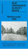
Marlborough, Avebury and the Downs in 1897 in a series of reproductions of Ordnance Survey’s famous ”Inch to the Mile” maps published in the Alan Godfrey Editions to provide a historical record of England and Wales in the second half of 19th and early 20th century.The map in printed in colour and covers the area around Avebury, stretching from Bowood House and Calne eastward to Marlborough, and from Wroughton southward to Alton Priors. A major feature of the map is the number of archaeological sites, including Avebury itself, Silbury Hill, Windmill Hill and others. Other locations include Allington, Alton Barnes, Berwick Bassett, Bishops Canning, Blackland, Bowood, Bremhill, Broad Hinton, Broad Town, Bromham, Calstone Wellington, Cherhill, Chisledon, Chittoe,
Christian Malford, Cliffe Pypard, Compton Bassett, Draycot Foliat, East Kennett, Fyfield, Heddington, Highway, Hilmarton, Huish, Lyneham, Mildenhall, North Savernake, Ogbourne St Andrew, Ogbourne St eorge, Preshute, Rowde, Seagry, Stanton St Bernard, Tockenham, Tytherington Kellaways, West Overton, Winterbourne Bassett, Winterbourne Monkton, Wootton Rivers and Yatesbury. On the reverse is a detailed map of Avebury, including most of the Stone Circle. About the Alan Godfrey Editions of the OS Inch to the Mile Maps: the maps provide an invaluable overview of a wider area, typically 18 x 12 miles (29 x 19 kms approx.), and offer historical mapping for small towns and villages not covered by the more detailed series for which the Godfrey Editions are better known. On
the reverse all the maps have historical notes and most titles also include a more detailed, large scale map of a small town or a village in the area.To see other titles in this series please click on the series link.
Product Description
Reviews/Comments
Add New
Vouchers
No voucher codes found.
Do you know a voucher code for this product or supplier? Add it to Insights for others to use.
Do you know a voucher code for this product or supplier? Add it to Insights for others to use.
 Denmark