
 United Kingdom
 France
 Germany
 Netherlands
 Sweden
 USA
USA
 Italy
Italy
 Spain
Spain
More From Contributor


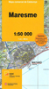

Maremma Regional Park
Maremma Regional Park on the southern coast of Tuscany on a recreational map at 1:25, 000 from Selca highlighting hiking and cycling routes, local tourist accommodation and other services, etc, plus information on vegetation and geology.The map has contours at 25m intervals, with additional relief shading. An overprint highlights waymarked hiking paths, indicating sections suitable for wheelchairs. Also marked are cycling routes. Icons indicate various tourist facilities including hotels, farms with accommodation, campsites, restaurants, picnic sites, sport and recreational facilities, petrol stations, etc. The map has no geographical coordinates. Two panels show the geological and the vegetation maps of the area. Also provided is a list of local fauna and flora with Italian
and Latin names.Map legends for the main map and the panels are in Italian only.
and Latin names.Map legends for the main map and the panels are in Italian only.
Product Description
Reviews/Comments
Add New
Vouchers
No voucher codes found.
Do you know a voucher code for this product or supplier? Add it to Insights for others to use.
Do you know a voucher code for this product or supplier? Add it to Insights for others to use.
 Denmark