
 United Kingdom
 France
 Germany
 Netherlands
 Sweden
 USA
USA
 Italy
Italy
 Spain
Spain
More From Contributor


Windhoek
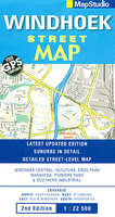
Windhoek with its outer suburbs on an indexed street plan at 1:22, 500 from South Africa’s leading map publishers Map Studio. One way streets and traffic lights are marked, with symbols indicating a range of features for the tourist and resident alike: railway lines with stations, shopping centres, various services and municipal buildings, tourist information, places of interest, etc. Neighbourhoods are clearly named and colours distinguish land use, e.g. industrial areas, parks, built-up areas, etc. The plan is indexed and has a latitude/longitude grid at intervals of 1’.An inset shows the main highways approaching the city, including access from the Hosea Kutako International Airport.

Product Description
Reviews/Comments
Add New
Vouchers
No voucher codes found.
Do you know a voucher code for this product or supplier? Add it to Insights for others to use.
Do you know a voucher code for this product or supplier? Add it to Insights for others to use.
 Denmark