
 United Kingdom
 France
 Germany
 Netherlands
 Sweden
 USA
USA
 Italy
Italy
 Spain
Spain
More From Contributor

Vienna Borch
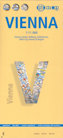
Tourist plan for visitors to Vienna: clear, indexed, laminated and waterproof, highlighting top 30 sights and providing plans of the Hofburg and Schönbrunn palaces, a map of the city’s environs, and a diagram of the rail/metro network. The main plan at 1:11, 000 covers the city from the Westbanhof to WienNeu Exhibition Centre and the Prater motorway interchange, and from the Augarten park to the Südbanhof. The plan indicates one way streets, prominently marks U and S-Bahn stations, and highlights places of interest, car parks, selected hotels, etc. An enlargement at 1:7, 000 shows the Hofburg palace and the nearby museums in greater detail. On the reverse plans at the same scale of 1:11, 000 show the imperial palace of Schönbrunn and its extensive grounds and the UNO-City.
The environs of the Vienna are presented at 1:100, 000, showing road access from the Schwechat airport and extending over to the Vienna Woods. All the plans and the road map are indexed, with list of both streets/localities and places of interest, parks, etc. The map also includes a diagram of the city’s U and S-Bahn networks, a small administrative map of Austria, and information on the city’s climate.
The environs of the Vienna are presented at 1:100, 000, showing road access from the Schwechat airport and extending over to the Vienna Woods. All the plans and the road map are indexed, with list of both streets/localities and places of interest, parks, etc. The map also includes a diagram of the city’s U and S-Bahn networks, a small administrative map of Austria, and information on the city’s climate.

Product Description
Reviews/Comments
Add New
Vouchers
No voucher codes found.
Do you know a voucher code for this product or supplier? Add it to Insights for others to use.
Do you know a voucher code for this product or supplier? Add it to Insights for others to use.
 Denmark