
 United Kingdom
 France
 Germany
 Netherlands
 Sweden
 USA
USA
 Italy
Italy
 Spain
Spain
More From Contributor


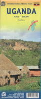
Uganda ITMB
Uganda at 1:550, 000 on an indexed, double-sided map from ITMB, with a street plan of central Kampala annotated with numerous facilities, plus notes on the country’s history, geography, national parks, etc.The map is double-sided, dividing the country north/south with a good overlap between the sided. Topography is shown by altitude colouring in feet, with spot heights also in feet except for main peaks where the height is shown either in metres or both in metres and feet. Graphics indicate wetlands and swamps. National parks are prominently highlighted.Road network distinguishes between paved and unpaved primary roads, indicates seasonal routes and shows selected tracks and trails. Locations of petrol stations and border crossings are marked. Railway lines are included, on
lakes ferry connections are shown, and local aerodromes are marked. A range of symbols indicate various places of interest including campsites, rest houses/hostels, UNESCO World Heritage sites, etc. Latitude and longitude lines are drawn at 1° intervals. Each side has a separate index.The map has a good size, clear street plan of central Kampala shwing locations of various hotels, restaurants, bus and rail terminals, and various services or facilities. Also provided are extensive notes on the country, s history, geography, sites, etc.
lakes ferry connections are shown, and local aerodromes are marked. A range of symbols indicate various places of interest including campsites, rest houses/hostels, UNESCO World Heritage sites, etc. Latitude and longitude lines are drawn at 1° intervals. Each side has a separate index.The map has a good size, clear street plan of central Kampala shwing locations of various hotels, restaurants, bus and rail terminals, and various services or facilities. Also provided are extensive notes on the country, s history, geography, sites, etc.

Product Description
Reviews/Comments
Add New
Vouchers
No voucher codes found.
Do you know a voucher code for this product or supplier? Add it to Insights for others to use.
Do you know a voucher code for this product or supplier? Add it to Insights for others to use.
 Denmark