More From Contributor

£75.00
The Times Complete History of the World is a comprehensive, authoritative & accessible work on world history, with a narrative scope covering the origins of mankind right through to the turmoil of the 21st century, the tome contains over 600 maps & charts & internet links throughout, which help bring its pages of history to life. The contents include chapters on Human Origins & Early Cultures, The First Civilisations, The Classical Civilisations of Eurasia, The World of Divided Religions, The World of the Emerging West, The Age of European Dominance & The Age of Global Civilisation. With fully up-to-date text for this eighth edition, including material on Iraq & Afghanistan, terrorism, the contemporary condition of the USA, Israel, the EU, the global economy, global environmental issues & short biographies of 100 key figures in world history, leading modern historian Professor Richard Overy ...
Archived Product
£90.00
The 11th edition of the prestigious & authoritative Times Concise Atlas of the World. Since its first inception in 1972 this reference atlas has excelled in detailed & beautifully crafted mapping that represents a blend of tradition, authority & style. All the maps & detailed thematic information are completely updated with the latest geographical & geo-political changes. This atlas

Includes::
sections on historical mapping, satellite images of the earth & maps illustrating the world today which specifically focus on issues such as earthquakes & volcanoes, biodiversity, energy & urbanization. 32 town centre plans, showing main thoroughfares for major cities of the world, are shown as insets on the relevant country maps.PLEASE NOTE: DUE TO THE SIZE OF THE BOOK, DELIVERY IS BY UPS ONLY.

...
Archived Product
£90.00
A fully revised & updated thirteenth edition of this major world atlas in the authoritative & prestigious Times Atlas range. This beautifully designed atlas has all the information you need, whether planning a trip, keeping in touch with world news, solving quizzes & crosswords or just exploring the world from your armchair. Comprehensive reference mapping provides an amazingly detailed view of the world, & the illustrated thematic content covers the most important geographical issues of the day, making this atlas a valuable addition to any reference collection. Updates include: * Over 4, 000 name changes throughout the world * Addition of newly named Queen Elizabeth Land in Antarctica * New administrative divisions in India, Bangladesh, Chad & Finland * Populations of major cities updated using latest UN figures * Major new railways added in China, Saudi Arabia, Spain, Algeria & Brazil * Major new roads added in France, Poland & India * Realigned International Date Line around Samoa & Tokelau Historical maps of the world show the political make-up of the world over the last 150 years & the atlas also

Includes::
plans of 41 of the world`s major cities. An expanded satellite imagery section contains an overview image of each continent, & is complemented with a detailed image. Produced in a quality finish & world atlas comes in a protective slipcase.

...
Archived Product
£17.99
The Times Desktop Atlas of the World is a complete world reference atlas in a convenient & easy to use format, retaining the authority, style & detail of the larger Times atlases. An excellent world atlas for every day use at home or work, representing broad coverage at a great price. This new edition of the Times Desktop Atlas of the World has been fully revised to bring all the maps & geographical information completely up-to-date. As with all the atlases in the Times range it offers great authority, outstanding quality & attention to detail. FULLY UPDATED Detailed up-to-date maps in the distinctive & respected Times style provide balanced, systematic coverage of all parts of the world. Each continent is introduced by a political map showing individual countries, followed by regional maps showing towns & cities, roads, railways, international boundaries & topography. The introductory section covers major world geographical themes
- from earthquakes & volcanoes to population growth, communications & climate change
- giving a global snapshot of our contemporary world. The extensive index to over 25, 000 place names illustrates the scope of this world atlas which is ideal for home & business use. MAIN FEATURES Authoritative updated Times mapping of the whole world, including the newly independent country of South Sudan. Geographical reference section with flags, statistics & facts for the world's states & territories. Statistics & world maps on major geographical themes, including population, cities, climate, the environment & telecommunications. Unique 16 pages full of thousands of world facts & figures. Over 25, 000 index entries.

...
Archived Product
£12.99
Discover the truth behind the headlines with this collection of Private Eye`s popular reportage column Scene & Heard, including previously unseen sketches & reports. David Ziggy Greene travels the country asking questions & sketching scenes of modern life. His detailed, funny, astute works of graphic reportage
- at protests & festivals, cycle rides, farms & prisons
- reveal the human cost of policy & the profound local impact of legislation. This new collection of columns also contains much brand new material
- including a series of insightful sketches of human hubs such as A&E, the tube & the courts. With a foreword by Mark Thomas.


...
Archived Product
£9.99
Times New Romanian provides a picture of Romania today through the individual first-person narratives of people who chose to go & make a life in this country. Each chapter a voice, each story in Times New Romanian provides readers with a look into the Romanian world
- the way things work, the vitality of the people, the living heritage of rural traditions, ordinary life
- sometimes dark, sometimes sublime, always interesting. In a land full of character & contradiction, there is a strong attraction for those with the spirit to meet the challenges, where the one thing you can be sure of is the unpredictable. Life is not always easy. These stories will tell you why... If you want to know more about Romanians & their country, the voices in Times New Romanian make for an enjoyable & lively read. Inspired by Studs Terkel & Tony Parker, Nigel used their oral history style & his own experience in Romania to guide him in recording these interviews.

...
Archived Product
£19.99
A stunning paperback collection of classic Morpurgo novels set in World War I, World War II & the Afghanistan conflict. Told ...
Archived Product
£30.00
A new edition of this popular atlas from the prestigious & authoritative Times Atlas range. This sixth edition contains the latest satellite images & fascinating historical images, & contains the breadth, scale & detail to make it an ideal reference resource for school, home & business. The atlas has been brought fully up-to-date to provide a detailed & attractive picture of the world today. The beautifully illustrated introductory section gives a detailed profile of today's world & covers major contemporary geographical & global issues
- such as environment & population growth
- through maps, images, statistics & graphics. The fully up-to-date reference maps give exceptional detail & provide accurate, accessible & attractive coverage, helping you explore the world. 44 city plans of the world's major cities, showing major places of interest, have also been revised. A comprehensive guide to the world's states & territories including flags, profiles & key facts in included, making this the ideal reference atlas for home, school or office.MAIN FEATURES 104 pages of authoritative mapping of the whole world Plans of 44 of the world's major cities Geographical reference section with flags, statistics & facts for the world's states & territories Statistics & world maps on major geographical themes, including earthquakes, population, cities, climate & the environment The latest images of the earth from space Historical mapping of the world from 1858 to the present day 45, 000 index entries

...
Archived Product
£3.99
An engaging Times Tables activity book to really help boost your child`s progress at every stage of their learning! Including helpful questions & answers, this Maths book provides reassurance whilst supporting your child`s learning at home. Combining useful Maths practice with engaging, colourful illustrations, this Times Tables practice book helps to boost your child`s confidence & develop good learning habits for life. Each fun activity is designed to give your child a real sense of achievement. Included in this book: * questions that allow children to practise the important skills learned at school * colourful activities that make learning fun & motivate children to learn at home * helpful tips & answers so that you can support your child`s learning ...
Archived Product
£50.00
The Times Universal Atlas of the World contains 170 pages of fully updated mapping which reflects recent geopolitical & geographical changes in the world. Detailed geographical information features alongside the mapping to provide greater contextual knowledge for the cartography. A special feature of this atlas is the inclusion of a historical mapping section, featuring unique images from the 150 year history of Times atlases. These images not only illustrate the dramatic changes of the world we live in, but also the development of cartography over the years. Street plans of 46 of the world ...
Archived Product

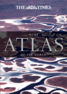
Times Mini Atlas Of The World

Accompanying its larger cartographical parent, The Times Mini Atlas of the World is an ideal gift and handy pocket sized reference guide providing clear and detailed maps of every part of the world. Since its first inception in 1967, The Times’ atlases have always excelled in detailed and beautifully crafted mapping that represents the perfect blend of tradition, authority and style.In this mini-edition, published in 2015, there are full updates to the world’s states and territories as well as geographical information on the world’s physical features. A clear and detailed overview of the world today is provided in a series of maps, graphics, and statistics. The states and territories section also includes up to date information on country area, flags, languages, currency &
population.Main features include 117 pages of authoritative up-to-date mapping of the whole world, geographical reference section with flags, statistics and facts for the world`s states and territories, statistics and thematic world maps on major geographical themes, including population, cities, climate and the environment. There is an extensive index which covers over 20, 000 locations.
RIP - This product is no longer available on our network. It was last seen on 25.09.2019

This page now acts as a permanent archive for this product. Add more information using the comments box below to ensure it can still be found by future generations.

Use our search facility to see if it is available from an alternative contributor.
  • Availability: Out Of Stock
  • Supplier: Stanfords
  • SKU: 9780008104979
Availability: In Stock
£6.99

Product Description

Accompanying its larger cartographical parent, The Times Mini Atlas of the World is an ideal gift & handy pocket sized reference guide providing clear & detailed maps of every part of the world. Since its first inception in 1967, The Times’ atlases have always excelled in detailed & beautifully crafted mapping that represents the perfect blend of tradition, authority & style. In this mini-edition, published in 2015, there are full updates to the world’s states & territories as well as geographical information on the world’s physical features. A clear & detailed overview of the world today is provided in a series of maps, graphics, & statistics. The states & territories section also

Includes::
up to date information on country area, flags, languages, currency & population. Main features include 117 pages of authoritative up-to-date mapping of the whole world, geographical reference section with flags, statistics & facts for the world`s states & territories, statistics & thematic world maps on major geographical themes, including population, cities, climate & the environment. There is an extensive index which covers over 20, 000 locations.

Reviews/Comments

Add New

Intelligent Comparison

Oooops!
We couldn't find anything!
Perhaps this product's unique.... Or perhaps we are still looking for comparisons!
Click to bump this page and we'll hurry up.

Price History

Vouchers

No voucher codes found.
Do you know a voucher code for this product or supplier? Add it to Insights for others to use.

Facebook

Jargon Buster

Date - A day on a calendar
Date - A social activity whith a current or potential partner
Graphics - A general term for visual aspects of an item/display
Physical - Used to describe strength or visual properties of an item
World - A physical grouping, commonly used to describe earth and everything associated with ti
Gift - Something that is presented without expecting anything in return
Pocket - A bag shaped insert in clothing used to carry items
Blend - To mix or combine together substances.
Reference - To prove evidence with a back up source.
Ideal - Something that satisfies a perfect criteria.
Environment - The conditions and surrounding area.

Supplier Information

Stanfords
Stanfords was established in 1853 and opened their iconic Covent Garden flagship store in 1901. They have become the top retailer of maps, travel books and accessories in the UK and arguably offer the largest selection of maps and travel books worldwide. Famous names such as Captain Robert Falcon Scott, Ranulph Fiennes and Michael Palin have purchased from Stanfords. They now have a shop in Bristol and both stores together with other venues operate a calendar of events including talks, book signings and exhibitions. As a specialist map retailer, the map selection is comprehensive and includes road maps, street maps and walking maps from worldwide destinations, as well as a selection of world atlases and wall maps. Books include travel guides and travel literature. Stanfords also stock globes, from miniatures made of blue marble to magnificent floor-standing globes. The website features a selection of interesting articles on travel topics.
Page Updated: 2023-11-12 20:15:36

Community Generated Product Tags

Oh No! The productWIKI community hasn't generated any tags for this product yet!
Menu