
 United Kingdom
 France
 Germany
 Netherlands
 Sweden
 USA
USA
 Italy
Italy
 Spain
Spain
More From Contributor


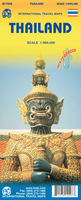
Thailand ITMB
Thailand on an indexed, double-sided road map from ITMB, printed on light, waterproof and tear-resistant plastic paper, with street plans of central Bangkok, Chiang Mai and Pattaya highlighting main places of interest and selected accommodation.The map divides the country north/south to provide coverage at 1:900, 000, but with no overlap between the two sides. Bangkok is included on the southern half, with coverage of the north starting at Phra Nakhon Si Ayutthaya, approximately 40km north of the capital. Elevation colouring with spot heights and graphics for mangrove areas show the topography. National parks and other protected areas are marked.The map shows the country’s road and rail networks, plus ferry connections to the islands and local airports. Symbols highlight various
places of interest, including temples, archaeological sites, beaches and diving sites, viewpoints, etc. Also shown are the country’s administrative boundaries with names of the provinces. The map is indexed and has a latitude and longitude grid at intervals of 1º.The map includes plans of central Bangkok, Chiang Mai and Pattaya highlighting various places of interest, numerous hotels, etc.
places of interest, including temples, archaeological sites, beaches and diving sites, viewpoints, etc. Also shown are the country’s administrative boundaries with names of the provinces. The map is indexed and has a latitude and longitude grid at intervals of 1º.The map includes plans of central Bangkok, Chiang Mai and Pattaya highlighting various places of interest, numerous hotels, etc.

Product Description
Reviews/Comments
Add New
Vouchers
No voucher codes found.
Do you know a voucher code for this product or supplier? Add it to Insights for others to use.
Do you know a voucher code for this product or supplier? Add it to Insights for others to use.
 Denmark