More From Contributor

£7.99
Paddlewheel riverboat, showboat, sternwheeler: in all its myriad forms, the steamboat revolutionized American travel in the 1800s, taking millions of people inland & helping to settle & develop the vast territories beyond the original colonies. It was an era in which young boys dreamed of becoming steamboat pilots & Mark Twain immortalized the ”floating palaces” that travelled up & down the Mississippi River. In this fascinating history, Sara Wright explains the factors that made the era perfect for the development of the steam engine & paddle boat, taking the reader far beyond the romantic image & revealing the steamboat as a vital & essential force in the development of the nation. ...
Archived Product
£395.00
Clearly created in a workroom, instead of an Italian designer’s studio. Almost Steampunk, with a rugged, tactile feel. Brass sheet, solid airplane aluminum fittings. Cooling ribs to divert heat. Good to touch. Even better to view. Lighting the galleries, passages, & corridors of early 20th C. steamships & tramp steamers. Will survive centuries. If we do not have this item in stock we will order it for you from our supplier. Delivery generally takes 3 weeks within the UK. For overseas delivery queries please email sales@stanfords.co.uk ...
Archived Product
£25.00
This nostalgic book looks back to the glorious final years of Steam on the British railways in the 1950s & 1960s. Featuring 33 routes covering the entire country, this guide is a fascinating combination of meticulously researched railway history & more than 350 rarely-seen images from Britain`s leading railway photographers. ...
Archived Product
£20.00
This lavish new volume explores Britain`s extensive railway heritage, offering a comprehensive history of their construction, use & subsequent preservation. The book outlines the development of Britain`s railways from the coming of steam through to the first age of the train, the `big four`, wartime service, the nationalisation of the network & the advent of diesels & electrification. It incorporates evocative photographs & artworks from the extensive archives of the National Railway Museum. Examples of steam preservation lines featured in the book include the North Yorkshire Moors Railway, North Norfolk Railway, Bluebell Railway, Nene Valley Railway, Severn Valley Railway & Paignton & Dartmouth Railway, which are presented in a useful appendix, with contact details & opening times for attractions. ...
Archived Product
£9.99
In the seven decades since the darkest moments of the Second World War it seems every tenebrous corner of the conflict has been laid bare, prodded & examined from every perspective of military & social history. But there is a story that has hitherto been largely overlooked. It is a tale of quiet heroism, a story of ordinary people who fought, with enormous self-sacrifice, not with tanks & guns, but with elbow grease & determination. It is the story of the British railways &, above all, the extraordinary men & women who kept them running from 1939 to 1945. Churchill himself certainly did not underestimate their importance to the wartime story when, in 1943, he praised `the unwavering courage & constant resourcefulness of railwaymen of all ranks in contributing so largely towards the final victory.` & what a story it is. The railway system during the Second World War was the lifeline of the nation, replacing vulnerable road transport & merchant shipping. The railways mobilised troops, transported munitions, evacuated children from cities & kept vital food supplies moving where other forms of transport failed. Railwaymen & women performed outstanding acts of heroism. Nearly 400 workers were killed at their posts & another 2, 400 injured in the line of duty. Another 3, 500 railwaymen & women died in action. The trains themselves played just as vital a role. The famous Flying Scotsman train delivered its passengers to safety after being pounded by German bombers & strafed with gunfire from the air. There were astonishing feats of engineering restoring tracks within hours & bridges & viaducts within days. Trains transported millions to & from work each day & sheltered them on underground platforms at night, a refuge from the bombs above. Without the railways, there would have been no Dunkirk evacuation & no D-Day. Michael Williams, author of the celebrated book On the Slow Train, has written an important & timely book using original research & over a hundred new personal interviews. This is their story. ...
Archived Product
£11.50
Topographic survey of France at 1:25, 000 in IGN`s excellent TOP25 / Série Bleue series. All the maps are GPS compatible, with a 1km UTM grid plus latitude & longitude lines at 5’ intervals. Contours are at 5m intervals except for mountainous areas where the maps have contours at 10m intervals, vividly enhanced by hill shading & graphics for rocky terrain. Colouring with graphics indicates different types of vegetation or land use (deciduous or coniferous forests, moors, orchards, vineyards, etc). PLEASE NOTE: coverage of France at this scale is currently being revised – the format & the presentation of each title are indicated by the letters at the end of its Sheet Reference number (e.g. 0416ET, 3531ETR, 1923SB, etc.)MAPS WITH FULL TOURIST OVERPRINT & AN ENGLISH MAP LEGEND: all TOP25 maps & the SB editions of Série Bleue have an overprint highlighting waymarked walking trails including long-distance GR routes &, where appropriate, ski routes. Symbols indicate campsites, gîtes d’etape, refuges, equestrian centres & other recreational facilities or sites, tourist information centres, cultural heritage, etc. Towns & locations of particular interest are highlighted.- ET or OT = single-sided TOP25 map covering approx. 29x 21 km / 18x 13 miles.- ETR or OTR = waterproof & tear resistant TOP25 map covering the same area as the corresponding ET or OT number, but double-sided, printed on a smaller size sheet with a good overlap between the sides.- SB = Série Bleue map with full tourist overprint; these maps, first introduced in summer 2014, each cover approx. 29x 24km / 18x 15 miles.SÉRIE BLEUE maps with numbers ending in E (Est) or O (Ouest): most editions now indicate the GR routes, but do not show any other tourist information. Map legend is in French only. Each map covers approx. 14x 20km / 9x 12 miles. ...
Archived Product
£17.99
Kadaster, Holland`s national survey organization, produces one of the most attractive topographic surveys in Europe. The maps are very colourful, with their characteristic patchwork of polders & an unusually large amount of land use information: meadows, arable l&, different types of forest, marshes, sand dunes, etc. Contours are shown at 5-metre intervals with numerous spot heights &, with such a large part of the country below the sea level, ”spot depths”. Each map covers an area of Approx. 25 x 20 km / 15 x 12 miles, with some sheets slightly larger. The maps have a 1-km Dutch national grid, plus latitude & longitude at intervals of 1`. Map legend

Includes::
English.IMPORTANT
- PLEASE NOTE BEFORE ORDERING: both the west (W) & the east (O) sheet of each number has the same name, although the town after which the two maps are named appears only on one of the sheets. For example: maps 41W & 41O are both called Arnhem, although the city of Arnhem appears only on sheet 40W, etc. To see the list of titles available in this series please click on the series link.


...
Archived Product
£7.95
Steiermark South & East
- Burgenland South Cycling Map at 1:100, 000 in a cycling series from Freytag & Berndt covering Austria
...
Archived Product
£9.99
Map No. 167, Steigerwald NP North
- Bamberg, in a series of hiking maps from Kompass providing extensive coverage of Austria
...
Archived Product

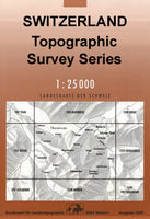
Steckborn Swisstopo 1033

Map No. 1033, Steckborn, in the topographic survey of Switzerland at 1:25, 000 from Bundesamt für Landestopographie (swisstopo), covering the whole country on 247 small format sheets, with special larger maps published for popular regions including some titles now available in hiking versions.Highly regarded for their superb use of graphic relief and hill shading, the maps give an almost 3-D picture of Switzerland`s mountainous terrain. Contours are at 10 m intervals, with 20m intervals in the mountainous areas. All the maps have a 1-km grid for Swiss national coordinates (datum CH 1903). *Small format sheets (Nos. 1011 - 1374)*Map legend in the language of the area covered by the map. Additional margin ticks show latitude and longitude in steps of 2`. The area covered by each map
is 17 x 12 km (11 x 7 miles approx). *Special larger sheets (Nos. from 2501 onwards) – STANDARD editions:* No map legend is included but a separate leaflet can be provided instead. The area covered by each map is 25 x 17 km (15 x 11 miles approx).*Special larger sheets (Nos. from 2501 onwards) – HIKING editions:* An overprint highlights hiking, mountain and alpine paths, including regional and national long-distance trails. The maps also show bus routes with bus stops, plus inns in remote locations. The area covered by each map is 25 x 17 km (15 x 11 miles approx).
RIP - This product is no longer available on our network. It was last seen on 25.09.2019

This page now acts as a permanent archive for this product. Add more information using the comments box below to ensure it can still be found by future generations.

Use our search facility to see if it is available from an alternative contributor.
  • Availability: Out Of Stock
  • Supplier: Stanfords
  • SKU: 9783302010335
Availability: In Stock
£12.99

Product Description

Map No. 1033, Steckborn, in the topographic survey of Switzerland at 1:25, 000 from Bundesamt für Landestopographie (swisstopo), covering the whole country on 247 small format sheets, with special larger maps published for popular regions including some titles now available in hiking versions. Highly regarded for their superb use of graphic relief & hill shading, the maps give an almost 3-D picture of Switzerland`s mountainous terrain. Contours are at 10 m intervals, with 20m intervals in the mountainous areas. All the maps have a 1-km grid for Swiss national coordinates (datum CH 1903). * Small format sheets (Nos. 1011
- 1374)* Map legend in the language of the area covered by the map. Additional margin ticks show latitude & longitude in steps of 2`. The area covered by each map is 17 x 12 km (11 x 7 miles approx). * Special larger sheets (Nos. from 2501 onwards) – STANDARD editions:* No map legend is included but a separate leaflet can be provided instead. The area covered by each map is 25 x 17 km (15 x 11 miles approx).* Special larger sheets (Nos. from 2501 onwards) – HIKING editions:* An overprint highlights hiking, mountain & alpine paths, including regional & national long-distance trails. The maps also show bus routes with bus stops, plus inns in remote locations. The area covered by each map is 25 x 17 km (15 x 11 miles approx).

Reviews/Comments

Add New

Intelligent Comparison

Oooops!
We couldn't find anything!
Perhaps this product's unique.... Or perhaps we are still looking for comparisons!
Click to bump this page and we'll hurry up.

Price History

Vouchers

No voucher codes found.
Do you know a voucher code for this product or supplier? Add it to Insights for others to use.

Facebook

Jargon Buster

Hiking - An outdoor activity envolving walking in nature
swiss - Short for Switzerland, one of the richest countries in the world
switzerland - A landlocked country in western Europe. One of the richest countries in the world
Language - the method of communication used in different areas. Humans and computers have many different languages.
Km - Kilometre. A unit of measurement equal to 1000 metres.
Small - something that takes up less space than normal.
Popular - Something that is admired and liked by many people.
Regional - An adjective to describe a set geographic area.
Language - The way humans communicate either written and spoken.

Supplier Information

Stanfords
Stanfords was established in 1853 and opened their iconic Covent Garden flagship store in 1901. They have become the top retailer of maps, travel books and accessories in the UK and arguably offer the largest selection of maps and travel books worldwide. Famous names such as Captain Robert Falcon Scott, Ranulph Fiennes and Michael Palin have purchased from Stanfords. They now have a shop in Bristol and both stores together with other venues operate a calendar of events including talks, book signings and exhibitions. As a specialist map retailer, the map selection is comprehensive and includes road maps, street maps and walking maps from worldwide destinations, as well as a selection of world atlases and wall maps. Books include travel guides and travel literature. Stanfords also stock globes, from miniatures made of blue marble to magnificent floor-standing globes. The website features a selection of interesting articles on travel topics.
Page Updated: 2023-11-12 20:15:36

Community Generated Product Tags

Oh No! The productWIKI community hasn't generated any tags for this product yet!
Menu