
 United Kingdom
 France
 Germany
 Netherlands
 Sweden
 USA
USA
 Italy
Italy
 Spain
Spain
More From Contributor

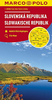

Slovakia
Slovakia on an indexed road map at 1:500, 000 from the Budapest-based Cartographia, prominently highlighting interesting locations and national parks, plus an enlargement showing Tatra Mountain in greater detail and a street plan of central Bratislava. Coverage extends north to Kraków to cover the Polish side of the Tatras and their foothills.Road network, graded into six types, indicates driving distances on main and secondary road, plus highlights scenic routes and has gradient markings. Railway lines are included and local airports are marked. Locations worth visiting, both towns or villages and natural sites, are prominently highlighted. Symbols indicate other places of interest, including campsites. Topography is shown by relief shading with names of mountain ranges and peak
heights, plus boundaries of national parks. The map has latitude and longitude lines at 30’ intervals. The index is on the reverse.An enlargement at 1:100, 000 shows in greater detail the High Tatra region, highlighting numerous waymarked hiking trails. Coverage extends north to Zakopane to include the eastern part of the Polish Tatrzanski National Park. Also included is a small street plan of central Bratislava.
heights, plus boundaries of national parks. The map has latitude and longitude lines at 30’ intervals. The index is on the reverse.An enlargement at 1:100, 000 shows in greater detail the High Tatra region, highlighting numerous waymarked hiking trails. Coverage extends north to Zakopane to include the eastern part of the Polish Tatrzanski National Park. Also included is a small street plan of central Bratislava.

Product Description
Reviews/Comments
Add New
Vouchers
No voucher codes found.
Do you know a voucher code for this product or supplier? Add it to Insights for others to use.
Do you know a voucher code for this product or supplier? Add it to Insights for others to use.
 Denmark