
 United Kingdom
 France
 Germany
 Netherlands
 Sweden
 USA
USA
 Italy
Italy
 Spain
Spain
More From Contributor

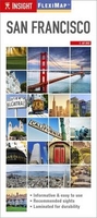
San Francisco Flexi Map
San Francisco on an Insight Flexi Pocket Map in their new format introduced to provide more convenient access to the special features of this series: various additional maps and/or street plans plus tourist information including a list of must-see sights. The map is tear-resistant, waterproof, and can be written on with non-permanent marker pens. On one side is a street plan of San Francisco at 1:19, 000, with coverage extending from the Golden Gate Bridge and the Alcatraz Island to the Castro subway station and the University of California Medical Center, including the whole of the Golden Gate park. The plan clearly shows subway stations, streetcar routes, and ferry piers with connections across the San Francisco Bay. The plan is indexed for streets, public buildings and points of
interest. (Please note: the map cover gives an incorrect scale).On the reverse are this title’s additional features:- A diagram of the Muni Metro network.- A road map at 1:300, 000 of the San Francisco Bay area, extending south to Stanford University in Palo Alto and north-east to Antioch. The map is indexed for places, points of interest, plus state parks / regional parks / nature reserves.- 26 main sights, neatly grouped into sections covering Top Attractions, Major Museums and Art Galleries, Shopping and Markets, plus Further Afield are given brief descriptions and are prominently highlighted on the relevant maps.- Information about Getting Around and Facts for Visitors, including tourist information, money, public holidays, opening times, tipping, telecommunications,
plus monthly climate charts.To see the list of other Insight Flexi titles in this series please click on the series link.

Product Description
Reviews/Comments
Add New
Vouchers
No voucher codes found.
Do you know a voucher code for this product or supplier? Add it to Insights for others to use.
Do you know a voucher code for this product or supplier? Add it to Insights for others to use.
 Denmark