
 United Kingdom
 France
 Germany
 Netherlands
 Sweden
 USA
USA
 Italy
Italy
 Spain
Spain
More From Contributor


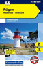


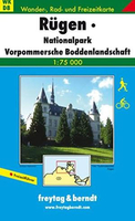
Rügen Freytag & Berndt Map
One of the titles in a series of contoured outdoor leisure maps, extending F&B’s extensive coverage of Austria to the neighbouring regions and other popular hiking areas of Germany. The maps have contours at 100-metre intervals in the mountainous areas, and 50 metres elsewhere, shading and graphic relief. An overprint highlights hiking paths, cycling routes and, on most of the titles, ski routes. The maps also show youth hostels, campsites, mountain huts and refuges. Margin ticks show latitude and longitude in steps of 5`. Most titles also give GPS waypoints, as indicated in the individual descriptions. Map legend includes English. Several of the titles come with a separate booklet, in German only, containing information on places of interest, brief descriptions of selected
hiking trails, addresses of various accommodation facilities, etc.This title shows Rügen and the neighbouring coast of the mainland. A booklet, in German only, provides additional information on the area.
hiking trails, addresses of various accommodation facilities, etc.This title shows Rügen and the neighbouring coast of the mainland. A booklet, in German only, provides additional information on the area.

Product Description
Reviews/Comments
Add New
Vouchers
No voucher codes found.
Do you know a voucher code for this product or supplier? Add it to Insights for others to use.
Do you know a voucher code for this product or supplier? Add it to Insights for others to use.
 Denmark