More From Contributor

£14.99
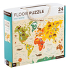
This Petit Collage floor puzzle features vibrant engaging artwork. Once kids have mastered our beginner puzzles, they`re ready to grow with these bigger concept, 24 piece large-sized puzzles. Contained in a perfect gift-to-go box with a soft cotton rope handle. Completed puzzle measures 45.7 x 61cm, each individual piece measures roughly 12.7 x 12.7cm. Age 3+ years. ...
Archived Product
£14.99
Kaori Watanabe illustrated this charming world map for Our World Jumbo Puzzle from Mudpuppy. Jumbo Puzzles are a fun way to work on hand & eye coordination & to have fun together. Count the fish, whales, & dolphins. 25 jumbo pieces all contained in a sturdy box with a colourful rope handle. ...
Archived Product
£10.00
This stylish photobook is a compilation of some 350 of the finest Reuters photographs of 2007. Reuters is the worlds largest international news agency. Its award-winning photographers submit some 1, 500 photos a day from locations across the globe, creating an annual archive of over half a million images. Drawing upon this unparalleled resource, Our World Now documents a year in the life of our vibrant, troubled, beautiful planet. Sometimes funny, sometimes devastating, always enthralling, these photographs encompass the fantastic diversity of trends, moods & stories that have defined 2007. ...
Archived Product
£10.00
Reuters photojournalists are continually bearing witness to events as they happen across the globe. They submit some 1, 500 photos a day, creating an annual archive of over half a million images. This award-winning work pushes the boundaries of what news photography is & can be. Our World Now 2 draws upon this unparalleled resource to document a year in the life of our vibrant, troubled, beautiful planet. Sometimes funny, sometimes devastating, always compelling, the images in this book encompass the fantastic diversity of trends, moods & stories that have defined 2008. ...
Archived Product
£8.99
Wherever we live in the world
- whether our country is rich or poor
- water is vital to our survival on this planet. This book

...
Archived Product
£9.99
Contoured, GPS-compatible, indexed road map at 1:200, 000 from CNIG
- Spain’s civilian survey organization, with exceptionally
...
Archived Product
£7.95
Ourense on an indexed street plan at 1:7, 000 from Editorial Everest with locations of several selected hotels. On the reverse is an indexed road map of the Ourense Province at 1:200, 000 highlighting places of interest. Street plans of Spanish cities from Editorial Everest cover each location with its outer suburbs &, where useful, also presenting a more detailed enlargement for the town ...
Archived Product
£15.95
A detailed, colour survey map from the Portuguese Military Survey's M782 series. Each map in this series has contours at 20m intervals with supplementary contours at 10m intervals. One major advantage the military mapping has over the civilian equivalent is that the legend is in English as well as Portuguese. This legend

Includes::
roads, railways, buildings, spot heights, vegetation type, fluvial information, scree, dunes, churches, ruins, etc. Latitude & longitude ticks are show at 10' intervals. Recently revised sheets also have a UTM grid at 100m intervals. Vertical Datum: Mean Sea Level at Cascais Harbour Projection: Transverse Mercator

...
Archived Product
£17.99
Topographic survey of Portugal at 1:50, 000 from the Instituto Geográfico do Exército, the country’s military survey organisation. The maps have contours at 20m intervals & in addition to the standard features shown on topographic mapping at this scale also indicate various types of terrain or vegetation (s&, terraces, rocks, woodlands, vineyards, etc). Each sheet covers an area of 32 x 20km (20 x 12.5 miles approx). The maps have a 1-km UTM grid plus latitude & longitude coordinates for the map corners. Map legend & a glossary of terms used on the maps include English.EDITION DATES: most titles in this series date from 1990s or later. To see all the titles in this series please click on the series link. ...
Archived Product
£17.99
Topographic survey of Portugal at 1:50, 000 from the Instituto Geográfico Português, the country’s civilian survey organisation. The maps have contours at 25m intervals & in addition to the standard features shown on topographic mapping at this scale also indicate various types of vegetation (vineyards, olive groves, etc). Each sheet covers an area of 32 x 20km (20 x 12.5miles approx). The maps have latitude & longitude margin ticks at 1’ intervals & UTM coordinates for the map corners – each sheet also shows conversion details from BBLx (Bessel-Bonnie system, Datum Lisbon) to UTM. Map legend is in Portuguese only.EDITION DATES: most titles in this series have now been updated in the 1990s or later. To see all the titles in this series please click on the series link. ...
Archived Product

Ouren

Topographical survey of Belgium at 1:20, 000 from Nationaal Geografisch Instituut / Institut Géographique National, the country’s national survey organization. Each 20K map covers one quarter of the corresponding 1:50, 000 map (with adjustments in the border and coastal areas). The maps provide all the information expected of topographic mapping at this scale and additionally have an unusually large amount of vegetation and/or land use information (different types of woodlands, gardens, orchards, heath, etc). The maps have a 1-km UTM grid, with margin ticks for latitude and longitude at intervals of 1`. Map legend and a glossary of terms used on the maps include English.Stanfords keeps as regular stock 20K maps for the World War I battlefields around the Ypres, Messines and
Passchendaele, and for the area of the Battle of Waterloo. The 1:20, 000 survey covers the whole of Belgium and maps for other regions can be supplied as special orders. To see the list of titles in this series please click on the series link.PLEASE NOTE: the Long-Distance Footpaths Map of Belgium at 1:300, 000 which shows the division of Belgium into the 50K survey sheets can also be used to see in more detail coverage by the 20K maps.
RIP - This product is no longer available on our network. It was last seen on 25.09.2019

This page now acts as a permanent archive for this product. Add more information using the comments box below to ensure it can still be found by future generations.

Use our search facility to see if it is available from an alternative contributor.
  • Availability: Out Of Stock
  • Supplier: Stanfords
  • SKU: 9781129302886
Availability: In Stock
£9.50

Product Description

Topographical survey of Belgium at 1:20, 000 from Nationaal Geografisch Instituut / Institut Géographique National, the country’s national survey organization. Each 20K map covers one quarter of the corresponding 1:50, 000 map (with adjustments in the border & coastal areas). The maps provide all the information expected of topographic mapping at this scale & in addition have an unusually large amount of vegetation and/or land use information (different types of woodlands, gardens, orchards, heath, etc). The maps have a 1-km UTM grid, with margin ticks for latitude & longitude at intervals of 1`. Map legend & a glossary of terms used on the maps include English. Stanfords keeps as regular stock 20K maps for the World War I battlefields around the Ypres, Messines & Passchendaele, & for the area of the Battle of Waterloo. The 1:20, 000 survey covers the whole of Belgium & maps for other regions can be supplied as special orders. To see the list of titles in this series please click on the series link.PLEASE NOTE: the Long-Distance Footpaths Map of Belgium at 1:300, 000 which shows the division of Belgium into the 50K survey sheets can also be used to see in more detail coverage by the 20K maps.

Reviews/Comments

Add New

Intelligent Comparison

Oooops!
We couldn't find anything!
Perhaps this product's unique.... Or perhaps we are still looking for comparisons!
Click to bump this page and we'll hurry up.

Price History

Vouchers

No voucher codes found.
Do you know a voucher code for this product or supplier? Add it to Insights for others to use.

Facebook

Jargon Buster

World - A physical grouping, commonly used to describe earth and everything associated with ti
Km - Kilometre. A unit of measurement equal to 1000 metres.
Large - something that takes up more space than normal.

Supplier Information

Stanfords
Stanfords was established in 1853 and opened their iconic Covent Garden flagship store in 1901. They have become the top retailer of maps, travel books and accessories in the UK and arguably offer the largest selection of maps and travel books worldwide. Famous names such as Captain Robert Falcon Scott, Ranulph Fiennes and Michael Palin have purchased from Stanfords. They now have a shop in Bristol and both stores together with other venues operate a calendar of events including talks, book signings and exhibitions. As a specialist map retailer, the map selection is comprehensive and includes road maps, street maps and walking maps from worldwide destinations, as well as a selection of world atlases and wall maps. Books include travel guides and travel literature. Stanfords also stock globes, from miniatures made of blue marble to magnificent floor-standing globes. The website features a selection of interesting articles on travel topics.
Page Updated: 2023-11-12 20:15:36

Community Generated Product Tags

Oh No! The productWIKI community hasn't generated any tags for this product yet!
Menu