More From Contributor
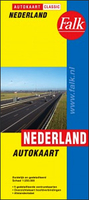
£5.99
Netherlands at 1:300, 000 from Insight Guides, with street plans of central Amsterdam, Rotterdam & The Hague, plus enlargements showing access to these cities & Utrecht, all presented on one side of a very large sheet. The road map presents very clearly the country ...
Archived Product
£11.99
Netherlands in the Countries & Regions series from Lonely Planet, market-leading comprehensive guides aimed at independent travellers & serving a large range of international destinations. Frank & informal in style, the guides explore an extensive range of sights, activities, accommodation, restaurants & nightlife & are designed for practical use while travelling on the road. Written & researched by a team of experts, each book is independent in its recommendations & suggestions, often offering individual takes on individual destinations. Widely recognised for their reliability, each Lonely Planet country & region guide has the same layout. Introductory sections profile the destination with individual chapters on particular highlights, getting started, (including when to go) itineraries, history, culture, arts, food & drink & the environment. Each guide is organised geographically by region, with individual sections detailing an extensive range of sights, places of interest, attractions, restaurants, nightlife, accommodation & any local activities. The guides have detailed explanations of historical context where relevant. There is also practical guidance on ...
Archived Product
£11.19
The Netherlands in the Countries, Regions & Cities series from Rough Guides; comprehensively detailed guidebooks specifically designed for independent travellers & serving a range of worldwide destinations. Widely recognised for their free editorial style, Rough Guide authors are allowed to express their personal opinions on a range of subjects. Although sometimes controversial, this editorial stance allows readers to experience more detailed & personal takes on each destination, a feature often more limited in other guidebooks. Cultural & historical nuances are explored in significant depth throughout the text & descriptions on the ambience of individual settings alongside personal recommendations, particularly in cities, are notably prevalent. Each Rough Guide in the Countries, Regions & Cities series has a similar layout. A ...
Archived Product
£14.99
The Netherlands in the Countries, Regions & Cities series from Rough Guides; comprehensively detailed guidebooks specifically designed for independent travellers & serving a range of worldwide destinations. Widely recognised for their free editorial style, Rough Guide authors are allowed to express their personal opinions on a range of subjects. Although sometimes controversial, this editorial stance allows readers to experience more detailed & personal takes on each destination, a feature often more limited in other guidebooks. Cultural & historical nuances are explored in significant depth throughout the text & descriptions on the ambience of individual settings alongside personal recommendations, particularly in cities, are notably prevalent. Each Rough Guide in the Countries, Regions & Cities series has a similar layout. A ...
Archived Product
£6.99
Netherlands at 1:300, 000 from Insight Guides, with street plans of central Amsterdam, Rotterdam & The Hague, plus enlargements showing access to these cities & Utrecht, all presented on one side of a very large sheet. The road map presents very clearly the country ...
Archived Product
£9.99
Netherlands with Belgium & Luxembourg at 1:350, 000 on an indexed, double- sided map from ITMB. Belgium & Luxembourg are on one side; Netherlands is divided along the Vlissigen (Flushing) / Eindhoven line with a small overlap between the sides. The map shows the three countries’ road & rail networks, with driving distances marked on main & on selected connecting roads. Symbols highlight various facilities & places of interest, including selected campsites & other tourist accommodation. The map has latitude & longitude lines at intervals of 20’. Each side has a separate index. ...
Archived Product
£14.99
Netherlands in the Countries & Regions series from Lonely Planet, market-leading comprehensive guides aimed at independent travellers & serving a large range of international destinations. Frank & informal in style, the guides explore an extensive range of sights, activities, accommodation, restaurants & nightlife & are designed for practical use while travelling on the road. Written & researched by a team of experts, each book is independent in its recommendations & suggestions, often offering individual takes on individual destinations. Widely recognised for their reliability, each Lonely Planet country & region guide has the same layout. Introductory sections profile the destination with individual chapters on particular highlights, getting started, (including when to go) itineraries, history, culture, arts, food & drink & the environment. Each guide is organised geographically by region, with individual sections detailing an extensive range of sights, places of interest, attractions, restaurants, nightlife, accommodation & any local activities. The guides have detailed explanations of historical context where relevant. There is also practical guidance on ...
Archived Product
£6.95
Netherlands in the Culture Smart range of pocket-sized guide books; providing detailed information on local customs, culture, etiquette & manners & ensuring that visitors are prepared for a diverse range of social environments. The series covers an extensive number of countries worldwide & are designed both for those working & living abroad, as well as for visitors who do not want to offend, either intentionally or inadvertently. Their aim is to prevent readers from making embarrassing mistakes & feel confident in unfamiliar situations, while preparing them before arrival on what to expect & how to behave. Each guide is arranged thematically, with dedicated individual chapters on land & people, values & attitudes, customs & traditions, making friends, people at home, ‘time-out’, travelling & communicating. There is also a separate chapter for business travelers, with important information on subjects such as business culture, meetings & making appointments. A Further Reading section also offers a list of recommended other history, travel literature & language titles available on the country. ...
Archived Product
£7.99
Taking readers beyond the stereotypical images of windmills, clogs, & tulips, this pocket-sized guide helps visitors understand the complex layers of identity in this small, densely populated country on Europe`s northwestern seaboard. With roots as a maritime nation that built a network for transportation, defense, & trade, the Netherlands of today is still a prime economic hub of Europe. The Netherlands is also famous for its liberal attitudes, recently challenged by high levels of immigration, & is home to an intelligent, cosmopolitan, enterprising, tolerant, & modest people. The visitor or business traveler will find that the predominant attitude continues to be one of ”live & let live, ” & that many different communities live alongside each other in harmony. ...
Archived Product
£9.95
Netherlands with the northern part of Belgium on a large, double-sided indexed map from Mair Dumont, with six street plans & special features to aid route planning & navigation: a fold-out flap in the jacket gives an overview of the whole area & the adjoining regions & highlights popular locations, with the grid reference system in the margins making it easier to find places on the main map. A set of seven peel-on/peel-off stickers, removable without damaging the map surface, is provided for making selected locations more prominent when navigating. Coverage conveniently presents on one side Netherlands north of Rotterdam & Hoek of Holl&, & on the other Netherlands south of Amsterdam with Flanders, including Brussels. The map boldly stresses main roads & motorways in strong colours & selected towns in large letters, but also shows minor roads & villages in considerable detail. Road information

Includes::
toll roads, traffic restrictions & seasonal closures, gradient marking for steep roads, scenic roads & special tourist routes, etc. Motorway services clearly indicate types of facilities available there. Railway network is shown with stations &

Includes::
tourist lines Picturesque towns or villages & sites worth visiting, including areas with interesting landscape, are given star rating, & other tourist information

Includes::
campsites & youth hostels, landmarks, recreational facilities etc. National parks & other protected areas are highlighted. Latitude & longitude grid is drawn at intervals of 10'. Map legend & all information include English. The index is in a separate booklet attached to the map cover. The booklet also contains street plans of central areas of Amsterdam, The Hague, Groningen, Maastricht, Rotterdam & Utrecht, plus a distance/travelling times table, emergency numbers & main traffic regulations.


...
Archived Product

Netherlands

Netherlands on a large, indexed road map at 1:250, 000 from Falk BV, with five city centre street plans, a route planning map, plus a distance table. Road network clearly shows motorway junction numbers and names. Driving distances are marked on main and selected local routes. Railway lines are shown with main stations and ferry connections, both internal across rivers/canals and to the North Sea islands, indicate maximum weight per vehicle. A range of symbols show various facilities and places of interest. The map has no geographical coordinates. The index is on the reverse. Map legend includes English.The reverse side also provides city centre street plans of Amsterdam, The Hague, Rotterdam, Utrecht and Maastricht. The plans show one way or restricted entry streets, pedestrian
zones, car parks and police stations, but do not indicate any places of interest or other important buildings. Also provides is a motorway map for route planning and a distance tablePLEASE NOTE: the same map is also available is the publisher’s special folded format with more additional features.
RIP - This product is no longer available on our network. It was last seen on 25.09.2019

This page now acts as a permanent archive for this product. Add more information using the comments box below to ensure it can still be found by future generations.

Use our search facility to see if it is available from an alternative contributor.
  • External links may include paid for promotion
  • Availability: Out Of Stock
  • Supplier: Stanfords
  • SKU: 9789028709133
Availability: In Stock
£8.50

Product Description

Netherlands on a large, indexed road map at 1:250, 000 from Falk BV, with five city centre street plans, a route planning map, plus a distance table. Road network clearly shows motorway junction numbers & names. Driving distances are marked on main & selected local routes. Railway lines are shown with main stations & ferry connections, both internal across rivers/canals & to the North Sea islands, indicate maximum weight per vehicle. A range of symbols show various facilities & places of interest. The map has no geographical coordinates. The index is on the reverse. Map legend

Includes::
English. The reverse side also provides city centre street plans of Amsterdam, The Hague, Rotterdam, Utrecht & Maastricht. The plans show one way or restricted entry streets, pedestrian zones, car parks & police stations, but do not indicate any places of interest or other important buildings. Also provides is a motorway map for route planning & a distance table PLEASE NOTE: the same map is also available is the publisher’s special folded format with more additional features.

Reviews/Comments

Add New

Intelligent Comparison

Oooops!
We couldn't find anything!
Perhaps this product's unique.... Or perhaps we are still looking for comparisons!
Click to bump this page and we'll hurry up.

Price History

Vouchers

No voucher codes found.
Do you know a voucher code for this product or supplier? Add it to Insights for others to use.

Facebook

Jargon Buster

vehicle - A manufactured device used to transport people or cargo.
police - Persons empowered to reduce civil disorder and enforce the law.
Car - A machine used for transport which runs on roads
weight - A measure of the force applied on an object by gravity. Measured metric in grams and kilos or imperial in lbs and oz
Weight - a measurement of how heavy an object appears due to the pull of gravity. For example the weight of an object on planet earth will be different to the weight of the object on the moon
Network - A link and communication between things. Often computers or people.
Large - something that takes up more space than normal.
Road - a manmade lane or a path that is used to speed up travel.
Junction - A point where two or more things come together, typically used to describe roads

Supplier Information

Stanfords
Stanfords was established in 1853 and opened their iconic Covent Garden flagship store in 1901. They have become the top retailer of maps, travel books and accessories in the UK and arguably offer the largest selection of maps and travel books worldwide. Famous names such as Captain Robert Falcon Scott, Ranulph Fiennes and Michael Palin have purchased from Stanfords. They now have a shop in Bristol and both stores together with other venues operate a calendar of events including talks, book signings and exhibitions. As a specialist map retailer, the map selection is comprehensive and includes road maps, street maps and walking maps from worldwide destinations, as well as a selection of world atlases and wall maps. Books include travel guides and travel literature. Stanfords also stock globes, from miniatures made of blue marble to magnificent floor-standing globes. The website features a selection of interesting articles on travel topics.
Page Updated: 2023-11-12 20:15:36

Community Generated Product Tags

Oh No! The productWIKI community hasn't generated any tags for this product yet!
Menu