More From Contributor

£14.99
The southern half of the Netherlands on a Super-Durable Cycling Map at 1:200, 000 from Buijten & Schipperheijn, showing the country’s extensive network of signposted cycling routes, with highlighting for the LF long-distance paths & recommended other trails, plus locations of campsites. The map is double-sided & coverage in this title extends south from the Leiden – Hilversum – Apeldoorn – Enschede line, so with a very generous overlap with the publishers’ map of the northern half of the country. Netherland’s extensive network of sign-posted cycling routes, including the LF long-distance cycle paths, consists of numbered junctions joined by sign-posted connecting routes in either direction. At each junction there is an information panel showing an overview map of the whole network with the junction numbers. A second panel shows all the intersections directly connected to that junction. The system enables cyclists to plan their own routes by preparing a list of junction numbers through which they want to travel. In addition to showing all the junctions with their numbers & connecting routes, the map highlights sections which are part of the LF long-distance network (also presented separately on a small inset), recommended unmarked NF routes & long cycling tours. The background map has the country’s road & rail networks, with colouring showing different terrain (forest, heath, dunes, etc). Symbols indicate campsites & ferries across rivers. The map has the lines of Netherlands’ national grid & the index of all the junctions gives their coordinates. Map legend

Includes::
English. More panels show & list with phone numbers 112 cycle hire locations, including railway stations, & other information for cyclists; the text/legends for them are in Dutch only.

...
Archived Product
£27.50
This is the fifth editon of ` Cruising Guide to the Netherlands` which was first published in 1988. It is regarded as the authoritative companion for anyone cruising the Netherlands using fixed mast routes. Brian Navin`s guide is based on popular selected routes which offer an opportunity to visit most of the regions of the Netherlands from the estuary of the Schelde up to the IJsselmeer & Waddensee. This new edition follows the same pattern, &

Includes::
corrections & updates that have accumulated since the fourth edition was published. This

Includes::
amended harbour plans & new photographs taken by the author. ` Cruising Guide to the Netherlands` is one of a well established series of guides from Brian Navin.


...
Archived Product
£13.99
Netherlands in Marshall Cavendish's Culture Shock! Series; comprising a range of guides that inform visitors of the finer points & details relating to social etiquette, traditions & customs; bringing visitors to a sensitive yet substantial understanding of the country or city in question. The series targets those who are planning long stays in the destination or extended periods of residence. The guides are written by authors who have experienced the joys & pitfalls of cultural adaptation, & so are ideally placed to provide informative & relevant advice. Each title contains insights into local culture & traditions, guidance on adapting to the local environment, linguistic help & lots of general advice about local culture & idiosyncrasies to help prepare readers for their visit. Each title is structured similarly, beginning with the first impressions a visitor might expect to have. The guides aim to help readers understand the local culture through first appreciating the motivations, beliefs & attitudes of the local people. Practical advice on settling in is provided, with focused sections on accommodation, utilities, health, education & telecommunications. There is also extensive information on the destination ...
Archived Product
£12.99
Netherlands in Marshall Cavendish`s Culture Shock! Series; comprising a range of guides that inform visitors of the finer points & details relating to social etiquette, traditions & customs; bringing visitors to a sensitive yet substantial understanding of the country or city in question. The series targets those who are planning long stays in the destination or extended periods of residence. The guides are written by authors who have experienced the joys & pitfalls of cultural adaptation, & so are ideally placed to provide informative & relevant advice. Each title contains insights into local culture & traditions, guidance on adapting to the local environment, linguistic help & lots of general advice about local culture & idiosyncrasies to help prepare readers for their visit. Each title is structured similarly, beginning with the first impressions a visitor might expect to have. The guides aim to help readers understand the local culture through first appreciating the motivations, beliefs & attitudes of the local people. Practical advice on settling in is provided, with focused sections on accommodation, utilities, health, education & telecommunications. There is also extensive information on the destination’s culture, food & leisure, in addition to a specific section addressing the concerns of those travelling on business. ...
Archived Product
£9.95
Netherlands Cycling & Hiking Map at 1:300, 000 from the ANWB, with each side of the map showing the whole country overprinted with different information: cycling or hiking, both with long-distance routes & shorter day trips. The map, indispensable for planning a cycling or hiking holiday in the Netherlands, may at a quick glance appear daunting, with its extensive colour-coded overprint, long lists & all the text in Dutch only, but all the information is clearly & logically laid out & can be easily understood without a reference to a dictionary or a free online translating service. The background map shows the country ...
Archived Product
£24.99
Bicycle maps from all over the Netherlands bundled into the most complete bike atlas in the Netherlands, scale 1: 100, 000 the LF routes all node routes with distances between the nodes mention of small roads mention of cycle paths locations of campsites & bed & breakfast addresses, with web links locations of catering & attractions locations & web links of foot feathers extensive landscape information & relief information place name register ...
Archived Product
£17.99
A complete atlas of the Netherlands in a 100-page guidebook, scale 1: 150 000 (1cm = 1.5km)• compact & extremely easy to read• size suitable for handlebar bags• low weight• clear cartography• renewed node routes• tourist routes, including LF roads• All campsites of nederl&-camping.nl• Landmarks• all roads & trails, even hiking routes ...
Archived Product
£17.99
The Netherlands Eyewitness travel guide from Dorling Kindersley is a lavishly illustrated book concerned with providing the visitor with detailed background information to sightseeing in the country & a broad cultural introduction. Popular historical buildings & museums are often described with cutaway diagrams allowing you to view ...
Archived Product
£10.99
Detailed road map of the Netherlands, with index & city centre street enlargements of Amsterdam & the Hague. Clearly shows the national road network & selected provincial & local roads, with each class of road clearly indicated & road numbers shown. Intermediate driving distances between locations are shown in kilometres alongside the road, motorway filling stations are shown & motorway junctions are indicated. Colour shading is used to indicate land types such as forests or marshl&. International & provincial boundaries are clearly marked, as are nature reserves & restricted military areas. Symbols indicate various sights & locations of tourist interest, such as churches, leisure & sports destinations, panoramas & viewing points, monuments & historic sites. Some hotels & campsites are marked. Railway lines, airports, ports & marinas are also shown. A grid divides the map at 30’ increments, & is also grid-referenced for the accompanying index booklet.* Multilingual map legend

Includes::
English.*

...
Archived Product
£18.99
Road atlas of the Netherlands at 1:200, 000 from Falk BV, in a spiral-bound format slightly smaller than A4, providing exceptionally quick access to the coverage of different parts of the country & its index through cleverly-designed presentation, plus city-centre street plans & access maps for eight town & ‘insiders tips’ for the four main cities. The division of the country into individual atlas pages is printed on the cover – next to it are thumb-tabs for individual map pages & sections of the index. Each spread of two pages has on one side the road map & opposite it the grid for the whole atlas, so adjoining pages can also be quickly found. The mapping provides detail presentation of the road network, with names & number of motorway exits, services, driving distances on main routes, etc. Railway lines are included & local airports are marked. Landscape is indicated by colouring for woodlands. Symbols mark various places of interest. The maps have no geographical coordinates. Map legend, conveniently placed on the back cover,

Includes::
English. Central Amsterdam, The Hague, Rotterdam & Utrecht have page-size street plans highlighting main sights for which brief descriptions are provided (in Dutch only), plus a road map showing access to the centre from the surrounding motorways & main roads. Street plans & access maps are also provided for central Arnhem, Breda, Eindhoven, Groningen, Den Bosch (s’ Hertogenbosch), Maastricht, Middelburg & Nijmegen. All the street plans indicate one-way streets, car parks & tourist information offices. Also provided is a distance table between 26 cities.PLEASE NOTE: this title is also available in a smaller glovebox format with main mapping reduced to 1:300, 000. All the information on the road maps & on the accompanying street plans is the same but with place names in reduced print size.

...
Archived Product

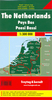
Netherlands Cycling Atlas

Cycling atlas of the Netherlands at 1:75, 000 from Falk BV, presenting in one A5 spiral-bound volume the country’s extensive network of signposted cycling routes and junctions, including the long-distance LF trails and smaller local cycle paths. The network consists of numbered junctions joined by sign-posted connecting routes in either direction. At each junction there is an information panel showing an overview map of the whole network with the junction numbers. A second panel shows all the intersections directly connected to that junction. The system enables cyclists to plan their own routes by preparing a list of junction numbers through which they want to travel. Falk mapping gives cycling distances between the junctions and indicates which roads, both within the numbered network
and outside it, have separate cycling paths. Routes which are part of the LF network of long-distance cycle routes are clearly marked. Symbols indicate tourist information offices and “i-points”. Landscape information is provided by colouring for woodlands, dunes, etc. The maps have no GPS coordinates. Map legend includes English; additional text is in Dutch only.PLEASE NOTE: the same cartography is also used in Falk’s series of cycling maps which cover Netherlands and Flanders at 1:50, 000. Maps in that series provide wider tourist information, with more accommodation options, etc. To find the 50K series please enter SI00001600 in the search box.
RIP - This product is no longer available on our network. It was last seen on 25.09.2019

This page now acts as a permanent archive for this product. Add more information using the comments box below to ensure it can still be found by future generations.

Use our search facility to see if it is available from an alternative contributor.
  • External links may include paid for promotion
  • Availability: Out Of Stock
  • Supplier: Stanfords
  • SKU: 9789028725270
Availability: In Stock
£25.99

Product Description

Cycling atlas of the Netherlands at 1:75, 000 from Falk BV, presenting in one A5 spiral-bound volume the country’s extensive network of signposted cycling routes & junctions, including the long-distance LF trails & smaller local cycle paths. The network consists of numbered junctions joined by sign-posted connecting routes in either direction. At each junction there is an information panel showing an overview map of the whole network with the junction numbers. A second panel shows all the intersections directly connected to that junction. The system enables cyclists to plan their own routes by preparing a list of junction numbers through which they want to travel. Falk mapping gives cycling distances between the junctions & indicates which roads, both within the numbered network & outside it, have separate cycling paths. Routes which are part of the LF network of long-distance cycle routes are clearly marked. Symbols indicate tourist information offices & “i-points”. Landscape information is provided by colouring for woodlands, dunes, etc. The maps have no GPS coordinates. Map legend

Includes::
English; additional text is in Dutch only.PLEASE NOTE: the same cartography is also used in Falk’s series of cycling maps which cover Netherlands & Flanders at 1:50, 000. Maps in that series provide wider tourist information, with more accommodation options, etc. To find the 50K series please enter SI00001600 in the search box.

Reviews/Comments

Add New

Intelligent Comparison

Oooops!
We couldn't find anything!
Perhaps this product's unique.... Or perhaps we are still looking for comparisons!
Click to bump this page and we'll hurry up.

Price History

Vouchers

No voucher codes found.
Do you know a voucher code for this product or supplier? Add it to Insights for others to use.

Facebook

Jargon Buster

GPS - Global Positioning System - Global position using satellites
Network - A link and communication between things. Often computers or people.
Accommodation - A room in which someone can live in, for example in a hotel
Junction - A point where two or more things come together, typically used to describe roads

Supplier Information

Stanfords
Stanfords was established in 1853 and opened their iconic Covent Garden flagship store in 1901. They have become the top retailer of maps, travel books and accessories in the UK and arguably offer the largest selection of maps and travel books worldwide. Famous names such as Captain Robert Falcon Scott, Ranulph Fiennes and Michael Palin have purchased from Stanfords. They now have a shop in Bristol and both stores together with other venues operate a calendar of events including talks, book signings and exhibitions. As a specialist map retailer, the map selection is comprehensive and includes road maps, street maps and walking maps from worldwide destinations, as well as a selection of world atlases and wall maps. Books include travel guides and travel literature. Stanfords also stock globes, from miniatures made of blue marble to magnificent floor-standing globes. The website features a selection of interesting articles on travel topics.
Page Updated: 2023-11-12 20:15:36

Community Generated Product Tags

Oh No! The productWIKI community hasn't generated any tags for this product yet!
Menu