
 United Kingdom
 France
 Germany
 Netherlands
 Sweden
 USA
USA
 Italy
Italy
 Spain
Spain
More From Contributor


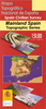

Lebanon Road Map
Lebanon at 1:250, 000 on an indexed road map from Explorer Publishing, with a special at-a-glance distance calculator incorporated into the map cover and showing distances in kilometres or miles between 13 locations, including Damascus.The map has at its base a satellite image of the country with a few spot heights and names of topographical features. All place names are in the Latin alphabet only. Road network includes selected desert tracks, gives distances on main routes and shows locations of border crossings and petrol stations. Railway lines are included and local airports are marked. Symbols indicate various places of interest, including archaeological remains, etc. Latitude and longitude are shown as margin ticks and cross-hairs at 30’ intervals. The index also lists places
of interest. Map legend is in English. The map itself includes a distance table for 13 locations and the map cover incorporates a special at-a-glance distance table.PLEASE NOTE: the map is printed on glossy paper which, as a rule, does not withstand frequent opening and closing whilst travelling.
of interest. Map legend is in English. The map itself includes a distance table for 13 locations and the map cover incorporates a special at-a-glance distance table.PLEASE NOTE: the map is printed on glossy paper which, as a rule, does not withstand frequent opening and closing whilst travelling.

Product Description
Reviews/Comments
Add New
Vouchers
No voucher codes found.
Do you know a voucher code for this product or supplier? Add it to Insights for others to use.
Do you know a voucher code for this product or supplier? Add it to Insights for others to use.
 Denmark